As the nation’s nautical chartmaker, Coast Survey produces the country’s traditional paper charts for coastal waters, territorial waters, and the Great Lakes. We maintain the Print-on-Demand charts that you can purchase from OceanGraphix and East View Geospatial. We make the nation’s raster navigational charts (NOAA RNC®) and electronic navigational charts (NOAA ENC®). And the free downloadable BookletCharts. But did you know we produce international charts, too? NOAA has five international charts covering the Northeastern Pacific Ocean and the Bering Sea… and we just published our sixth, for the opposite coast.
International mariners entering U.S. waters around southwestern Florida now have a new international (INT) nautical chart to help ease their transit. The new chart, INT 4148, has the same information as Chart 11420, Havana to Tampa Bay, but the depictions are converted to the metric system. (Most U.S. charts use either feet or fathoms for depth measurements). INT charts also use some different symbology, so Coast Survey makes those modifications as well.
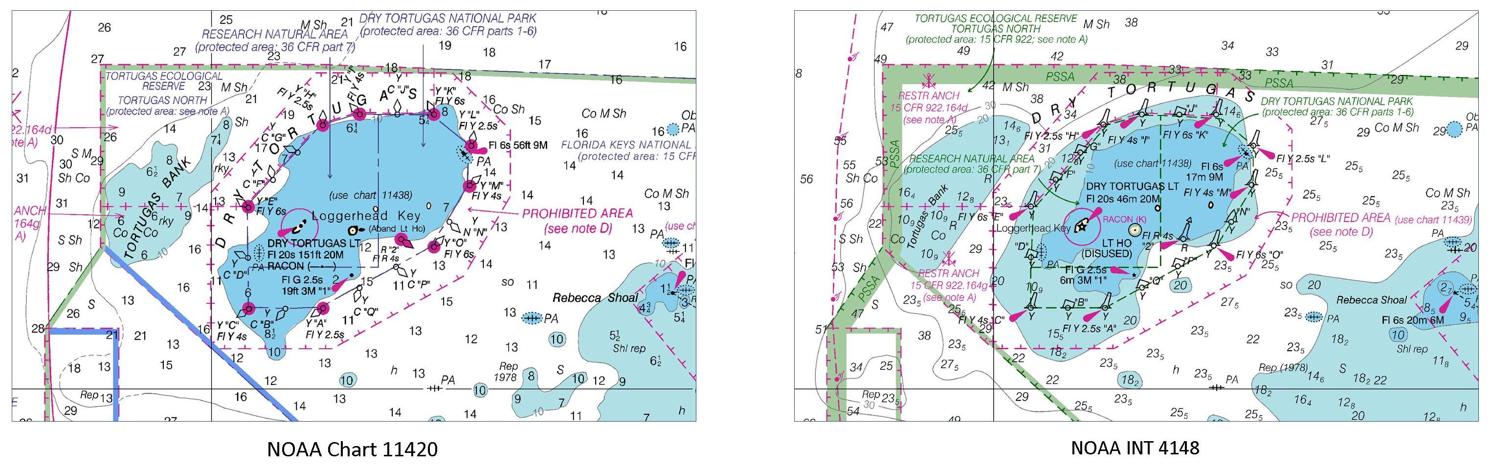
Starting in April, INT 4148 will be printed on the reverse side of Chart 11420. The new chart will soon be available as a print-on-demand chart.
In 1971, the International Hydrographic Organization adopted the idea of a common, worldwide chart series (INT Charts) produced to a single set of agreed specifications. IHO encourages countries to publish INT charts, and to make them available to hydrographic offices from neighboring countries, so they can use them for comparison or compilation with their domestic charts. Regional Hydrographic Commissions coordinate the production of INT charts. This particular chart was coordinated by the Meso-American and Caribbean Sea Hydrographic Commission – where NOAA experts are committed to supporting international hydrographic cooperation.
Coast Survey’s Marine Chart Division is responsible for updating the nation’s 1022 nautical charts. INT 4148 was compiled by Christie Ence and reviewed by Brian Martinez, under the management of Mark Griffin.

News and Updates
How do I obtain the updates for Chart #4148?
Hello,
Here is the most recent edition of Chart 4148.
https://www.charts.noaa.gov/PDFs/4148.pdf
This was last corrected on March 4, 2022.
You can also find updated ENC’s at the chart locator. It looks like coverage for that area would be US3GC07M and US2EC01M.
Thanks!