
Most NOAA Office of Coast Survey customers have a practical mariner’s bent—they are interested in up-to-date and accurate navigational products and services. However, an increasing number of customers are using Coast Survey online resources for historical research.
In May 2017, Coast Survey received an inquiry via the Inquiry and Discrepancy Management System (IDMS) that illustrates this point.
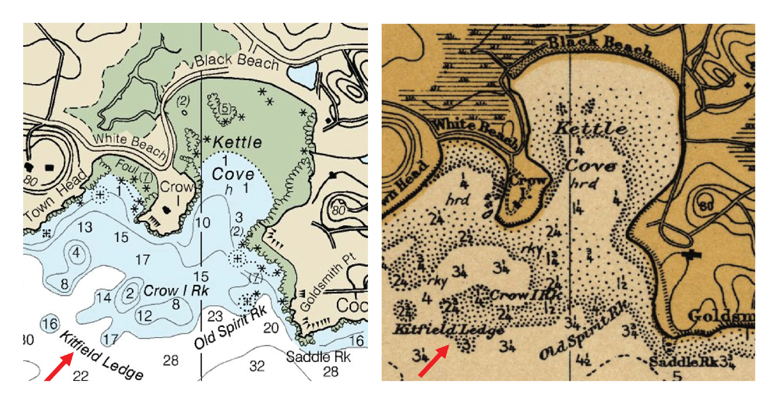
Original message: My dad is from Manchester-By-Sea, MA. There is a ledge on the NAUTICAL charts, “Kitfield Ledge”. Is there a place where we can get some history, when it was named, and how it came about. We have not been able to find any information on that. My dad was born in 1926, and he and his dad, used to lobster off of Black Beach in the 1930’s. We were back there 2 years ago and did some research at the Cape Ann Museum, but were not able to locate any information. Appreciate any help you may be able to provide. Thank you.

The first step in solving this mystery was to locate Kitfield Ledge on the current chart. Using the “Place Names” search in the Chart Catalog, Kitfield Ledge was located on the current edition of chart 13279. Using the Historical Map & Chart Collection, I was able to trace the name back to Coast and Geodetic Survey Chart 243 published in 1912. Interesting….but where to go from here? I then accessed the hydrographic surveys archive maintained by NOAA’s National Center for Environmental Information (NCEI, formerly NGDC). Using the interactive map interface for bathymetric data, I was able to view and download an 1896 hydrographic survey that showed Kitfield Ledge. Geographic name references are not always included in hydrographic survey descriptive reports, however to my surprise,the following note was discovered in the hand written descriptive report.

(Transcription)
- “Kitfield’s Ledge. This ledge lies SW of Crow Island with a least depth of 2 ½ fathoms. It is covered with kelp and Crow Island Rock is situated on it. Its name was derived from the fact that at old woman, Granny Kitfield by name, used to fish for cod on it with much success.“
Granny Kitfield must have been quite an angler to have a rocky ledge named after her!
The Granny Kitfield inquiry, and its resolution, illustrates that Coast Survey (and other organizations within the National Ocean Service) offer impressive online resources to assist in historical research. Many customers are interested in what shoreline or coastal features looked like a century ago. Others are interested in where a currently charted feature (like a wreck) originated. Resources that may help customers interested in historical research include:
- Historical Charts
- Hydrographic Surveys Archive
- Historical T-Sheets
- Wrecks and Obstructions
- Historical information about charted features: Coast Survey’s Marine Chart Division’s Nautical Data Branch does a stellar job of tracking down the origin of currently charted features.
So go ahead, check these resources out. Mysteries of the deep are waiting to be discovered—or maybe you’ll find another one of Granny Kitfield’s favorite fishing spots.