
New data will update nautical charts around the country
As sure as spring arrives, NOAA vessels and independent contractors are hitting the seas for the nation’s 182nd hydrographic surveying season, collecting data for over two thousand square nautical miles in high-traffic U.S. coastal waters.

“Nautical charts are the foundation for the nation’s maritime economy, and NOAA hydrographers spend months at sea, surveying critical areas to ensure safe navigation for the shipping, fishing, and boating communities,” said Rear Admiral Gerd Glang, director of the Office of Coast Survey.
“Spring is the traditional beginning of the survey season,” Glang explained. “After a winter of data processing, ship maintenance, and personnel refresher training, the NOAA survey ships and Coast Survey navigation response teams are anxious to get to their survey assignments.”
U.S. waters cover 3.4 million square nautical miles, including a seafloor that is constantly changing due to storms, erosion, and development. To keep the nation’s suite of over a thousand nautical charts up to date, the Office of Coast Survey annually plans hydrographic survey projects to measure water depths and identify new navigational hazards. Survey planners consider requests by marine pilots, port authorities, the Coast Guard, the boating community and others when setting the year’s schedule.
Planned 2016 survey projects
- Penobscot Bay, Maine, most of which hasn’t been surveyed since the 1950s, will get its first modern NOAA multibeam echo sounder survey, to acquire data for needed chart updates.
- Buzzards Bay, Massachusetts, is the subject of a multiyear project for updating charts. 2016 is the third year, and the survey ship will validate U.S. Geological Survey interferometric survey data for charting, and will align with NOAA’s Remote Sensing Division lidar data.
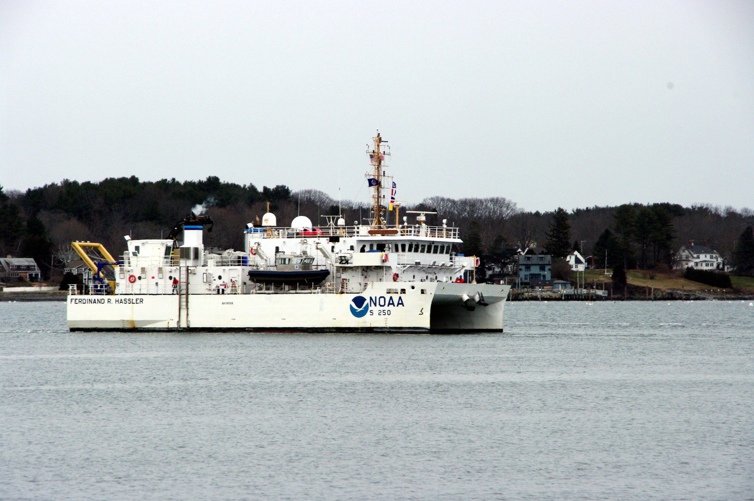
- Chesapeake Bay is also the subject of a multiyear survey project for updating charts. NOAA Ship Ferdinand R. Hassler will work offshore, while launches from NOAA Ship Thomas Jefferson will survey in the vicinity of Hampton Roads concurrent to the ship’s maintenance period in drydock.
- Wilmington, North Carolina, survey project will support the U.S. Coast Guard Atlantic Coast Port Access Route Study.
- Savannah, Georgia, needs hydrographic survey data for the port deepening project in preparation for post-Panamax ships.
- Sabine, Louisiana, will have a continuation of last year’s project to survey part of the approaches to Port Arthur and Calcasieu.
- Atchafalaya, Louisiana, will have a continuation of last year’s project to survey part of the approaches to Morgan City.
- Approaches to SW Pass, Louisiana, will be surveyed at the request of the U.S. Coast Guard and the Bureau of Ocean Energy Management, to provide new chart data for consideration of a proposed anchorage area near Port Fourchon.
- Chandeleur Sound, Mississippi, will have surveys to acquire critical updates since Hurricane Katrina.
- Yukon River, Alaska, will be partially surveyed to validate a new charting approach using satellite-derived bathymetry.
- Etolin Strait, Alaska, will also validate satellite-derived bathymetry data, as well as establish a survey corridor between Nunivak Island and mainland Alaska. This project will provide data for some of the new charts identified in the U.S. Arctic Nautical Charting Plan.
- Dutch Harbor, Alaska, will benefit from a shore-based survey operation simultaneous with a NOAA Fishpac project, as the ship’s smaller launches will acquire more data at the site of the 2015 M/V Fennica grounding.
- Kodiak Island, Alaska, will have another year of a multi-year surveying campaign in this critical area for increasing fishing and tourism.
- Prince of Wales Island, Alaska, needs updated survey data to improve charts to Tlevak Strait, expanding to Sukkwan Strait and Howkan Narrows.
- Behm Canal, Alaska, will get its third (and final) year of survey work to circumnavigate Revillagigedo Island as well as George and Carol Inlet, Alaska.
The surveys will be conducted by NOAA’s four dedicated survey ships ‒ Thomas Jefferson, Ferdinand Hassler, Rainier, and Fairweather ‒ and private companies that survey on a contract basis with NOAA. The NOAA ships are operated and maintained by the Office of Marine and Aviation Operations, with hydrographic survey projects managed by the Office of Coast Survey.
The schedule for Coast Survey’s navigation response teams (NRTs), 3-person boats that work closer in shore to acquire data for nautical chart updates, was announced earlier.


