Port officials around the country know they can rely on the expert advice of Coast Survey’s navigation managers, cartographic experts, and hydrographers as the ports plan the essential improvements necessary for a thriving maritime economy. One example of Coast Survey assistance is in Port Fourchon, Louisiana, where port officials have determined that the volume and density of vessels have reached a level that requires one or more offshore anchorage areas. Sending vessels to a designated anchorage reduces the population in port and provides a safe area for vessels to power down their engines (rather than hold in place offshore in dynamic positioning mode), which would improve both safety and efficiency in the area known as the “Gulf’s Energy Connection.”
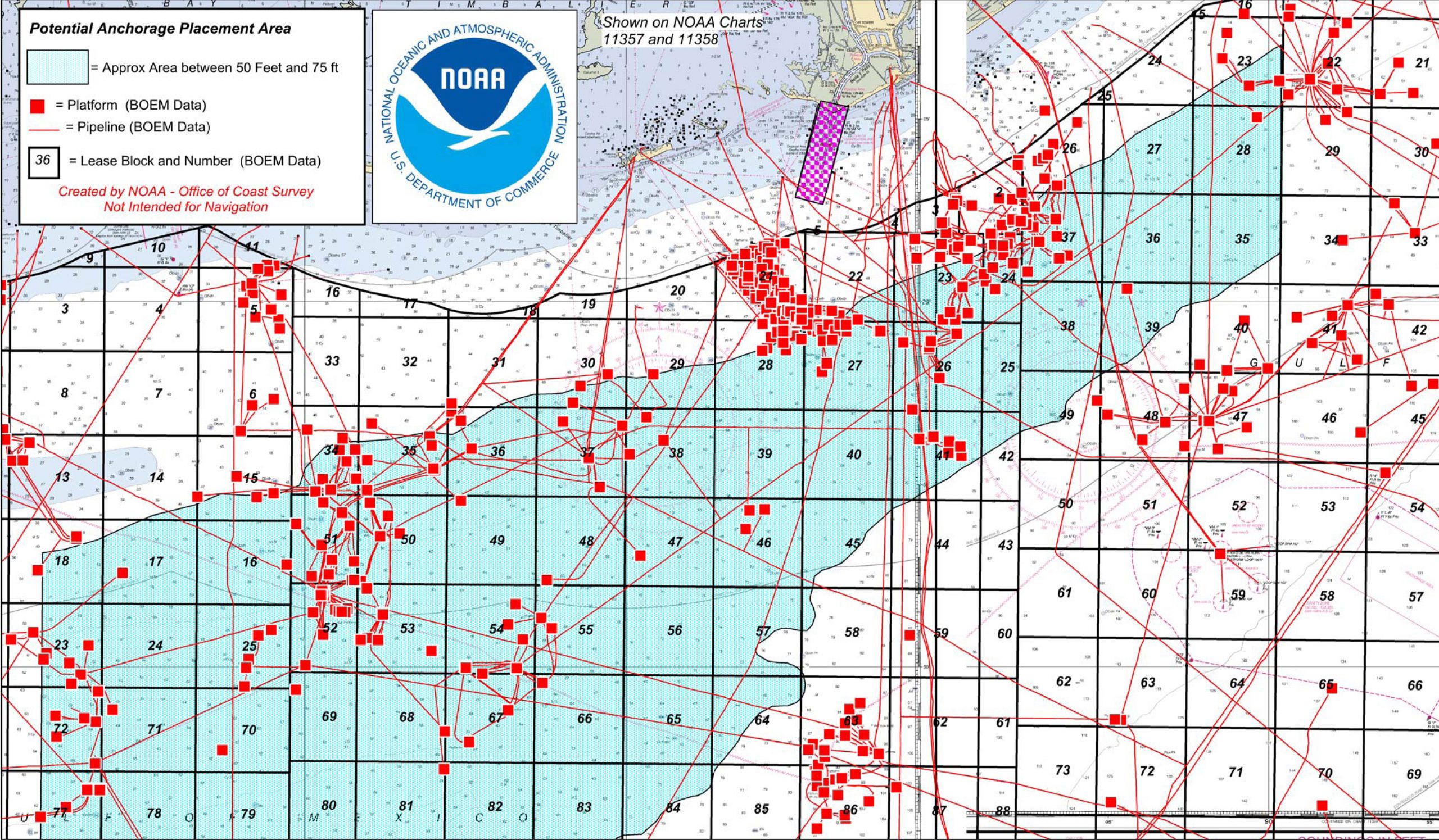
Using nautical charts of the areas, Coast Survey provided a range of possible sites that helped port officials narrow their anchorage options. After navigation manager Tim Osborn worked with the officials, and with additional requirements in hand, Coast Survey cartographic expert Steve Soherr provided a digital graphic showing likely areas, with information that guards against pipeline and platform interference with safe anchorage.
As additional safeguards, hydrographic surveys will likely be needed to confirm that the seafloor of the recommended areas are free of hazards and do not have uncharted pipelines. Coast Survey will work with the Department of Interior’s Bureau of Ocean Energy Management and Bureau of Safety and Environmental Enforcement as needed.
The port will bring its recommendations to the U.S. Coast Guard, who has the authority to designate the anchorages.


News and Updates