Crew of NOAA Ship Rainier surveys Everett, Washington, to update charts

By Lt. j.g. Michelle Levano

everett1
RA-6 in Elliott Bay, downtown Seattle. Photo Credit: Lt. Andrew Clos

As NOAA Ship Rainier underwent repairs in South Seattle, the ship’s survey launches and their crews carried out a project to update nautical charts around the Port of Everett and its approaches in Possession Sound. The boats used state-of-the-art positioning and multibeam echo sounder systems to achieve full bottom coverage of the seafloor.
The ports of Seattle, Tacoma, and Everett have experienced an increase in vessel traffic and capacity within the last decade. The Port of Everett serves as an international shipping port bringing jobs, trade, and recreational opportunities to the city. Across Possession Sound, Naval Station Everett is the homeport for five guided-missile destroyers, and two U.S. Coast Guard cutters. The data collected from this project will support additional military traffic transiting to and from Naval Submarine Base Bangor in addition to the Washington State Ferries’ Mukilteo/Clinton ferry route, commercial and tribal fishing, and recreational boating in the area. Continue reading “Crew of NOAA Ship Rainier surveys Everett, Washington, to update charts”

NOAA surveys Lake Champlain for improved flood modeling and mitigation strategies

At the request of the NOAA Great Lakes Environmental Research Lab (GLERL), NOAA’s Office of Coast Survey deployed a survey team and a new autonomous surface vehicle (ASV) to gather hydrographic data in and around the narrow causeway inlets that dot the Lake Champlain basin in Vermont. GLERL will use the data to improve flood forecast models and analyze flood mitigation strategies in the Lake Champlain-Richelieu River system as part of a U.S. and Canada study led by the International Joint Commission.
Continue reading “NOAA surveys Lake Champlain for improved flood modeling and mitigation strategies”

Coast Survey spotlight: Meet Brian Martinez

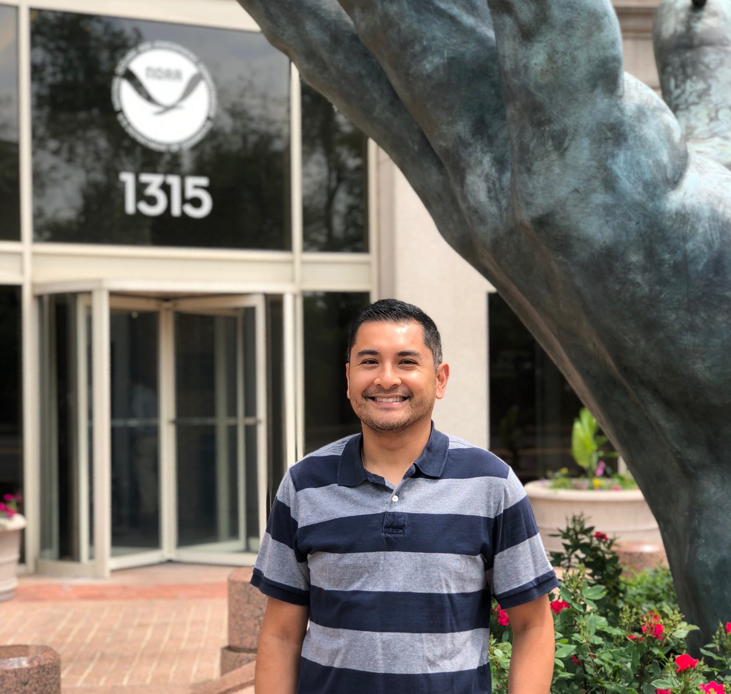
Brian Martinez stands in front of the NOAA Headquarters building

Ever wonder what it’s like to be a member of the NOAA Coast Survey team? We use the Coast Survey spotlight blog series as a way to periodically share the experiences of Coast Survey employees as they discuss their work, background, and advice.


Brian Martinez, Lead Cartographer

Knowing that the products we provide to the mariner community is essential to safe navigation for commerce gives me a sense of accomplishment.

Continue reading “Coast Survey spotlight: Meet Brian Martinez”

Coast Survey spotlight: Meet Starla Robinson

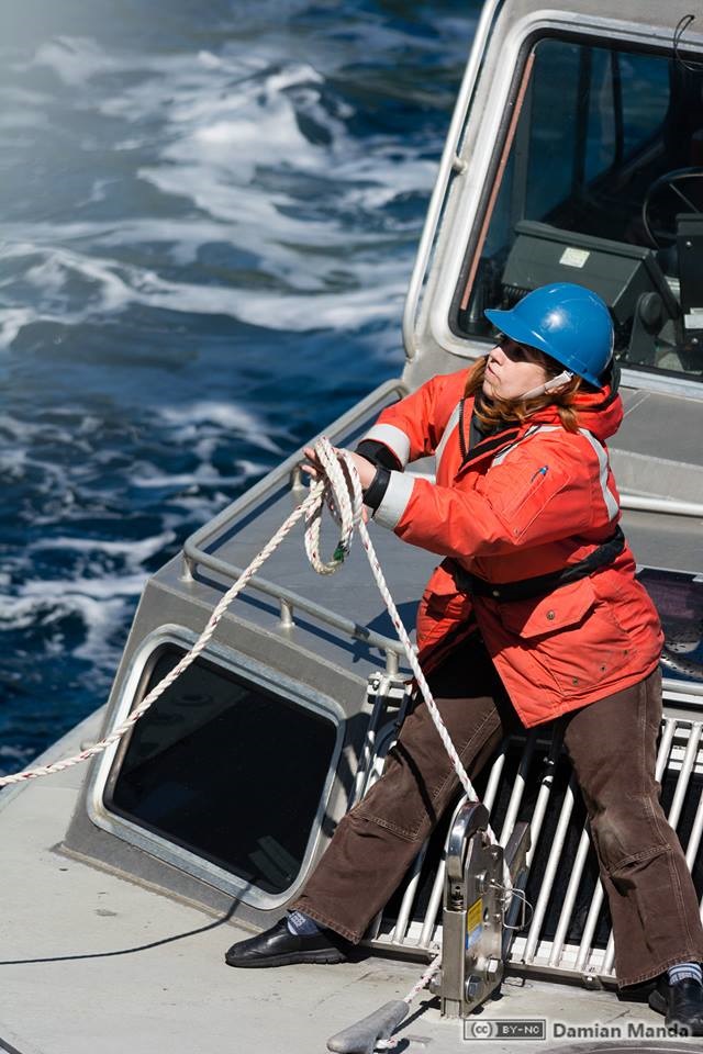
Starla Robinson served as a crew member on the NOAA Ship Rainier. Photo credit: Lt. Damian Manda, NOAA Corps

Ever wonder what it’s like to be a member of the NOAA Coast Survey team? We will use the Coast Survey spotlight blog series as a way to periodically share the experiences of Coast Survey employees as they discuss their work, background, and advice.


Starla Robinson, Physical Scientist

The work we do has real value and every sounding takes a team of professionals from multiple disciplines. I like being a part of something greater.

Continue reading “Coast Survey spotlight: Meet Starla Robinson”

From seaports to the deep blue sea, bathymetry matters on many scales

By Rear Adm. Shep Smith, director of the Office of Coast Survey

On Thursday, June 21, we celebrate World Hydrography Day. This year’s theme—Bathymetry – the foundation for sustainable seas, oceans and waterways—is very timely as many hydrographic organizations worldwide are focusing on bathymetry at local and global scales. While we work to perfect real-time data and high-resolution bathymetry for ports, we are still working to build a foundational baseline dataset of the global seafloor. Our work at both scales have implications for the local and global economies.
Continue reading “From seaports to the deep blue sea, bathymetry matters on many scales”

New NOAA precision navigation program increases safety, efficiency for maritime commerce

Mariners face complex decisions as ever-larger vessels make their way through congested U.S. ports.

By Capt. Liz Kretovic, deputy hydrographer of the Office of Coast Survey

Nowadays, many cars have sensors, video cameras, and other technology installed to help drivers park in tight spaces. Now imagine you are trying to parallel park a tractor-trailer on an icy hill, against a strong crosswind, with millions of dollars of products that depend on your precise execution. Dynamic conditions, tight spaces, and high stakes are exactly the scenario that many commercial vessels face as they move 95 percent of the United States’ foreign trade in and out of U.S. ports and waterways. In a manner comparable to the way car technology supports drivers, NOAA has launched a new program to develop the next generation of marine navigation tools that provide mariners with the information they need to safely and efficiently transport maritime commerce. This next generation of products is referred to as precision navigation.
Continue reading “New NOAA precision navigation program increases safety, efficiency for maritime commerce”

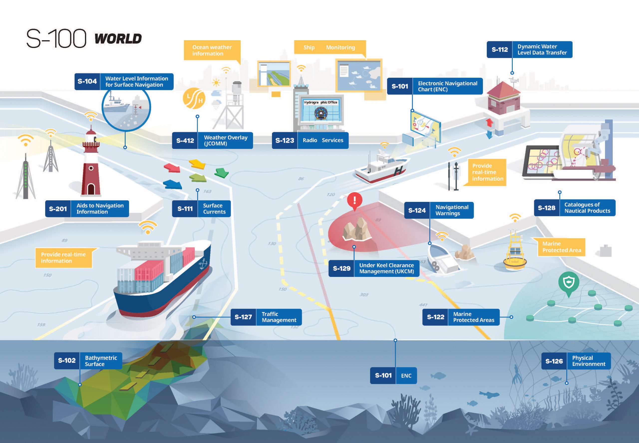
The world of S-100: Updated framework of maritime data standards to be released in 2018

Navigation products that follow the updated S-100 framework will allow many aspects of maritime navigation to be better connected. Image credit: Korea Hydrographic and Oceanographic Agency

By Julia Powell, deputy chief of the Coast Survey Development Lab

As e-Navigation becomes more popular, mariners are provided with streams of maritime data from multiple sources that allow them to more safely and efficiently navigate the seas. However, as the amount of information and number of sources grows, there is a need to standardize the data so it can be easily integrated and seamlessly displayed on navigation systems. Later this year, the International Hydrographic Organization (IHO) will publish edition 4.0.0 of S-100 – Universal Hydrographic Data Model. S-100 is the IHO’s framework for the standardization of maritime data products such as high resolution bathymetry, surface currents, marine protected areas, and the new standards for electronic navigational charts (ENCs).
Continue reading “The world of S-100: Updated framework of maritime data standards to be released in 2018”