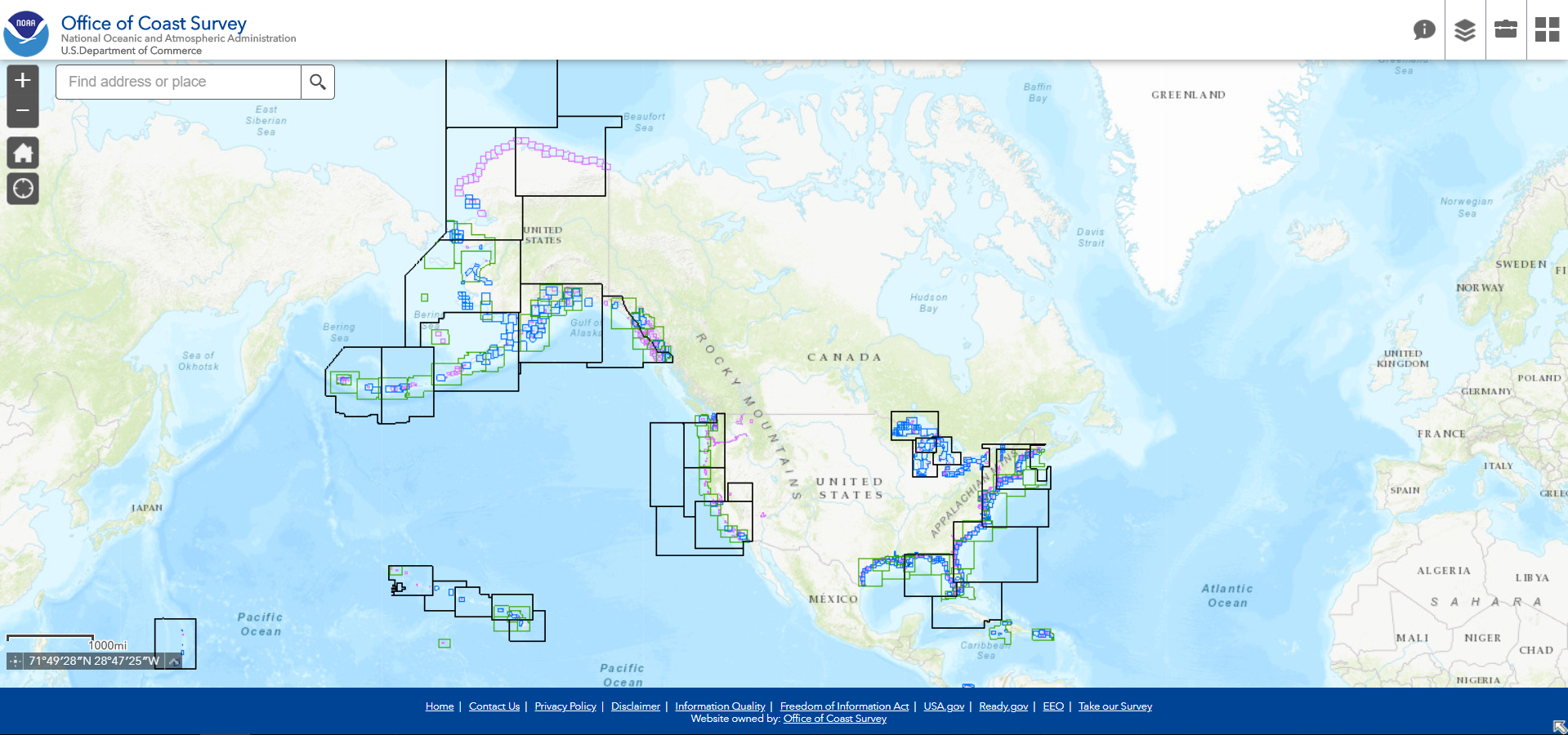
NOAA updated its NOAA ENC Direct to GIS website with a more modern viewer and the latest Esri GIS tools, removing the requirement for older software. The viewer retains the familiar, easy-to-use interface and tools, now with a modern user interface.
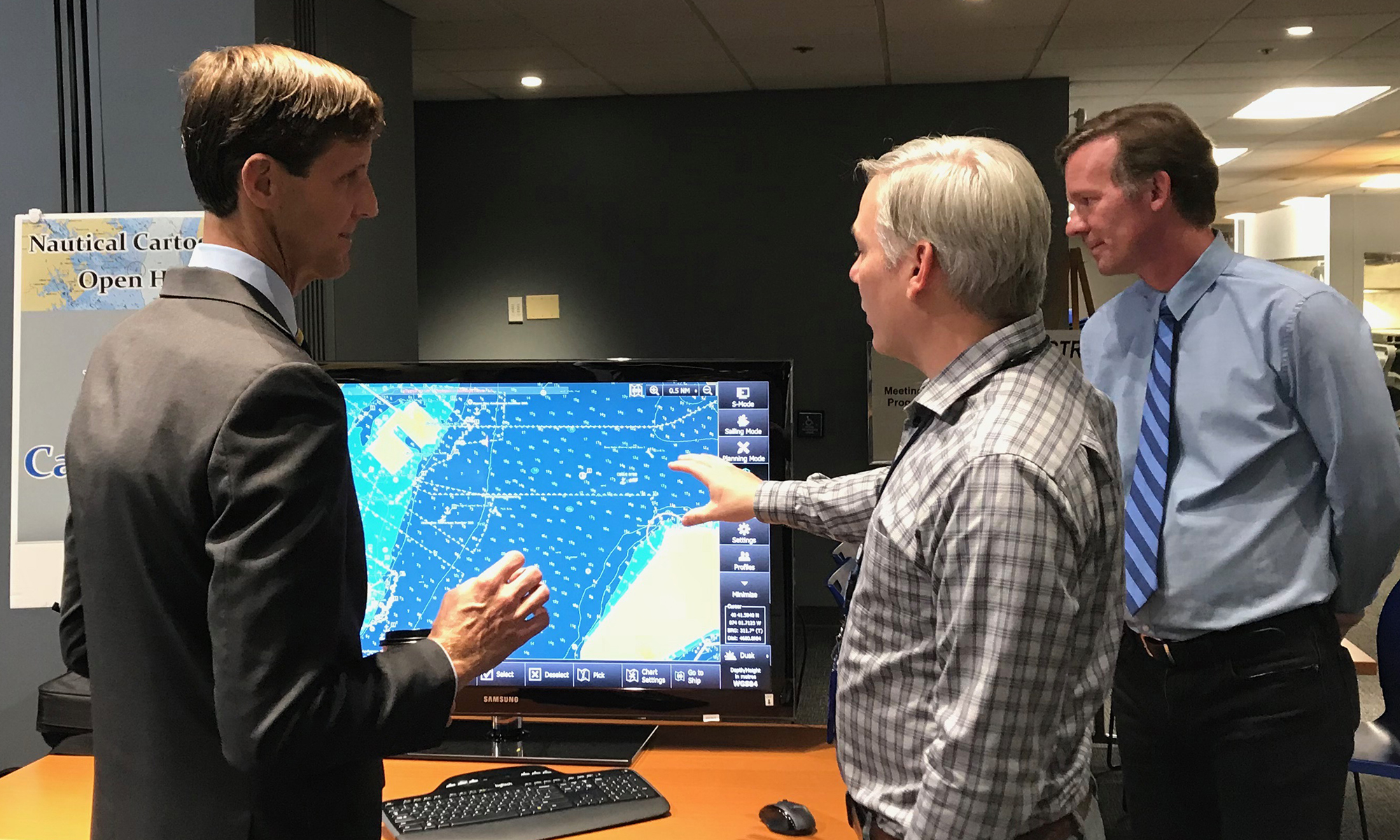
Last week NOAA Coast Survey welcomed approximately 170 attendees representing 17 countries to the 2018 Nautical Cartography Open House. Industry partners, members of the public, and other government agencies attended, including the Bureau of Ocean Energy Management, Naval Hydrographic and Oceanic Service (SHOM) from France, Canadian Hydrographic Service, Dalian Naval Academy, National Taiwan Ocean University, and the Joint Hydrographic Center/Center for Coastal and Ocean Mapping (JHC/CCOM).
On July 23, NOAA Coast Survey hosted a three-day Chart Adequacy Workshop that included participants from 13 countries. This is the fourth Chart Adequacy Workshop held at NOAA’s Silver Spring, Maryland campus.
The participants of the 2018 Chart Adequacy Workshop.
The main goal of the workshop is to provide training for professional cartographers and hydrographers on techniques for assessing nautical chart adequacy using publicly-available information, such as satellite images and maritime automatic identification system (AIS) data. The participants received an overview on Coast Survey datasets, processes, and requirements for nautical charts. They also learned about preprocessing hydrographic data, such as loading charts, uploading imagery, and applying electronic navigation charts (ENCs) and AIS point data. Through a series of lab units, the attendees practiced performing the concepts they learned.
NOAA’s Christie Ence (left), Megan Bartlett (third from left), and Noel Dyer (right) explain their posters to attendees of the poster symposium at the University of Maryland. Students of NOAA’s certification program in nautical cartography completed their final projects and presented them along with other Master of Professional Studies in GIS students during a poster symposium at the University of Maryland’s Department of Geographical Sciences. At the event, NOAA students explained their capstone projects and described how their research benefits nautical charting at NOAA. Project topics included:
Improving Shoreline Application to NOAA Electronic Navigational Charts, Megan Bartlet
An Automated Approach to Generate Nautical Vector Features from Raster Bathymetric Attributed Grid Data, Noel Dyer
Developing a Rasterization Procedure for Vector Chart Data, Christie Ence
NOAA Chart Discrepancies: A Temporal and Spatial Analysis for Navigation Response Teams, Lt. Cmdr. Matt Forney
Airborne Lidar Bathymetry’s Impact on NOAA Charts, Andres Garrido
Validating and Refining the Proposed Rescheming of NOAA Electronic Navigational Charts, Colby Harmon
High Resolution Bathymetry as an Alternative to Charting Controlling Depths in U.S. Army Corps of Engineers Channels, Craig Winn
Satellite Derived Bathymetry: An Alternative Analysis to Nautical Chart Updates, Aleah Worthem
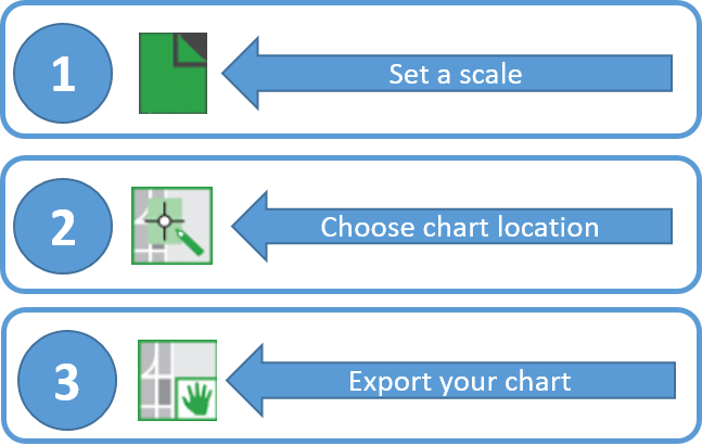
A prototype version of a powerful new online tool, NOAA Custom Chart, is now available for boaters and other nautical chart users. The application enables users to define the scale and paper size of custom-made nautical charts centered on a position of their choosing. Once the functionality of this prototype is fully developed, NOAA Custom Chart will be an easy way for boaters to create a paper or digital back-up for the electronic chart system or other GPS-enabled chart display that they are using on board. Continue reading “Online NOAA Custom Chart lets boaters create their own charts”
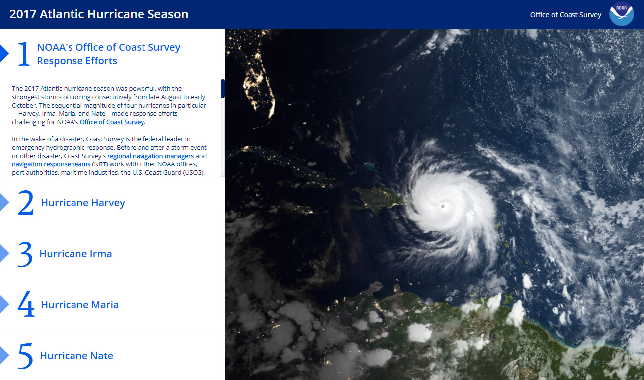
The 2017 Atlantic hurricane season was powerful, with the strongest storms occurring consecutively from late August to early October. The sequential magnitude of four hurricanes in particular—Harvey, Irma, Maria, and Nate—made response efforts challenging for NOAA’s Office of Coast Survey. Coast Survey summarized this season’s response efforts along with the efforts of NOAA Ship Thomas Jefferson (operated by NOAA’s Office of Marine and Aviation Operations) in the following story map.
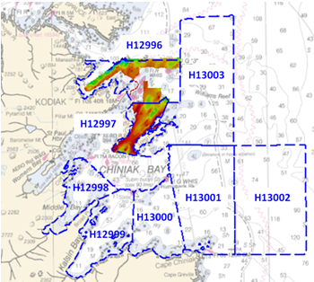
Kodiak Island is the 2nd largest island in the United States; it is part of the Kodiak Island Archipelago, a group of islands roughly the size of Connecticut. Due to the island’s location in the Gulf of Alaska and North Pacific Ocean, Kodiak is ranked as third in commercial fishing ports in the U.S. in terms of value of seafood landed. In 2015, the Port of Kodiak was responsible for 514 million pounds of fish and $138 million of product. More than one-third of the jobs in Kodiak are related to the fishing industry. The Port of Kodiak is home to more than 700 commercial fishing vessels, and has more than 650 boat slips and three commercial piers that can dock vessels up to 1,000 feet. In addition to fishing, Kodiak is the hub of the Gulf of Alaska container logistics system, serving the southwest Alaskan communities with consumer goods and outbound access to the world’s fish markets.
Features in an electronic navigational chart represent thousands of pieces of data describing the coastal and marine environment. This data includes coastal topography, bathymetry, landmarks, geographic place names, and marine boundaries for the specific geographic region encompassed by the chart. What if we could aggregate the ENC features into a geospatial database? Such a product would provide a continuous depiction of the U.S coastal and marine environment. Continue reading “Introducing NOAA’s new ENC Direct to GIS”