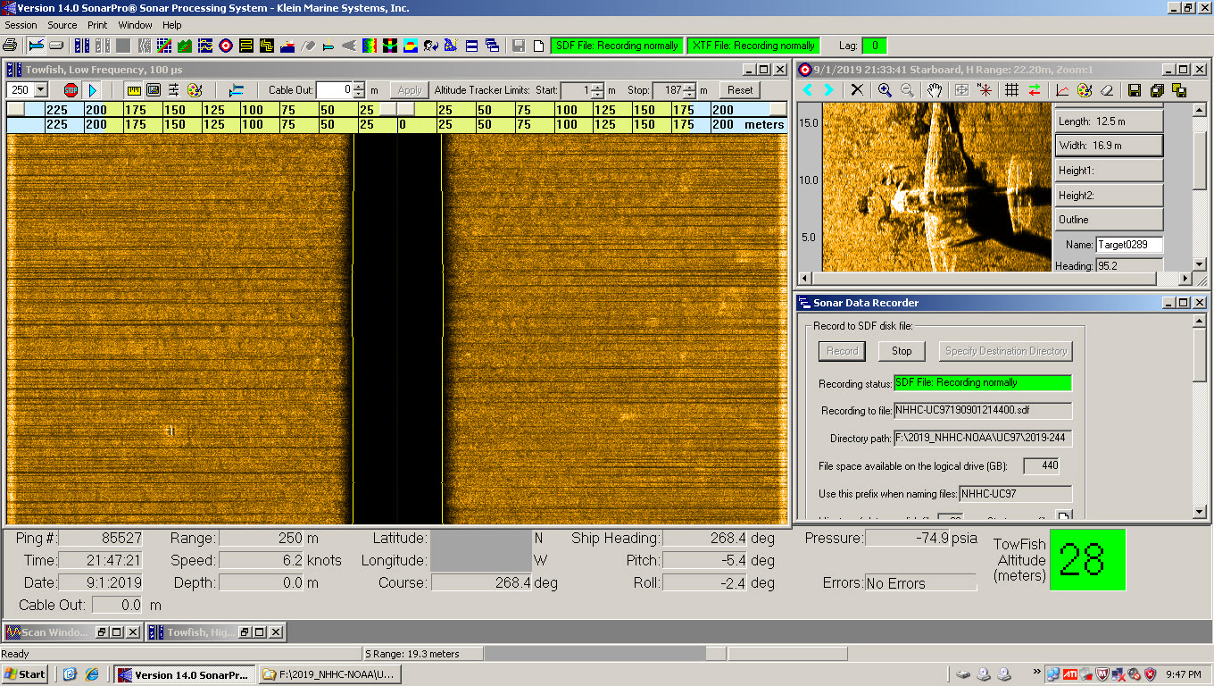
Did you know that there are about 120 World War II era aircraft lying at the bottom of Lake Michigan? The Navy used these aircraft to train and certify pilots to take off and land from aircraft carriers during World War II. U.S. Naval operations along Lake Michigan, one of the Great Lakes, began in 1923. Between 1923 and 1942, operations expanded as the Navy built hangars, airfields, and landing strips across the village of Glenview, Illinois. By 1942, the Navy had a robust presence on the shores of Lake Michigan. With the U.S. entrance into World War II, the Navy needed a location to train carrier pilots. The growing threat of enemy vessels and mines along the Pacific and Atlantic coastlines and an already strong Naval presence in the area made Lake Michigan the safest location for carrier training.
Continue reading “NOAA in the Great Lakes supports inter-agency search for WWII aircraft”Change of command for NOAA Ship Rainier
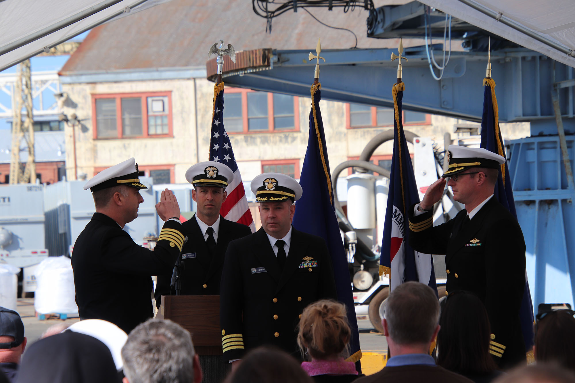
On November 15, 2019, the crew of NOAA Ship Rainier hosted a change of command in Valejo, California. Cmdr. Sam Greenaway accepted command of Rainier, relieving Capt. Ben Evans in a ceremony led by Capt. Michael Hopkins, commanding officer of NOAA’s Office of Marine and Aviation Operations (OMAO) Marine Operations Center-Pacific.
Continue reading “Change of command for NOAA Ship Rainier”Hawaiian island surveys will update nautical charts and support habitat mapping efforts
By Ens. Lyle I. Robbins
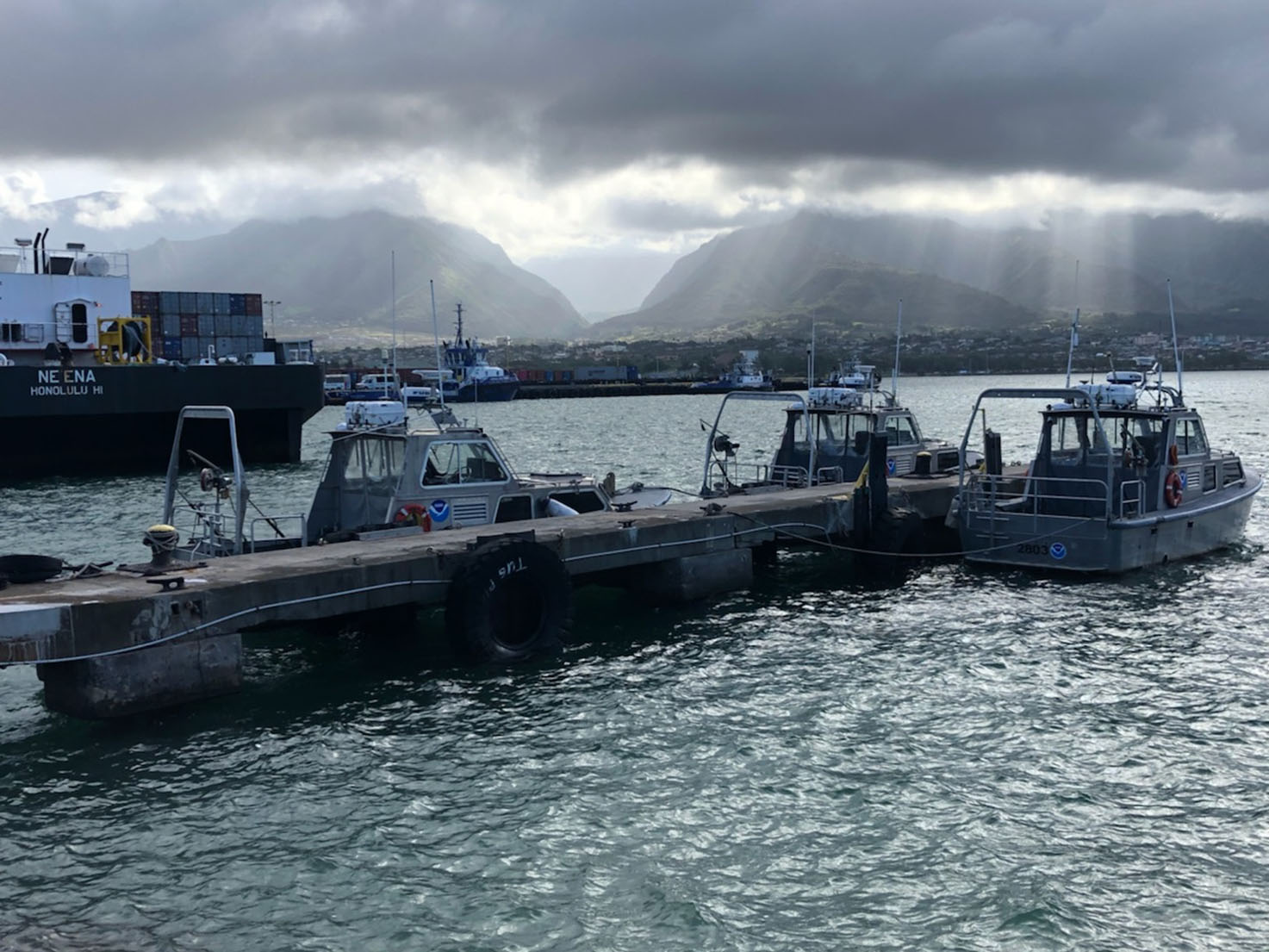
For more than 50 years, NOAA Ship Rainier and its hydrographic survey launches have surveyed the Pacific seafloor. During this time, Rainier sailed thousands of miles, including the entire U.S. west coast, Alaska, and Hawaii. This year, Rainier expands on its traditional role of hydrographic survey and is supporting dive operations in the Northwest Hawaiian Islands and in the Papahānaumokuākea Marine National Monument. While Rainier is sailing these remote coral atolls, the survey launches — that are usually in its davits and deployed directly from the ship — are tasked to their own surveys around the islands of Maui, Moloka’i, and O’ahu.
Continue reading “Hawaiian island surveys will update nautical charts and support habitat mapping efforts”NOAA releases 2019 hydrographic survey plans
NOAA’s Office of Coast Survey is the nation’s nautical chartmaker, and maintains a suite of more than a thousand nautical charts. Coast Survey is responsible for charting U.S. waters and Great Lakes covering 3.4 million square nautical miles (SNM) of water and 95,000 miles of coastline.
NOAA’s hydrographic survey ships along with hydrographic contractor vessels, recently kicked off the 2019 hydrographic survey season. These surveys not only update the suite of nautical charts, but also help to maintain the safety of maritime commerce, recreational boaters, natural ecosystems, and much more. Operations are scheduled for maritime priority areas around the country and are outlined in Coast Survey’s “living” story map. Here is a list of where they are headed this year:
Continue reading “NOAA releases 2019 hydrographic survey plans”Hydro on the Great Lakes: preserving American history
By Ensign Max P. Andersen
Formed by retreating ice sheets over 14,000 years ago, the Great Lakes have long represented one of the most valuable fresh water resources in North America. They contain more than one-fifth of the world’s supply of fresh surface water, and the vast size is easily visible from space. From Native American hunting routes to French fur-trade exploration to influential battles in the War of 1812, the Lakes have proved a key platform for numerous historical events that shaped the development of the country.
Uniquely, these bodies of water served as the gateway to connect the booming production of an expanding population in the Midwest from 1825 to 1925. During this time, a broad range of wooden, sailing, and steam-powered ships trekked across the lakes, carrying coal, grain, and passengers. Due to unpredictable weather conditions, fire, ice, high-traffic areas, and an ever-increasing pressure to meet shipping quotas, hundreds of ships were lost in collisions and accidents. These incidents have earned this period the nickname “Shipwreck Century.” Today, the history of the “Shipwreck Century” is presented at Thunder Bay National Marine Sanctuary’s visitor’s center, the Great Lakes Maritime Heritage Center, in Alpena, Michigan.
Thunder Bay is located in Lake Huron, near one of the most historically dangerous areas of navigation in the Great Lakes. The sanctuary covers 4,300 square miles. In this area, over 200 shipwrecks are known to exist, and 92 have been discovered and accurately charted. The staff provides continual archaeological monitoring to ensure the preservation of the sites.
Continue reading “Hydro on the Great Lakes: preserving American history”
Coast Survey finds historic City of Chester wreck, again
NOAA announced that one of Coast Survey’s navigation response teams found the underwater wreck of the passenger steamer City of Chester, which sank in 1888 in a collision in dense fog near where the Golden Gate Bridge stands today. City of Chester had just left San Francisco and was headed up the California coast to Eureka with 90 passengers on August 22, 1888, when it was struck by the steamer Oceanic. Impaled on Oceanic, which was arriving from Asia, City of Chester remained afloat for six minutes before sinking. Sixteen people died in the accident.
Navigation Response Team 6 (NRT6) found the wreck in May 2013 while they were conducting regular survey duties for safe navigation, assessing a potential pollution threat from the S.S. Fernstream, a wreck from 1952. Sonar images confirmed that the target was the 202-foot steamship City of Chester, sitting upright, shrouded in mud, 216 feet deep at the edge of a small undersea shoal, rising 18 feet from the seabed.

Continue reading “Coast Survey finds historic City of Chester wreck, again”
The colors of sound
The digital terrain model depicts the wreck of the freighter Fernstream, a 416-foot motor cargo vessel that sank after a collision near the entrance of the San Francisco Bay in 1952. NRT6 surveyed Fernstream as part of a recent study – identifying potential polluting shipwrecks – conducted by the Office of National Maritime Sanctuaries and the Office of Response and Restoration.
A nation pays final tribute to Civil War sailors interred at Arlington National Cemetery
Last week we blogged about the Civil War sailors whose remains were being interred at Arlington National Cemetery on March 8. The funeral, for unknown sailors who were lost when the USS Monitor capsized, was solemn and stirring, and reflected the nation’s great esteem for our fallen patriots. The unknown sailors were lost along with 14 of their shipmates when Monitor sank off Cape Hatteras, N.C., on Dec. 31, 1862.
All 16 sailors will be memorialized on a group marker in section 46 of the cemetery, which is between the amphitheater and the USS Maine Mast memorial.
Rear Admiral Gerd Glang, Coast Survey’s director, was honored to represent NOAA in the officer escort for the caissons. Glang and Rear Admiral Anthony Kurta (USN) served as Escort Commanders, and were joined by Capt. Gary Clore (Navy Chaplain) and Cmdr. Nathaniel Standquist (U.S. Navy Ceremonial Guard), as the nation paid a final tribute.
Continue reading “A nation pays final tribute to Civil War sailors interred at Arlington National Cemetery”
NOAA Coast Survey director to escort caissons for USS Monitor sailors’ interment at Arlington
On Friday, March 8, a NOAA Corps admiral will have the honor of doing something extraordinary. Coast Survey’s director, Rear Admiral Gerd Glang, will be the NOAA Escort Flag Officer for the full honors funeral of two unknown sailors who went down with the Civil War ironclad USS Monitor in 1862. Rear Adm. Glang will join Rear Adm. Anthony Kurta, U.S. Navy, as the two officers escort the caissons during the somber event at Arlington National Cemetery.
The interment will be open to the public.

The Monitor sank southeast of Cape Hatteras, North Carolina, during a New Year’s Eve storm, carrying 16 crew members to their deaths.
The wreck was discovered in 1973, and confirmed in 1974 by John Newton and a team from Duke University. The ironclad was lying upside down with the turret separated from the hull, resting in 230 feet of water approximately 16 miles off Cape Hatteras. In the late 1990s through 2002, experts recovered iconic Monitor artifacts, which are now conserved at the Mariners’ Museum in Newport News, Virginia. Two skeletons were discovered in 2002 when the turret was raised from the seafloor, and efforts to identify the remains have been unsuccessful so far.
Continue reading “NOAA Coast Survey director to escort caissons for USS Monitor sailors’ interment at Arlington”
NOAA Ship Ferdinand R. Hassler submits survey of historic wrecks acquired during test and evaluation operations
by Lt. Madeleine Adler, NOAA, Navigation Officer, NOAA Ship Ferdinand R. Hassler

NOAA Ship Ferdinand R. Hassler recently submitted a multibeam echo sounder survey of two sunken World War I era battleships to the Office of Coast Survey. Hassler, which was commissioned earlier this summer, surveyed the site of these two wrecks while transiting through the area during test and evaluation operations in 2011, and has been using the resulting dataset for calibration purposes since then. Although the wreck locations were well known, they had never been surveyed with modern techniques.
The ships are USS New Jersey and USS Virginia, which were intentionally sunk during aerial bombing experiments in 1923. U.S. Army Colonel Billy Mitchell, a pioneer of military aviation, urged the Navy to investigate the effectiveness of aerial bombing against surface vessels. As part of a series of tests, the Navy anchored the two obsolete “White Fleet” battleships off Cape Hatteras in September 1923 to serve as targets. Bombers under Mitchell’s direction sank both ships in short order. The success of these tests had a significant influence on subsequent development of U.S. air power and air defense for naval vessels.
Continue reading “NOAA Ship Ferdinand R. Hassler submits survey of historic wrecks acquired during test and evaluation operations”


