U.S. and Cuba work on navigation safety improvements

Directors of ONHG and Coast Survey

First up, improving charts and geodesy for Straits of Florida 

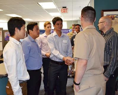
Coast Survey welcomed Cuban colleagues to NOAA offices this week, as representatives of Cuba’s National Office of Hydrography and Geodesy (ONHG) traveled to Maryland for the first time since last December. In March, NOAA and ONHG signed a Memorandum of Understanding in Havana.
Continue reading “U.S. and Cuba work on navigation safety improvements”

NOAA hosts international “Chart Adequacy Workshop”

Cartographers and hydrographers from twelve countries gathered in Maryland last week to participate in a three-day NOAA workshop on evaluating the adequacy nautical charts. During the workshop, they learned techniques to evaluate the suitability of nautical chart products using chart quality information and publicly available information. The participants then generated key layers in adequacy assessments:

  • Using automatic identification systems (AIS) information to classify navigational routes, they generated a vessel traffic layer.
  • Comparing satellite-derived bathymetry or other surveys of opportunity with the existing chart, to identify areas that showed significant bathymetric changes, they generated a bathymetric difference layer.
  • Classifying chart quality information, they generated a hydrographic characteristics layer.

Continue reading “NOAA hosts international “Chart Adequacy Workshop””

Updating digital nautical charts is faster and easier

Coast Survey introduces new service for downloading raster chart updates

We click on our smart phone map app, and we can immediately see any place on land. We turn on our boat’s navigational system and a nautical chart appears. Where do the apps get their maps and charts, and how often are they updated? Let’s look deeper into the chart services…
Recreational boaters use chart plotters and computer-based navigation systems, including tablets and mobile devices — at last count, there are over 60 mobile apps — as well as web mapping applications. These commercial products often use privately produced charts derived from official NOAA raster navigational charts (NOAA RNC®). In recent years, larger manufacturers have switched to using NOAA raster charts themselves. Until recently, the systems had to work through a major problem: each of NOAA’s thousand charts is a huge file that takes bandwidth and time to upload. So the entrepreneurs developed work-arounds, especially when they needed to update the charts. Many of them cut NOAA chart files into more manageable “tiles.” Many didn’t update these chart tiles for months, or sometimes even up to a year, despite NOAA issuing updates weekly, often because of time and storage space problems.
Continue reading “Updating digital nautical charts is faster and easier”

Developing products for “precision navigation”

ship clearance at 1 degree pitch

Ports of Los Angeles and Long Beach are first up

by Capt. Richard Brennan, chief, Coast Survey Development Lab
The increased size of vessels entering U. S. ports, coupled with the diminishing margins that must be navigated with reference to the seafloor, provides NOAA with the opportunity to develop new products to support precision navigation. The ports of Los Angeles and Long Beach are testing grounds for current product development, since developing products for these ports will allow us to examine the value of precision navigation products under actual at-sea conditions. The channel leading to the Port of Long Beach has an authorized depth of 76 feet, allowing drafts of 69 feet. A major concern for this port is high sea swell conditions that can be present when ultra large crude carriers enter port. These large swells can cause vessels to pitch, which results in a significant change in their draft.
Continue reading “Developing products for “precision navigation””

NOAA is open for business with navigation industry

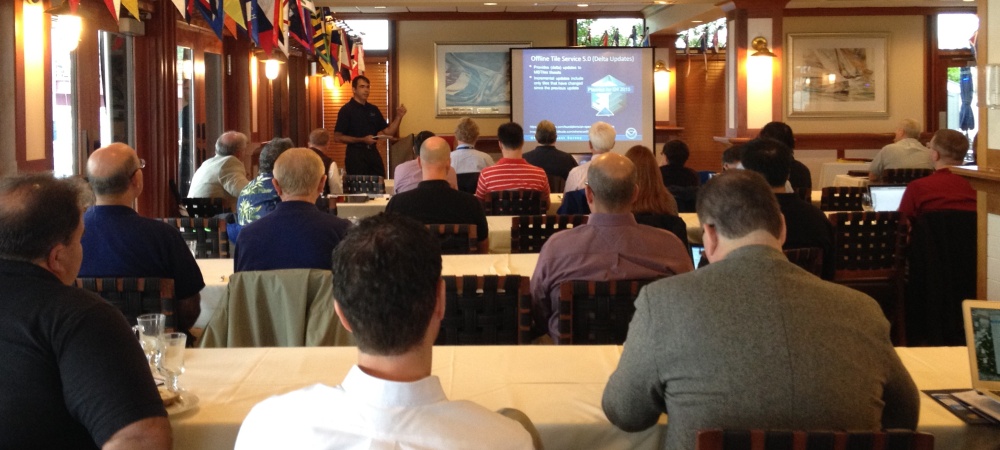
At the first NOAA Navigation Industry Day, held October 10 in conjunction with the Annapolis Boat Show, over two dozen of the world’s top maritime app and navigation system developers met with NOAA experts to learn more about the vast amounts of NOAA data that is available for free access and use.

IT charting specialist Pete Gomez explains how Coast Survey is developing a new chart tile service, to be unveiled this winter.

Continue reading “NOAA is open for business with navigation industry”

Catch the digital wave in NOAA navigation products #Data4Coasts

Navigation manager Kyle Ward explains some of Coast Survey's new products at the Savannah Boat Show.
Navigation manager Kyle Ward explains some of Coast Survey’s new products at the Savannah Boat Show.

This week, NOAA’s National Ocean Service is inviting you to explore #Data4Coasts that NOS provides to the public, to researchers and decision makers, and to the many industries involved in coastal resilience and maritime commerce. Much of Coast Survey’s data for the coasts is easily accessible by downloading or by using a web map. Other products, like our beautiful printed nautical charts, are available for purchase – as they have been since the mid-1800s – from chart agents.
We’ve been making charts for a long time – and we’ve never been more excited about it! A quickly evolving (r)evolution is transforming the way we plan voyages and navigate, and Coast Survey is reconstructing our nautical product line for the millions of boaters and commercial pilots who are catching the new digital wave.
Continue reading “Catch the digital wave in NOAA navigation products #Data4Coasts”

Great Lakes mariners get new NOAA nautical chart for St. Mary’s River

Vessel operators transiting St. Mary’s River, between Lake Superior and the lower Great Lakes, have a new nautical chart to help lessen the dangers inherent in this narrow and complicated waterway. The first edition of Chart 14887 (St. Marys River – Vicinity of Neebish Island) is available this week as a paper print-on-demand chart, PDF, and raster navigational chart. The electronic navigational chart will be available by March, in time for the beginning of the shipping season. (UPDATE, 2/12/14: NOAA ENC US5MI50 is now available.)
Coast Survey has built the chart from original sources, providing the highest standard of accuracy for hydrographical and topographical features and aids to navigation. The chart provides large-scale (1:15,000) coverage of the up bound and down bound channels of the St. Mary’s River – one of the busiest waterways in the nation. Over 4,100 transits of commercial and government vessels move about 75 million tons of cargo through the 300-day shipping season.
Continue reading “Great Lakes mariners get new NOAA nautical chart for St. Mary’s River”

Coast Survey unveils NOAA ENC Online Viewer

For more than ten years, since NOAA introduced its electronic navigational charts, you have needed to purchase a specialized chart display system to view the NOAA ENC® as a seamless chart database. Starting today, you don’t need a system to view the ENC depictions; you can use Coast Survey’s new web-based viewer called NOAA ENC® Online. (IMMEDIATE CAVEAT: You still need a specialized display system to use the multi-layered functional data that make ENCs so valuable. NOAA ENC downloads are still free to the public.)

Screengrab from NOAA ENC Online

Continue reading “Coast Survey unveils NOAA ENC Online Viewer”

Boaters! Get free NOAA nautical products for fun and safety…

Coast Survey’s mandate is to provide nautical products that help make maritime transportation safe. As we develop and improve navigational products for commercial mariners, we also look for opportunities to serve the recreational boating community. All of the products listed below are available as free downloads.
BookletCharts™ are nautical charts in booklet form, downloadable for printing from home computers. People like to put each page into a sheet protector, and keep the updated notebooks on their boats.

BookletCharts

For the tons (and tons) of useful information that can’t be put on the nautical charts, check out the United States Coast Pilot®, nine volumes of supplemental information important to safe and enjoyable navigation.
Continue reading “Boaters! Get free NOAA nautical products for fun and safety…”

NOAA’s latest mobile app provides free nautical charts for recreational boating

UPDATE: the beta testing period for MyNOAACharts has ended 

Public is invited to try beta version of MyNOAACharts

As recreational boaters gear up for a summer of fun on coastal waters and the Great Lakes, NOAA is testing MyNOAACharts, a new mobile application that allows users to download NOAA nautical charts and editions of the U.S. Coast Pilot. The app, which is only designed for Android tablets for the testing period, was just released.
MyNOAAChart, which can be used on land and on the water, lets users find their positions on a NOAA nautical chart. They can zoom in any specific location with a touch of the finger, or zoom out for the big picture to plan their day of sailing. The Coast Pilot has geo-tagged some of the major references and provides links to appropriate federal regulations.
Continue reading “NOAA’s latest mobile app provides free nautical charts for recreational boating”