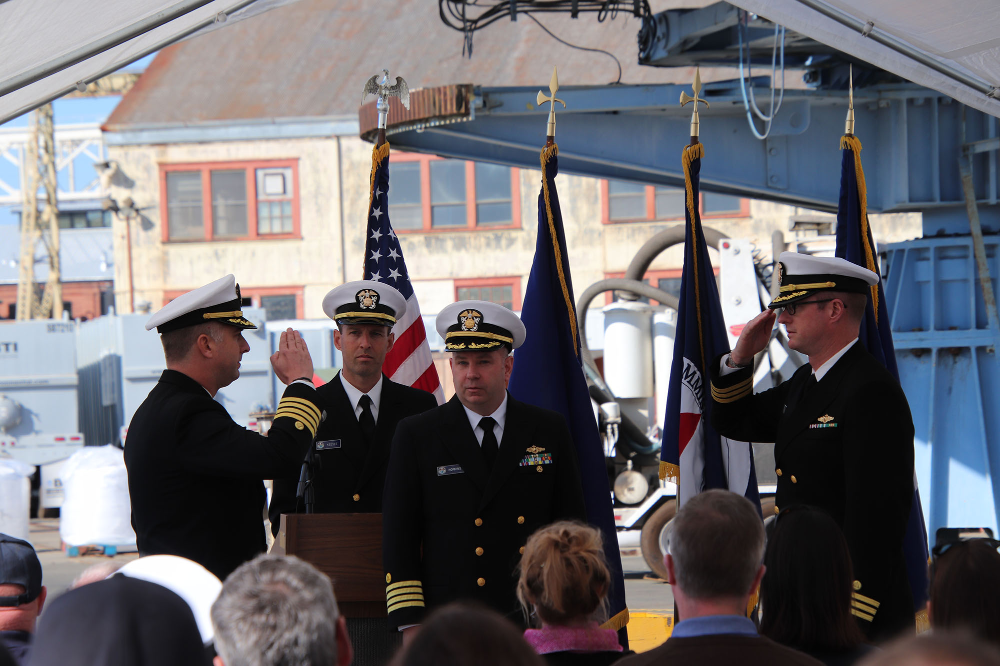
NOAA releases 2019 hydrographic survey plans

NOAA Hydrographic Survey Projects 2019 story map cover

NOAA’s Office of Coast Survey is the nation’s nautical chartmaker, and maintains a suite of more than a thousand nautical charts. Coast Survey is responsible for charting U.S. waters and Great Lakes covering 3.4 million square nautical miles (SNM) of water and 95,000 miles of coastline.

NOAA’s hydrographic survey ships along with hydrographic contractor vessels, recently kicked off the 2019 hydrographic survey season. These surveys not only update the suite of nautical charts, but also help to maintain the safety of maritime commerce, recreational boaters, natural ecosystems, and much more. Operations are scheduled for maritime priority areas around the country and are outlined in Coast Survey’s “living” story map. Here is a list of where they are headed this year:

Continue reading “NOAA releases 2019 hydrographic survey plans”

From NOAA Ship Fairweather to Mt. Fairweather: Commanding officer summits ship’s namesake

The high camp, at an elevation of 10,400 feet on the Grand Plateau Glacier.

By Cmdr. Mark Van Waes, former commanding officer of NOAA Ship Fairweather

Mount Fairweather stands tall above Glacier Bay National Park and Preserve, dominating the skyline for miles around (when weather permits visibility). Only about 12 miles inshore from the Gulf of Alaska and soaring to 15,325 feet, it is one of the highest coastal peaks in the world.
Continue reading “From NOAA Ship Fairweather to Mt. Fairweather: Commanding officer summits ship’s namesake”

NOAA researches autonomous survey system in the Arctic

The unmanned surface vehicle BEN launched from NOAA Ship Fairweather. Photo by Christina Belton, NOAA.

By Rob Downs, Office of Coast Survey unmanned systems projects lead

A team composed of research engineers and a graduate student from the University of New Hampshire Center for Coastal and Ocean Mapping/Joint Hydrographic Center (UNH CCOM/JHC) and personnel from NOAA’s Office of Coast Survey are aboard the NOAA Ship Fairweather to test UNH’s BEN (Bathymetric Explorer and Navigator) unmanned surface vehicle (USV). On Saturday, July 28, the Fairweather made the first successful launch of a USV for an operational hydrographic survey from a NOAA vessel in the Arctic. The team conducted four additional deployments, including an extended overnight survey made in coordination with the ship.
Continue reading “NOAA researches autonomous survey system in the Arctic”

NOAA surveys the unsurveyed, leading the way in the U.S. Arctic

President Thomas Jefferson, who founded Coast Survey in 1807, commissioned Lewis and Clark’s Corps of Discovery Expedition in 1803, the first American expedition to cross the western portion of the contiguous United States. Today there remains a vast western America territory that is largely unknown and unexplored – the U.S. waters off the coast of Alaska. As a leader in ocean mapping, NOAA Coast Survey launches hydrographic expeditions to discover what lies underneath the waves.
Alaska is one-fifth the size of the contiguous United States, and has more than 33,000 miles of shoreline. In fact, the Alaskan coast comprises 57 percent of the United States’ navigationally significant waters and all of the United States’ Arctic territory. Alaskan and Arctic waters are largely uncharted with modern surveys, and many areas that have soundings were surveyed using early lead line technology from the time of Capt. Cook, before the region was part of the United States. Currently only 4.1 percent of the U.S. maritime Arctic has been charted to modern international navigation standards. Continue reading “NOAA surveys the unsurveyed, leading the way in the U.S. Arctic”

Everyday actions keep mariners safe aboard NOAA hydrographic survey vessels

A NOAA Corp officer watches for hazards to navigation on board NOAA Ship Fairweather.

Collecting bathymetric data for our nation’s nautical charts requires skilled work on the water. Whether survey data is actively being collected or the ship is transiting to its next destination, NOAA crews perform a number of ancillary tasks as they operate NOAA hydrographic ships 24 hours a day, 7 days a week. Atmospheric and ecological observations provide context for the crew so they can avoid dangerous situations, while also supporting NOAA environmental databases and records. Drills and training are necessary to keep people and property safe. The following are some of the actions the mariners take while they are aboard the vessel.
Continue reading “Everyday actions keep mariners safe aboard NOAA hydrographic survey vessels”

NOAA ships Fairweather and Rainier mark 50 years of service and survey

NOAA ships Rainier and Fairweather.

To recognize the successful history of NOAA ships Fairweather and Rainier, as well as the professional mariners, hydrographers, and commissioned officers who have served aboard these ships for the last 50 years, NOAA hosted a ceremony and public ship tours at the Marine Operations Center – Pacific (MOC-P) in Newport, Oregon. Continue reading “NOAA ships Fairweather and Rainier mark 50 years of service and survey”

Take a 360 tour of NOAA Ship RAINIER

In celebration of 50 years of survey and service to the nation, NOAA ships Rainier and Fairweather—two of NOAA’s hydrographic survey vessels—will be opening their doors and hosting public ship tours. Since we understand that many of you are unable to be in Newport, Oregon, the afternoon of March 22 to take a tour in person, we are bringing the tour to you! The following 20 images offer a 360 degree view of the interior and exterior of NOAA Ship Rainier. The images were taken last field season on the survey operations mission to Channel Islands, California. From the crew mess and engine room to a view from the bow, we have captured it all.
Continue reading “Take a 360 tour of NOAA Ship RAINIER”

NOAA Ship Fairweather uses new technology to improve survey efficiency

Area surveyed by Fairweather May 30- June 10, 2017.
By ENS Peter Siegenthaler

Following the scheduled winter repair period, Fairweather is kicking off the 2017 field season in Tlevak Strait; the waterway between Dall Island and Prince of Wales Island in Southeast Alaska. This area was last surveyed between 1900 and 1939, and the lead-lines used at the time to determine depths were susceptible to omission of rocks and other features in an area. Using the latest innovations in hydrographic technology, Fairweather will be resurveying these areas with complete coverage multibeam echo sounder bathymetry. This allows Fairweather to identify any rocks or shoal features missed in prior surveys, increasing the safety for local communities, whose economies and livelihoods are dependent on maritime transportation of goods. Continue reading “NOAA Ship Fairweather uses new technology to improve survey efficiency”