Coast Survey Spotlight: Meet Glen Rice

Glen Rice embarking on the "NOAA Ship Nancy Foster" to conduct acceptance testing to confirm proper operation of a newly installed multibeam system.

Ever wonder what it’s like to be a member of the NOAA Coast Survey team? We use the Coast Survey spotlight blog series as a way to periodically share the experiences of Coast Survey employees as they discuss their work, background, and advice.


“Coast Survey serves the public important information that has a real impact both to national commerce and to the individual.”

Continue reading “Coast Survey Spotlight: Meet Glen Rice”

A message to hydrographers: Your time is now

A global view of mapped and unmapped portions of the world ocean.

By Rear Adm. Shep Smith, Director of NOAA’s Office of Coast Survey

There has never been a better time to be a hydrographer. Our skills, data, and technology are in high demand globally, driven by an increased emphasis both on supporting the blue economy and of protecting the ocean upon which all life on earth depends. The UN declared this decade the “Decade of Ocean Science for Sustainable Development,” and that vision specifically calls out the need to map the world’s oceans. The Nippon Foundation has breathed new energy into the century-long project to create a General Bathymetric Chart of the Oceans (GEBCO) with a supporting campaign called Seabed 2030. Hydrography is now invaluable for habitat mapping, for mineral and energy exploration, for offshore wind development, and for ocean modeling supporting everything from predicting local harmful algal blooms to understanding the earth system itself at a global scale.

Continue reading “A message to hydrographers: Your time is now”

NOAA improves coastal resilience tools for U.S. Pacific Islands vulnerable to natural disasters

NOS tide and surge guidance coverage over the Pacific.

By Jack Riley and Sergey Vinogradov, Ph.D.

The Pacific Ocean is the largest and deepest of Earth’s oceanic divisions. It extends from the Arctic Ocean in the north to the Southern Ocean in the south and is bound by the continents of Asia and Australia in the west and the Americas in the east. Most of the U.S. Pacific territories are located in the northern half of the Pacific Ocean and are among the Pacific Islands that are highly exposed to natural disasters. As part of NOAA’s coastal resilience efforts, the National Ocean Service (NOS) is developing better tools to define changes in water level related to tropical cyclones and other weather related conditions. This work is part of the global effort to develop disaster risk assessment tools and practical technical applications to reduce and mitigate coastal countries’ vulnerability to natural disasters.

Continue reading “NOAA improves coastal resilience tools for U.S. Pacific Islands vulnerable to natural disasters”

NOAA Ship Thomas Jefferson tests innovative DriX unmanned surface vehicle

Drone photo of the DriX underway from the ship with the DDS still in the water.

By Ens. Taylor Krabiel

During the month of October, NOAA Ship Thomas Jefferson integrated and operated a DriX, an Unmanned Surface Vessel (USV) created by the French technology company iXblue. The primary goal of the project was to test iXblue’s unique deployment and recovery solution specifically designed for Thomas Jefferson’s on board survey launch davit. Survey launches are limited to daylight operations and deployment and recovery are the most challenging operations the ship undertakes. Utilizing a DriX for continuous survey operations without having to recover and/or service it for up to four days straight would significantly increase the ship’s efficiency.

Continue reading “NOAA Ship Thomas Jefferson tests innovative DriX unmanned surface vehicle”

Register for NOAA Nav-cast webinar: NOAA’s nowCOAST

Image announcing Nav-cast webinar.

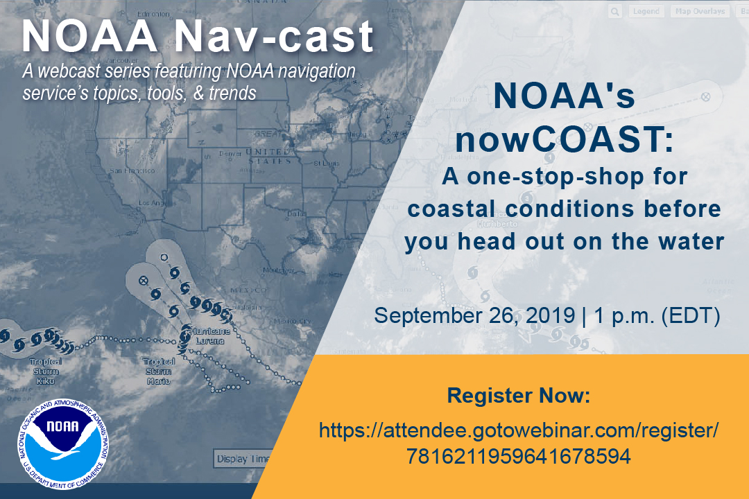
UPDATE: The Nav-cast scheduled for 9/26 at 1 p.m. (EDT) is cancelled and will be rescheduled at a later date. We apologize for the inconvenience.

Join us for our next NOAA Nav-cast, a quarterly webinar series that highlights the tools and trends of NOAA navigation services.

NOAA’s nowCOAST: A one-stop-shop for coastal conditions before you head out on the water

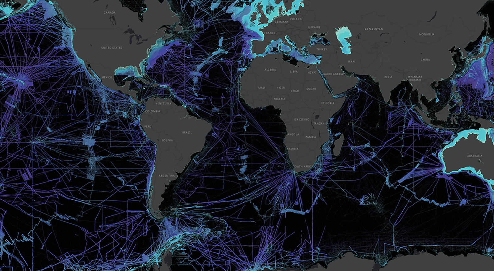
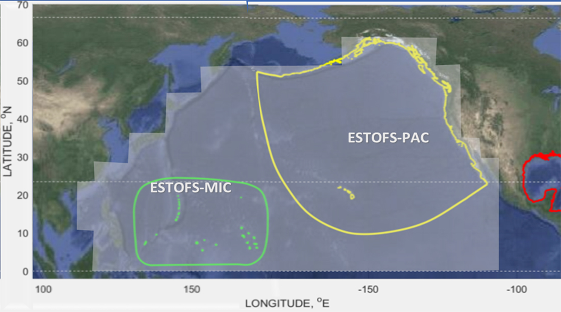
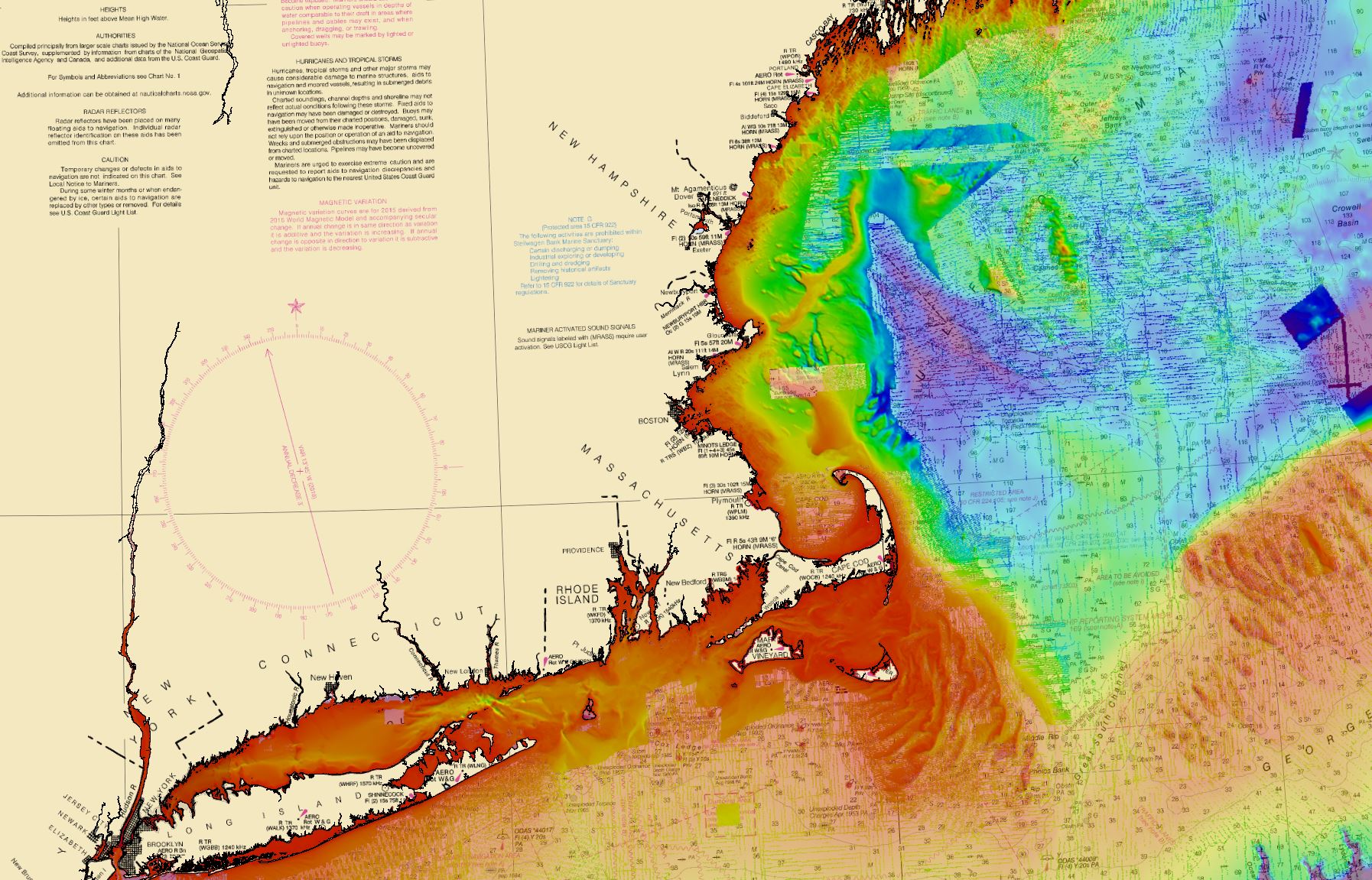
NOAA’s nowCOAST (nowcoast.noaa.gov) — a free online interactive map viewer —provides situational awareness on present and future weather and oceanographic conditions for mariners and other coastal users by integrating data from across NOAA and regional observing systems. Users can assess present conditions by creating maps of the latest in-situ weather/marine weather observations, weather radar mosaics, cloud images from GOES weather satellites, and surface wind and sea-surface temperature analyses for the last few hours. Users can also obtain maps of critical weather/marine weather advisories, watches, and warnings, weather forecasts, tropical cyclone track and intensity forecasts, and forecast guidance of water levels, water temperature, salinity, and currents from NOAA oceanographic forecast models.  Users can display these maps using the nowCOAST map viewer or by connecting to its map services. nowCOAST operates in a high-availability hosting facility and is monitored 24 x 7.

Continue reading “Register for NOAA Nav-cast webinar: NOAA’s nowCOAST”

NOAA Ship Rainier successfully field tests autonomous hydrographic survey launch

Autonomous survey launch.

By Lt. j.g. Airlie Picket

NOAA Ship Rainier field tested a new hydrographic survey platform this season. Last winter, one of the ship’s hydrographic survey launches was converted into a semi-autonomous vessel, allowing it to be operated remotely.  Hydrographic surveying is, by nature, dangerous. Autonomous systems have the potential to augment traditional surveying methods, improving efficiency and decreasing (or eliminating) risk to the surveyors themselves. As such, this technology is an exciting step toward fully-autonomous hydrographic survey systems.

Continue reading “NOAA Ship Rainier successfully field tests autonomous hydrographic survey launch”

Saildrone launched with seafloor mapping capabilities in the Gulf of Mexico shows promise for remote Arctic mapping

Rear Adm. Shep Smith, Richard Jenkins, and Brian Connon in front of a Saildrone.

NOAA’s Office of Coast Survey, the University of Southern Mississippi (USM), and Saildrone accomplished a key milestone in the research and testing of unmanned technology that can lead to enhanced seafloor mapping capabilities with the launch of the first Saildrone — a wind-driven and solar-powered unmanned surface vehicle (USV) — equipped with multibeam echo sounder technology in the Gulf of Mexico. NOAA anticipates the success of this mission and technical achievement will lead to mapping projects in the Arctic.

Continue reading “Saildrone launched with seafloor mapping capabilities in the Gulf of Mexico shows promise for remote Arctic mapping”

From historic air disasters to hurricane response, NOAA uses cutting edge science to survey the seafloor

NOAA ships Rude and Whiting's search limits off Martha’s Vineyard.

By Christine Burns

Hydrographic surveying continually evolves to improve safety, efficiency, and accuracy in data collection. From using side scan sonar equipment during hydrographic survey response efforts following air disasters in the late 1990s, to recent hurricane response efforts to re-open ports to maritime commerce, our science always strives to be cutting edge.

Continue reading “From historic air disasters to hurricane response, NOAA uses cutting edge science to survey the seafloor”

NOAA Ship Thomas Jefferson tests drone use for shoreline mapping

By, Lt. j.g. Matt Sharr, NOAA, and Lt. Charles Wisotzkey, NOAA

NOAA’s Office of Coast Survey and the National Geodetic Survey (NGS) recently conducted operational tests of small unmanned aerial systems — or drones — on board NOAA Ship Thomas Jefferson in support of survey operations conducted along the south coast of Puerto Rico. The tests show the potential of imagery from low-cost off-the-shelf drones to meet NOAA survey specifications for near-shore and shoreline feature mapping. This could replace traditional shoreline verification and mapping techniques used by NOAA hydrographic survey field units. Potential benefits of using drones for shoreline mapping include: improved data collection efficiency compared to data collection from small skiffs; more accurate feature investigation than traditional techniques; and, most importantly, removal of personnel from potentially dangerous situations (i.e. survey in close proximity to features being mapped). Continue reading “NOAA Ship Thomas Jefferson tests drone use for shoreline mapping”