Beta test of crowdsourced bathymetry holds promise for improving U.S. nautical charts

BHII bathymetric data collection

We are on the verge of acquiring a significant new source of data to improve NOAA nautical charts, thanks to an enthusiastic industry and mariners equipped with new technology.

By Lt. Adam Reed, Integrated Oceans and Coastal Mapping (IOCM) Assistant Coordinator
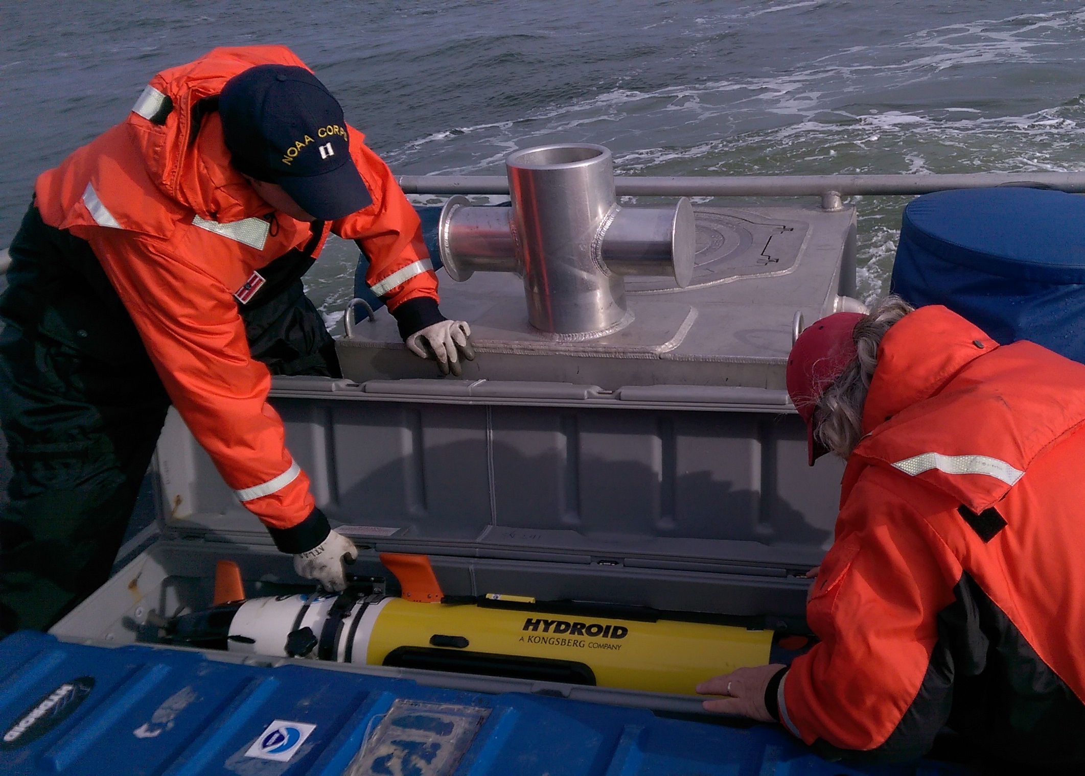
The United States has about 3,400,000 square nautical miles of water within our coastal and Great Lakes jurisdiction. Coast Survey, who is responsible for charting that vast area, averages about 3,000 square nautical miles of hydrographic surveying each year. The data collected by those surveys update over a thousand NOAA charts. However, hydrographic surveys are expensive and laborious, and so Coast Survey directs them toward the highest priority sites, which leaves many coastal areas without updates for many years.
Coast Survey may soon get new sources of information, provided voluntarily by mariners, which will alert cartographers to areas where shoaling and other changes to the seafloor have made the chart inaccurate.
Continue reading “Beta test of crowdsourced bathymetry holds promise for improving U.S. nautical charts”

Four Gulf of Mexico basins named for officers who led EEZ bathymetric mapping

The U.S. Board on Geographic Names recently named four previously unknown basins in the United States Exclusive Economic Zone (EEZ) in the Gulf of Mexico, honoring retired NOAA officers who mapped the area in the late 1980s and early 1990s. The names — Armstrong Basin, Floyd Basin, Matsushige Basin and Theberge Basin — were proposed by Texas A&M University, based on their new compilation of bathymetry drawn largely from the NOAA multibeam mapping project conducted by now-decommissioned NOAA ships Whiting and Mt. Mitchell.

Newly named Armstrong Basin
A basin in the Gulf of Mexico was named after retired NOAA Captain Andrew Armstrong.

Retired NOAA Capt. Richard P. Floyd was the commanding officer of NOAA Ship Whiting from February 1990 to March 1992; he was followed by retired Capt. Andrew A. Armstrong III, who was CO from February 1992 to January 1994. Retired NOAA Capt. Roy K. Matsushige was commanding officer of NOAA Ship Mt. Mitchell from December 1988 to January 1991, followed by retired Capt. Albert E. Theberge, who served as CO from January to November 1991. The officers led the bathymetric mapping operations under the direction of NOAA’s Office of Charting and Geodetic Services, a predecessor of today’s Office of Coast Survey.
Continue reading “Four Gulf of Mexico basins named for officers who led EEZ bathymetric mapping”

How accurate are nautical charts?

Charts will provide more information on “zone of confidence”

It is a major challenge – some might say an impossibility – to keep all thousand U.S. nautical charts up to date. But exactly how out of date is the chart data? Chart users will get a better idea now that Coast Survey is gradually rolling out a new chart feature called the zone of confidence, or “ZOC” box. It will replace the source diagram that is currently on large-scale charts. Source diagrams, and now the improved ZOC, help mariners assess hydrographic survey data and the associated level of risk to navigate in a particular area.
The first charts to show the new ZOC box are 18622, 18682, 18754, and 11328. They were released on April 7.
Continue reading “How accurate are nautical charts?”

U.S. Coast Pilot goes interactive

Coast Survey published its earliest version of the United States Coast Pilot in 1858, as Appendix No. 44 in Coast Survey’s Annual Report. The publication, organized into nine regional volumes, provides navigational information that can’t fit on nautical charts.
The U.S. Coast Pilot has gone through many iterations over the last 158 years. In the last century, we’ve added more information and added color to the historically black and white copy. More recently, we began posting book files on the web for easy download. We have now taken the next major step, enabled by interactive digital technology, to give boaters an enhanced and more accessible product. (Please note, the improved version is not mobile-friendly. You should use a tablet or larger screen.)
Breakthroughs in digital editing and publishing have allowed us to produce the U.S. Coast Pilot in a digital format called extensible markup language (XML). People won’t notice a difference from the original format — it looks the same as the paper copy — but the online version has some neat interactive features. To find them, go to the U.S. Coast Pilot, select your volume, and then click on a chapter in the left hand HTML column.
Continue reading “U.S. Coast Pilot goes interactive”

Maria Mitchell: Coast Survey’s “indefatigable comet-seeker”

Among women trailblazers, there is one who may not be sufficiently recognized: Maria Mitchell, the first female professional employed by Coast Survey. March is Women’s History Month, so it is especially appropriate to introduce this extraordinary woman to the Coast Survey audience.
According to the National Women’s History Museum, Mitchell “probably was the first woman employed in a professional capacity by the federal government. Although women had been hired as cooks, laundresses, etc., her 1849 employment appears to be the first case of a woman earning an annual salary for work based on knowledge of an academic field.”

theb3534
August 1, 1818 – June 28, 1889

Actually, Coast Survey records indicate that she began her Coast Survey career in August 1845, when the agency hired her as an astronomic observer, based in Nantucket. Coast Survey Superintendent Alexander Dallas Bache asked Marie and her father, William Mitchell, to assist in observations associated with a project to establish a cardinal point for latitude and longitude for the United States and North America. Records indicate that Bache paid her $300 a year.
Retired NOAA Captain Albert “Skip” Theberge has woven Maria Mitchell’s story into his history of the U.S. Coast Survey.
“Bache’s progressive, although somewhat tight-fisted, views on managing personnel led to the Coast Survey being the first federal agency to hire women for professional work both within its ranks as permanent personnel and on a contract basis. The astronomer, Maria Mitchell of Nantucket, was the pioneer in this radical departure from custom,” Theberge writes.
Continue reading “Maria Mitchell: Coast Survey’s “indefatigable comet-seeker””

NOAA begins 2016 hydrographic survey season

New data will update nautical charts around the country

As sure as spring arrives, NOAA vessels and independent contractors are hitting the seas for the nation’s 182nd hydrographic surveying season, collecting data for over two thousand square nautical miles in high-traffic U.S. coastal waters.

NOAA Ship Ferdinand Hassler heads out to survey.

“Nautical charts are the foundation for the nation’s maritime economy, and NOAA hydrographers spend months at sea, surveying critical areas to ensure safe navigation for the shipping, fishing, and boating communities,” said Rear Admiral Gerd Glang, director of the Office of Coast Survey.
“Spring is the traditional beginning of the survey season,” Glang explained. “After a winter of data processing, ship maintenance, and personnel refresher training, the NOAA survey ships and Coast Survey navigation response teams are anxious to get to their survey assignments.”
Continue reading “NOAA begins 2016 hydrographic survey season”

New tips for understanding nautical chart symbols

SymbolGlobeAs a responsible boater, you examine your nautical chart before sailing, determined to avoid problems during a nice trip along the coast. Charts are packed with symbols and abbreviations, so you might refer to the free copy of U.S. Chart No. 1, which lists all of the symbols used on NOAA nautical charts. It is an excellent quick reference for identifying unfamiliar symbols.
However, sometimes mariners need a deeper understanding…
Coast Survey is now providing additional information about complex or particularly confusing chart symbols to augment what is available in U.S. Chart No. 1. The first two tip sheets are available now. Coast Survey will add more chart symbology tip sheets to the U.S. Chart No. 1 webpage as the need arises.
Continue reading “New tips for understanding nautical chart symbols”

Coast Survey uses unmanned technology to find submerged danger to navigation

AUV preparation

Coast Survey has been discovering and marking the locations of underwater dangers since our surveyors took the nation’s first official ocean soundings in 1834. We’ve used or developed all the technological advancements – lead lines, drag lines, single beam echo sounders, towed side scan sonars, and post-1990 multibeam echo sounders – and now we can point to a new major advancement for fast deployment and quick recovery. In February, Coast Survey’s Mobile Integrated Survey Team (MIST) used an autonomous underwater vehicle (AUV) to locate a submerged buoy that was interfering with anchorages in the Chesapeake Bay.
“You and the crew of the HASSLER put us right where we needed to be!” said a confirmation email from the U.S. Coast Guard to NOAA Lt. Ryan Wartick, one of Coast Survey’s navigation managers. “Thanks for the great work!”
Continue reading “Coast Survey uses unmanned technology to find submerged danger to navigation”

Happy 209th anniversary to the Office of Coast Survey, the oldest federal scientific organization

The Office of Coast Survey dates from 1807, when much of the commerce between the states was by coastal shipping. And all foreign trade, especially critical to our prosperity, had to come by ship. With so many ships coming into our ports and harbors, shipwrecks were common, and it was clear the young maritime nation needed accurate nautical charts.

NINTH CONGRESS OF THE UNITED STATES
At the Second Session,
Begun and held at the city of Washington, in the territory of Columbia,
on Monday the first of December, one thousand eight
hundred and six.

AN ACT to provide for surveying the coasts of the United States.

Be it enacted by the Senate and House of Representatives of the United States of America, in Congress assembled, that the president of the United States shall be, and he is hereby authorized and requested, to cause a survey to be taken of the coasts of the United States, in which shall be designated the islands and shoals, with the roads or places of anchorage, within twenty leagues of any part of the shores of the United States; and also the respective courses and distances between the principal capes, or head lands, together with such other matters as he may deem proper for completing an accurate chart of every part of the coasts within the extent aforesaid.
Continue reading “Happy 209th anniversary to the Office of Coast Survey, the oldest federal scientific organization”

Coast Survey announces surveys by navigation response teams

NRT data will be used to update nautical charts

Coast Survey’s navigation response teams have proven their value, time and again, especially after hurricanes when ports suspend operations, and shipping (or naval movements) cease until Coast Survey’s small boats can locate underwater dangers to navigation. But what do the six navigation response teams (NRTs) do during those long periods between deployments for maritime emergencies? They are busy, mostly year-round, collecting hydrographic data for updating nautical charts.
Continue reading “Coast Survey announces surveys by navigation response teams”