
Coast Survey published its earliest version of the United States Coast Pilot in 1858, as Appendix No. 44 in Coast Survey’s Annual Report. The publication, organized into nine regional volumes, provides navigational information that can’t fit on nautical charts.
The U.S. Coast Pilot has gone through many iterations over the last 158 years. In the last century, we’ve added more information and added color to the historically black and white copy. More recently, we began posting book files on the web for easy download. We have now taken the next major step, enabled by interactive digital technology, to give boaters an enhanced and more accessible product. (Please note, the improved version is not mobile-friendly. You should use a tablet or larger screen.)
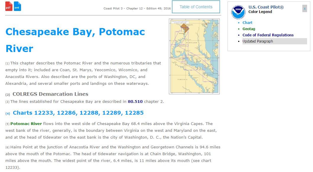
Breakthroughs in digital editing and publishing have allowed us to produce the U.S. Coast Pilot in a digital format called extensible markup language (XML). People won’t notice a difference from the original format — it looks the same as the paper copy — but the online version has some neat interactive features. To find them, go to the U.S. Coast Pilot, select your volume, and then click on a chapter in the left hand HTML column.
This new version of the U.S. Coast Pilot is formatted for reading on the web. Certain place names and objects, highlighted in green, are now directly view-able on a nautical chart and linked to entries in the official U.S. Geographic Names database. Some other features include:
-
- images that embiggen when clicked;
-
- an interactive table of contents for each book; and
- raster nautical chart links (highlighted in light blue) that can be viewed with each section in the book.
Coast Survey updates the Coast Pilot weekly, and now readers can see where we made changes. The system automatically highlights changes (in gray), and retains those highlights until the next annual version is published. (The print-on-demand paper copy contains all updates made up to the time of printing.) The annual versions are published on a staggered yearly schedule.
Contact coast.pilot@noaa.gov with any questions or comments about the Coast Pilot, the format, downloads, or XML code.
this would be fantastic if it worked well on a mobile device. accessing it via my phone is a horrible user experience.
We apologize for your frustration. You are correct, Coast Pilot is not mobile-friendly and should be viewed on a larger screen. We will add a note so others can avoid your user experience.
I am unable to view the .xml form – I get message “This XML file does not appear to have any style information associated with it. The document tree is shown below.” using Google Chrome or Internet Explorer the XML code appears without any similar message. Any advice on how to view them ?
Brian, that XML message appears when someone is using an older version of Internet Explorer. The XML code can be viewed in up-to-date browsers (Chrome, Firefox, IE, Edge). Also, we should stress that XML is meant for computers to read — as opposed to HTML, which is meant for humans. XML probably won’t make any sense to anyone not familiar with it.
Please provide a link for coast pilot downloads. I keep getting the 404 error using the old link.
https://nauticalcharts.noaa.gov/publications/coast-pilot/index.html
U.S. Coast Pilot links, http://www.nauticalcharts.noaa.gov/nsd/cpdownload.htm, on this page are broken
Thank you for your comment. Since this blog was posted, Coast Survey redesigned the nauticalcharts.noaa.gov, resulting in many url changes. Please find the U.S. Coast Pilot here: https://nauticalcharts.noaa.gov/publications/coast-pilot/index.html.