Data dissemination web interface supports navigation

Waves on the sea beach on a cloudy rainy day

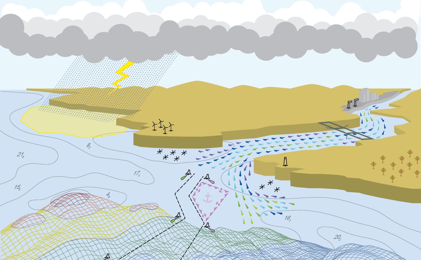
Imagine navigating a vessel along the coast and planning the approach to your destination, whether that be a local marina or large vessel berth in a harbor. What factors affecting the movement of the vessel should you be aware of once underway and in transit through the entrance and into the port? These may include observations on the present and forecasted weather, water current speed and direction, water depths and tidal direction, and any anomalies or warnings that may exist. Knowing what these factors are will assist you in preparing your vessel for safe passage to the destination.

Continue reading “Data dissemination web interface supports navigation”

A look back at 2023 and the Office of Coast Survey’s significant activities throughout the year

An image of a rocky coastline and low clouds with the title Coast Survey Year in Review, superimposed over it.

NOAA’s Office of Coast Survey is reflecting on a successful and remarkable 2023! We completed many significant activities with meaningful impacts. As we look ahead to more progress in 2024, we are proud to share some highlights of the past year in our Coast Survey Year in Review ArcGIS StoryMap.

Continue reading “A look back at 2023 and the Office of Coast Survey’s significant activities throughout the year”

NOAA-NSF collaboration – evaluating coastal models utilizing Texas Advanced Computing Center services

The Unified Forecast System (UFS) is a proposed community-based earth modeling system that is designed to incorporate oceanographic forecast model core(s) into a simplified NOAA modeling suite. This simplification is intended to reduce the footprint of the number of NOAA models and thus reduce development, operations, and maintenance.

Continue reading “NOAA-NSF collaboration – evaluating coastal models utilizing Texas Advanced Computing Center services”

Model Upgrade: Global Extratropical Surge and Tide Operational Forecast System Upgraded to Version Two

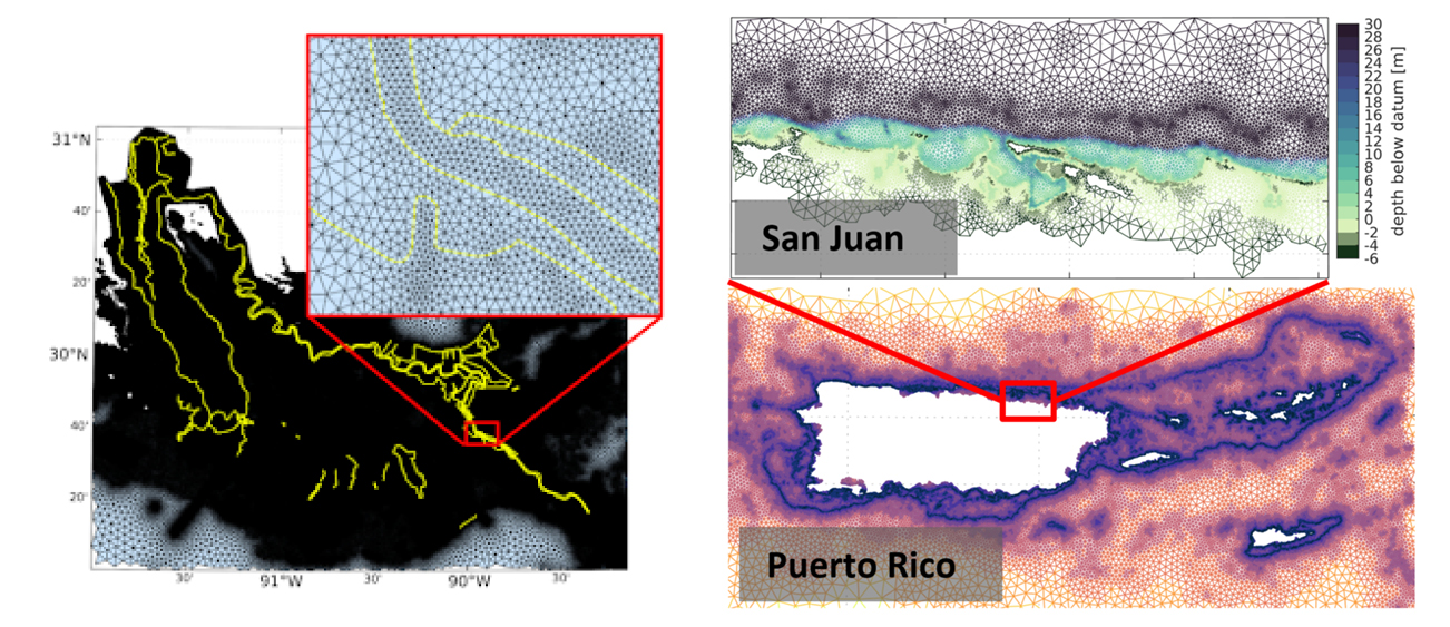
Screen captures of two new implementations of version two; federal levees along the Mississippi and flood plain inclusion for Puerto Rico.

In late July 2021, the Global Extratropical Surge and Tide Operational Forecast System (Global ESTOFS) upgrade to version two was implemented into operations on the National Weather Service’s (NWS) Weather and Climate Operational Supercomputing System (WCOSS). The modeling system provides forecast guidance for combined water levels caused by storm surge and tides globally, and is to our knowledge the highest resolution global operational storm surge modeling system available today. The forecast guidance from the model is used by forecasters at NWS Weather Forecast Offices (WFO) and the Ocean Prediction Center to generate their storm surge and flood forecasts during storms, including Nor’easters along the U.S. East Coast.

Continue reading “Model Upgrade: Global Extratropical Surge and Tide Operational Forecast System Upgraded to Version Two”

NOAA’s Precision Marine Navigation data service receives first major update

The Precision Marine Navigation (PMN) program has completed the first update of its prototype navigation data service – the PMN data processing and dissemination system and PMN Data Gateway viewer. The data processing and dissemination system provides surface current forecast guidance from NOAA’s forecast systems, in a prototype marine navigation data format. The viewer allows users to visualize the predictions and discover where they are. Both the system and the viewer were updated to include data from the recently upgraded Northern Gulf of Mexico Operational Forecast System (NGOFS2).

Continue reading “NOAA’s Precision Marine Navigation data service receives first major update”