One year later – Coast Survey’s response to the Anchorage earthquake

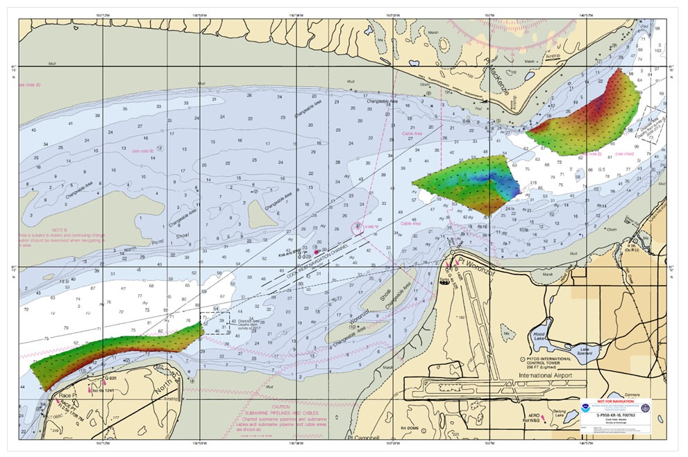
Multibeam data acquired by eTrac in Knik Arm, offshore of Anchorage.

By Lt. Cmdr. Bart Buesseler

At 8:29, on the morning of Friday, November 30, 2018, a magnitude 7.1 earthquake shook Anchorage, Alaska, for thirty stressful seconds. It was the largest earthquake in Anchorage since the Good Friday Quake of 1964, and brought Alaska’s most populated city to a standstill as residents evacuated buildings and came to terms with what they had just experienced.

Continue reading “One year later – Coast Survey’s response to the Anchorage earthquake”

NOAA Ship Rainier returns to survey the Hawaiian coast, provides update on lava flow development

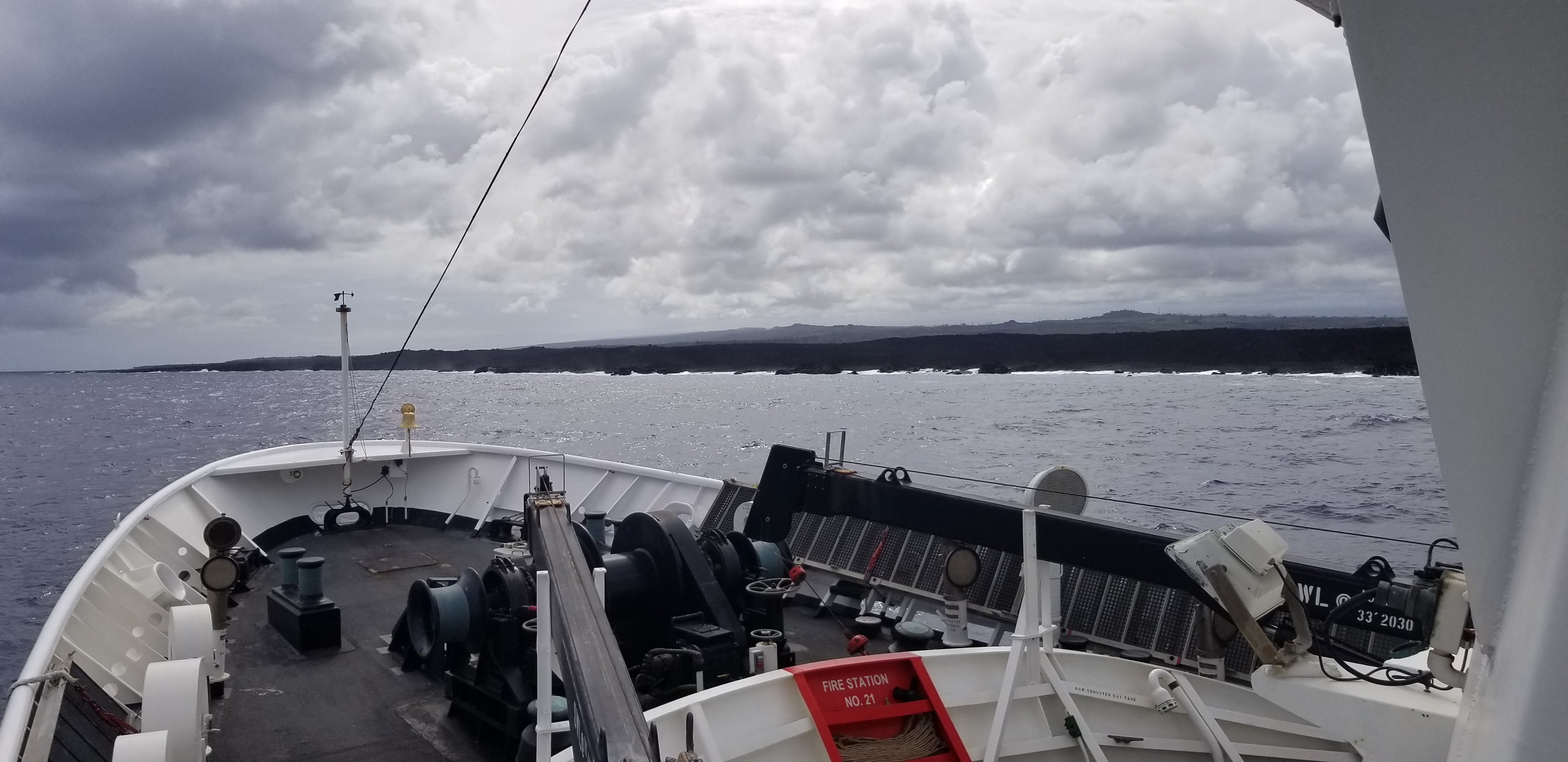
Rainier collects multibeam sonar data along Puna Coast on the Big Island of Hawaii.

By Ens. Harper Umfress

NOAA Ship Rainier’s four-decade tropical sonar silence is over and Hawaiian hydrography is back! The 2019 field season was productive, challenging, and geographically diverse. After starting the season with traditional hydrographic surveys in Alaska, Rainier was re-tasked to support science diving operations in the Papahānaumokuākea Marine National Monument that surrounds the Northwestern Hawaiian Islands. Though the primary purpose of this dispatch was to support coral reef research, the world’s most productive coastal hydrographic survey platform would have been remiss to forego this opportunity to ping new waters.

Continue reading “NOAA Ship Rainier returns to survey the Hawaiian coast, provides update on lava flow development”

NOAA seeks public comment on ending production of traditional paper nautical charts

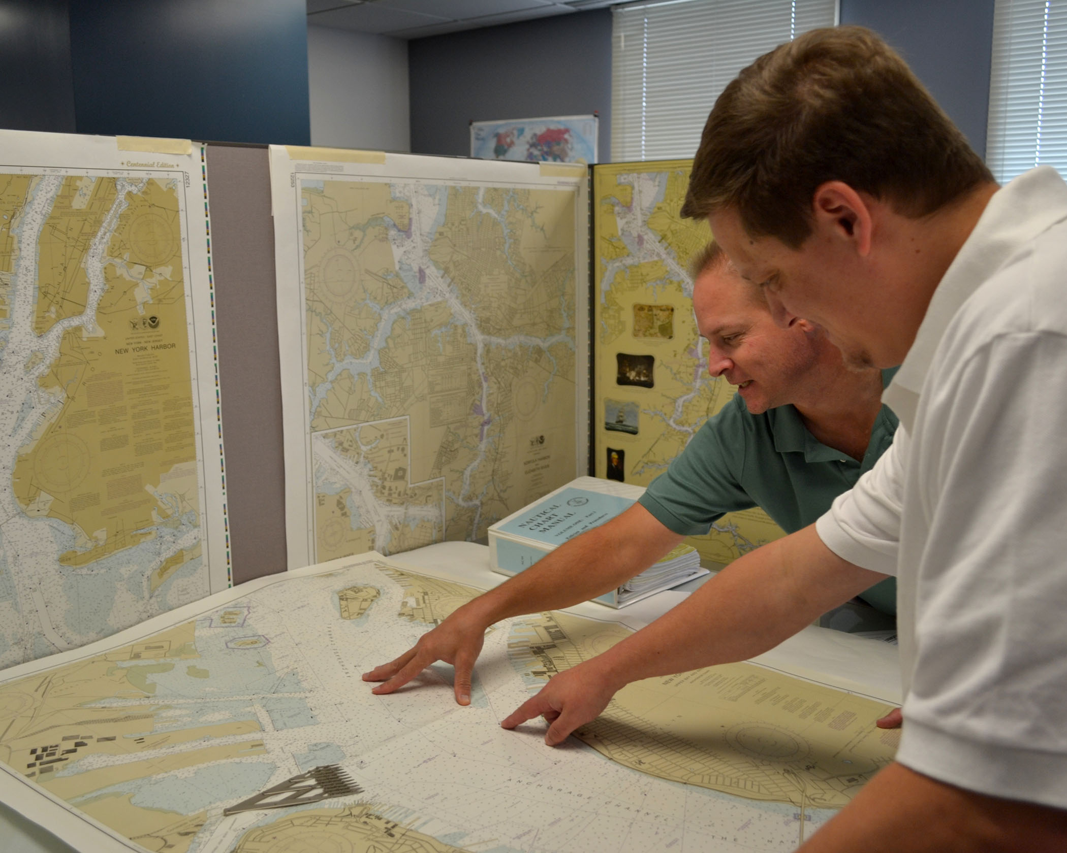
NOAA cartographers review a traditional printed nautical chart.

NOAA is initiating a five-year process to end all traditional paper nautical chart production and is seeking the public’s feedback via a Federal Register Notice published on November 15, 2019. Chart users, companies that provide products and services based on NOAA raster and electronic navigational chart (NOAA ENC®) products, and other stakeholders can help shape the manner and timing in which the product sunsetting process will proceed. Comments may be submitted through NOAA’s online ASSIST feedback tool.

Continue reading “NOAA seeks public comment on ending production of traditional paper nautical charts”

NOAA Ship Thomas Jefferson tests innovative DriX unmanned surface vehicle

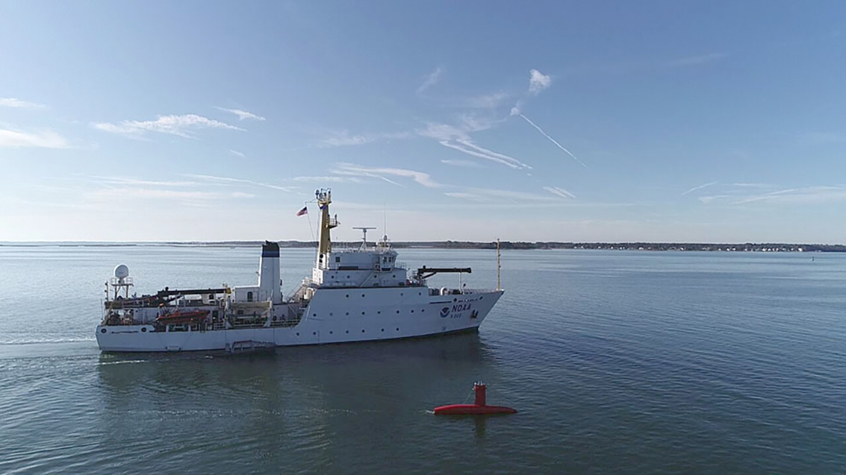
Drone photo of the DriX underway from the ship with the DDS still in the water.

By Ens. Taylor Krabiel

During the month of October, NOAA Ship Thomas Jefferson integrated and operated a DriX, an Unmanned Surface Vessel (USV) created by the French technology company iXblue. The primary goal of the project was to test iXblue’s unique deployment and recovery solution specifically designed for Thomas Jefferson’s on board survey launch davit. Survey launches are limited to daylight operations and deployment and recovery are the most challenging operations the ship undertakes. Utilizing a DriX for continuous survey operations without having to recover and/or service it for up to four days straight would significantly increase the ship’s efficiency.

Continue reading “NOAA Ship Thomas Jefferson tests innovative DriX unmanned surface vehicle”

Coast Survey Spotlight: Meet Kolleen Mortimer

Kolleen Mortimer standing on the banks of the Elizabeth River in Portsmouth, Virginia.

Ever wonder what it’s like to be a member of the NOAA Coast Survey team? We use the Coast Survey spotlight blog series as a way to periodically share the experiences of Coast Survey employees as they discuss their work, background, and advice.


Kolleen Mortimer, Physical Scientist

“Knowing the data we examine every day contributes to safe navigational products is greatly rewarding. It’s also rewarding to see the process come to life in a greater scope. When the data leaves my desk and makes it to a chart product, I can say that my work contributed to that.”

Continue reading “Coast Survey Spotlight: Meet Kolleen Mortimer”

NOAA responds to bridge damage near Houston following Tropical Depression Imelda

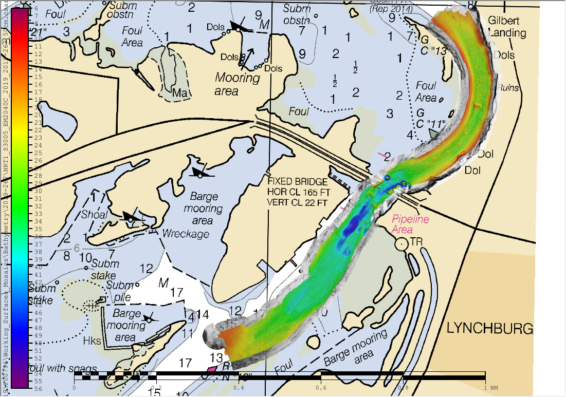
Overview of multibeam and side scan sonar data overlaid on chart 11329.

While many are aware that hurricanes can inflict costly damage when they make landfall, tropical storms and depressions are not to be underestimated. Tropical Depression Imelda moved over the Texas coast in mid-September producing heavy rain and causing extensive flooding. Nine barges broke free from their mooring on the San Jacinto River and two of these barges hit the Interstate 10 bridge in Lynchburg, Texas. At the request of the U.S. Coast Guard Captain of the Port Houston-Galveston, NOAA’s Navigation Response Team (NRT)- Stennis was called in for rapid hydrographic survey response.

Continue reading “NOAA responds to bridge damage near Houston following Tropical Depression Imelda”

NOAA Ship Nancy Foster performs full-coverage mapping survey of Northern Blake Plateau

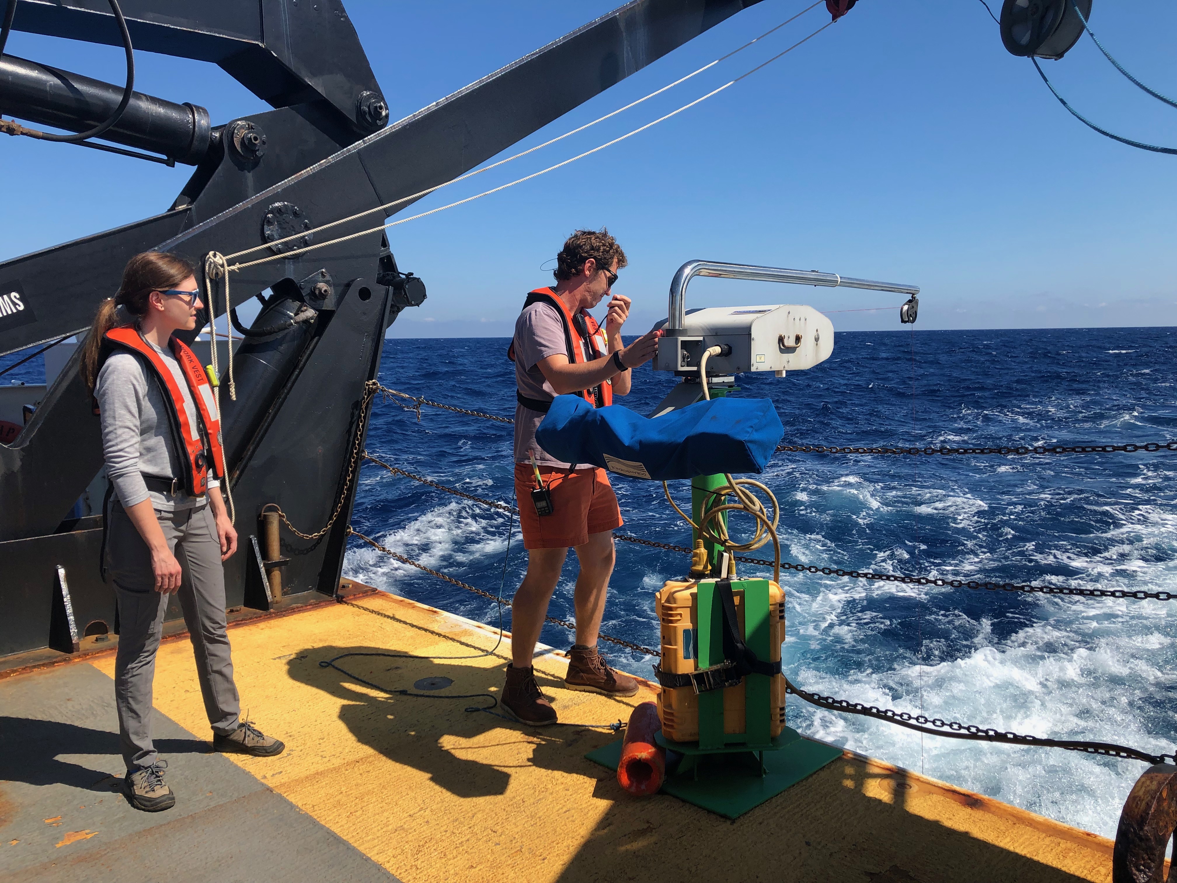
ST Barbee and NOAA Affiliate Veronica Martinez deploy Nancy Foster’s Underway CTD.

By Julia Wallace and Lt. j.g. Michelle Levano

NOAA Ship Nancy Foster conducted survey operations offshore of coastal South Carolina from August 12-30, 2019, as a joint effort between NOAA’s Office of Coast Survey and Office of Ocean Exploration and Research. This survey encompassed portions of the Blake Plateau, and was particularly special because this region has never been mapped using contemporary sonar systems. The project served Coast Survey’s mission of providing contemporary data to update nautical charting products and supported the U.S. contribution to Seabed 2030, a multi-national initiative to map the world ocean by 2030. NOAA’s contribution to this project includes providing continuous multibeam survey coverage within the U.S. Exclusive Economic Zone.

Continue reading “NOAA Ship Nancy Foster performs full-coverage mapping survey of Northern Blake Plateau”

Register for NOAA Nav-cast webinar: NOAA’s nowCOAST

Image announcing Nav-cast webinar.

UPDATE: The Nav-cast scheduled for 9/26 at 1 p.m. (EDT) is cancelled and will be rescheduled at a later date. We apologize for the inconvenience.

Join us for our next NOAA Nav-cast, a quarterly webinar series that highlights the tools and trends of NOAA navigation services.

NOAA’s nowCOAST: A one-stop-shop for coastal conditions before you head out on the water

NOAA’s nowCOAST (nowcoast.noaa.gov) — a free online interactive map viewer —provides situational awareness on present and future weather and oceanographic conditions for mariners and other coastal users by integrating data from across NOAA and regional observing systems. Users can assess present conditions by creating maps of the latest in-situ weather/marine weather observations, weather radar mosaics, cloud images from GOES weather satellites, and surface wind and sea-surface temperature analyses for the last few hours. Users can also obtain maps of critical weather/marine weather advisories, watches, and warnings, weather forecasts, tropical cyclone track and intensity forecasts, and forecast guidance of water levels, water temperature, salinity, and currents from NOAA oceanographic forecast models.  Users can display these maps using the nowCOAST map viewer or by connecting to its map services. nowCOAST operates in a high-availability hosting facility and is monitored 24 x 7.

Continue reading “Register for NOAA Nav-cast webinar: NOAA’s nowCOAST”

NOAA supports safe ferry transit in Puget Sound

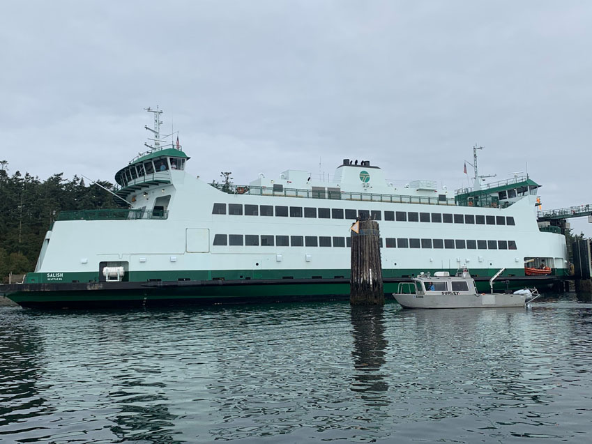
NRT-Seattle with the F/V Salish.

By Lt. j.g. Michelle Levano

If you have spent time on the water in Puget Sound, you have probably seen the large, distinct green and white vessels. These vessels move passengers, vehicles, and cargo across Puget Sound to the San Juan Islands and to Victoria, Canada, year round. They are a part of the Washington State Department of Transportation ferry system. The state has been operating ferries since 1951, and intended to run the ferry service until cross Sound bridges could be built.  These bridges were never built, and the state continues to operate the ferries to this day. As of last July, there are 22 state-operated ferries on Puget Sound, with the largest vessel able to carry 2500 passengers and 202 vehicles. 

Continue reading “NOAA supports safe ferry transit in Puget Sound”

S-100 sea trials: working toward harmonized navigation products

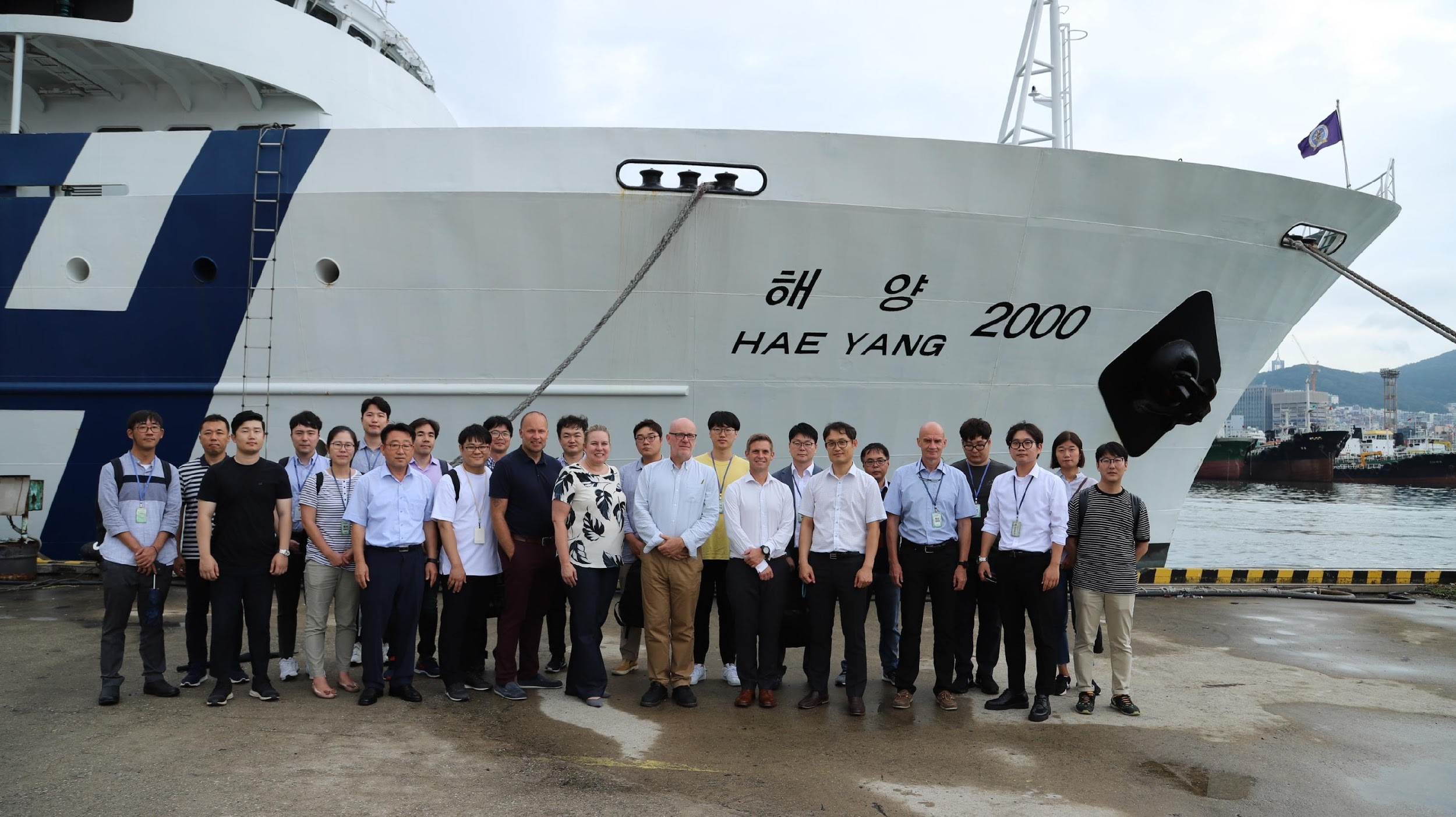
International team participating in the S-100 sea trial.

By Julia Powell, deputy division chief of the Coast Survey Development Lab

On August 27, an international contingent from the United States (NOAA), the United Kingdom Hydrographic Office, and the Canadian Hydrographic Service participated in the S-100 sea trial in Busan, Republic of Korea.

S-100 is the International Hydrographic Organization’s (IHO) Universal Hydrographic Data Model’s framework standard from which a variety of product specifications can be developed for use within navigation systems and marine spatial data infrastructure.  For many years, NOAA and the Ministry of Fisheries of the Republic of Korea have had a Joint Project Agreement and one of the projects is to develop and promote and S-100 test bed.  This test bed is designed to help further the development of S-100 infrastructure used to develop S-100 related products and further the testing of S-100 interoperability within navigation systems.

Continue reading “S-100 sea trials: working toward harmonized navigation products”