One year later – Coast Survey’s response to the Anchorage earthquake

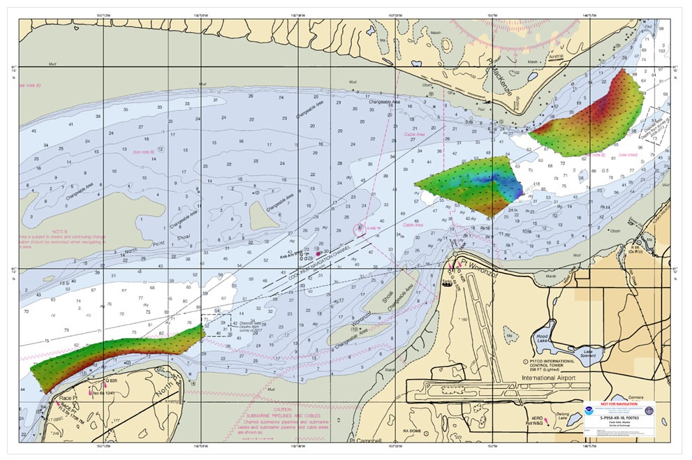
Multibeam data acquired by eTrac in Knik Arm, offshore of Anchorage.

By Lt. Cmdr. Bart Buesseler

At 8:29, on the morning of Friday, November 30, 2018, a magnitude 7.1 earthquake shook Anchorage, Alaska, for thirty stressful seconds. It was the largest earthquake in Anchorage since the Good Friday Quake of 1964, and brought Alaska’s most populated city to a standstill as residents evacuated buildings and came to terms with what they had just experienced.

Continue reading “One year later – Coast Survey’s response to the Anchorage earthquake”
Saildrone launched with seafloor mapping capabilities in the Gulf of Mexico shows promise for remote Arctic mapping

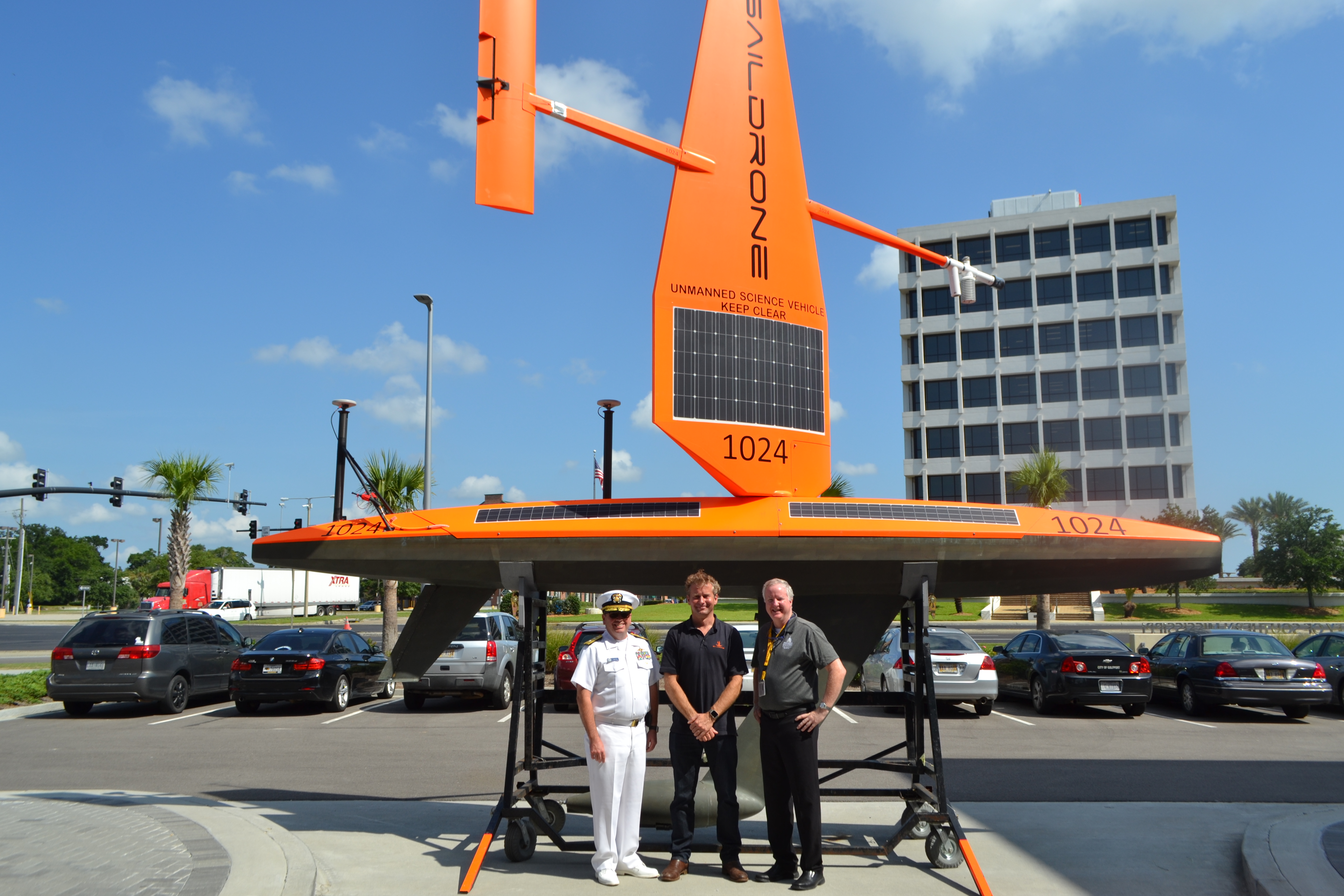
Rear Adm. Shep Smith, Richard Jenkins, and Brian Connon in front of a Saildrone.

NOAA’s Office of Coast Survey, the University of Southern Mississippi (USM), and Saildrone accomplished a key milestone in the research and testing of unmanned technology that can lead to enhanced seafloor mapping capabilities with the launch of the first Saildrone — a wind-driven and solar-powered unmanned surface vehicle (USV) — equipped with multibeam echo sounder technology in the Gulf of Mexico. NOAA anticipates the success of this mission and technical achievement will lead to mapping projects in the Arctic.

Continue reading “Saildrone launched with seafloor mapping capabilities in the Gulf of Mexico shows promise for remote Arctic mapping”

NOAA releases 2019 hydrographic survey plans

NOAA Hydrographic Survey Projects 2019 story map cover

NOAA’s Office of Coast Survey is the nation’s nautical chartmaker, and maintains a suite of more than a thousand nautical charts. Coast Survey is responsible for charting U.S. waters and Great Lakes covering 3.4 million square nautical miles (SNM) of water and 95,000 miles of coastline.

NOAA’s hydrographic survey ships along with hydrographic contractor vessels, recently kicked off the 2019 hydrographic survey season. These surveys not only update the suite of nautical charts, but also help to maintain the safety of maritime commerce, recreational boaters, natural ecosystems, and much more. Operations are scheduled for maritime priority areas around the country and are outlined in Coast Survey’s “living” story map. Here is a list of where they are headed this year:

Continue reading “NOAA releases 2019 hydrographic survey plans”

NOAA Improves Etolin Strait Data with New NOAA ENC® Layout

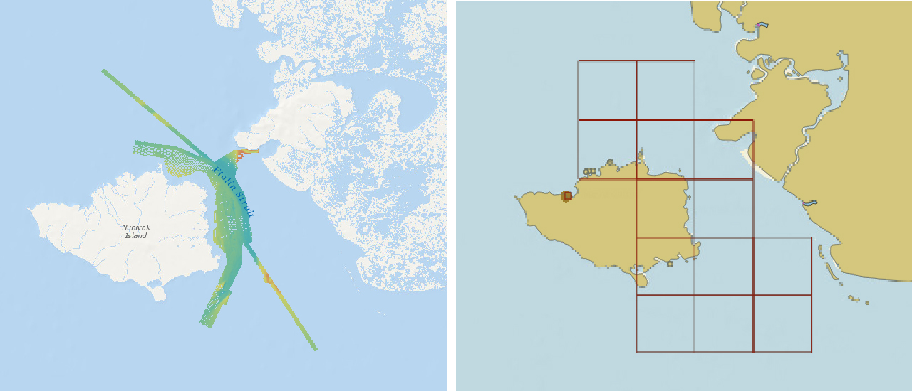
Etolin Strait survey area and reschemed grid

NOAA recently released 13 new large-scale electronic navigational charts (NOAA ENC®) of Etolin Strait, Alaska. These charts provide a nearly twenty-fold increase in scale over the previous ENC coverage. New Etolin Strait hydrographic surveys and the resulting ENCs served as a pilot project for the overall rescheming of the entire NOAA ENC suite with a regular, gridded layout for ENC charts, as outlined in NOAA’s National Charting Plan. No corresponding NOAA raster nautical chart products in Etolin Strait will be produced. This is in keeping with Coast Survey’s “ENC-only” production concept, which generally maintains the current raster chart product coverage, but only creates new larger scale coverage in the ENC product line.

Continue reading “NOAA Improves Etolin Strait Data with New NOAA ENC® Layout”

NOAA Office of Coast Survey wraps up a busy 2017 hurricane season

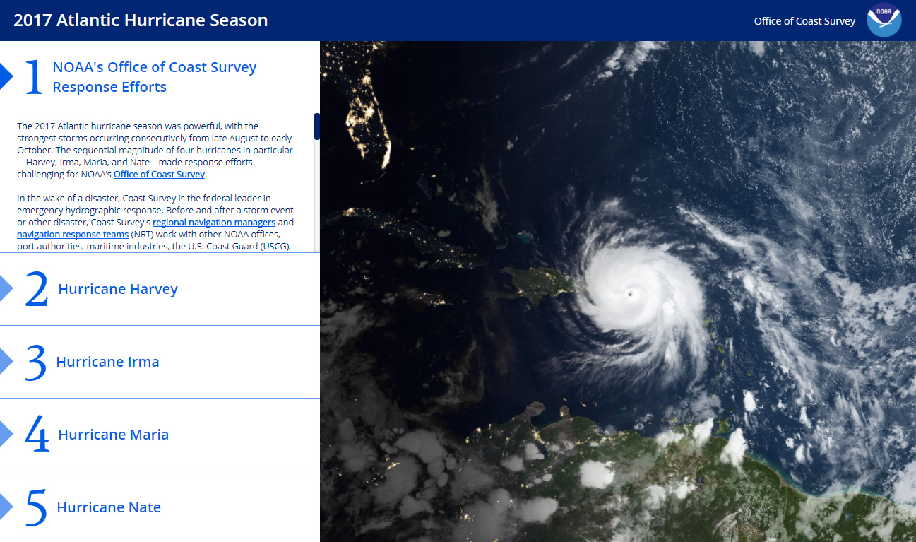
The 2017 Atlantic hurricane season was powerful, with the strongest storms occurring consecutively from late August to early October. The sequential magnitude of four hurricanes in particular—Harvey, Irma, Maria, and Nate—made response efforts challenging for NOAA’s Office of Coast Survey. Coast Survey summarized this season’s response efforts along with the efforts of NOAA Ship Thomas Jefferson (operated by NOAA’s Office of Marine and Aviation Operations) in the following story map. Continue reading “NOAA Office of Coast Survey wraps up a busy 2017 hurricane season”

NOAA releases 2017 hydrographic survey season plans

NOAA’s Office of Coast Survey maintains the nautical charts and publications for U.S. coasts and the Great Lakes. This is over a thousand charts covering 95,000 miles of shoreline and 3.4 million square nautical miles of waters. Measuring depths and determining new dangers to navigation in this large area is a monumental job given the seafloor is constantly changing.
One of NOAA Coast Survey’s biggest tasks during the winter months is to plan hydrographic survey projects for the coming field season. Survey planners consider requests from stakeholders such as marine pilots, local port authorities, the Coast Guard, and the boating community, and also consider other hydrographic priorities in determining where to survey and when. Continue reading “NOAA releases 2017 hydrographic survey season plans”

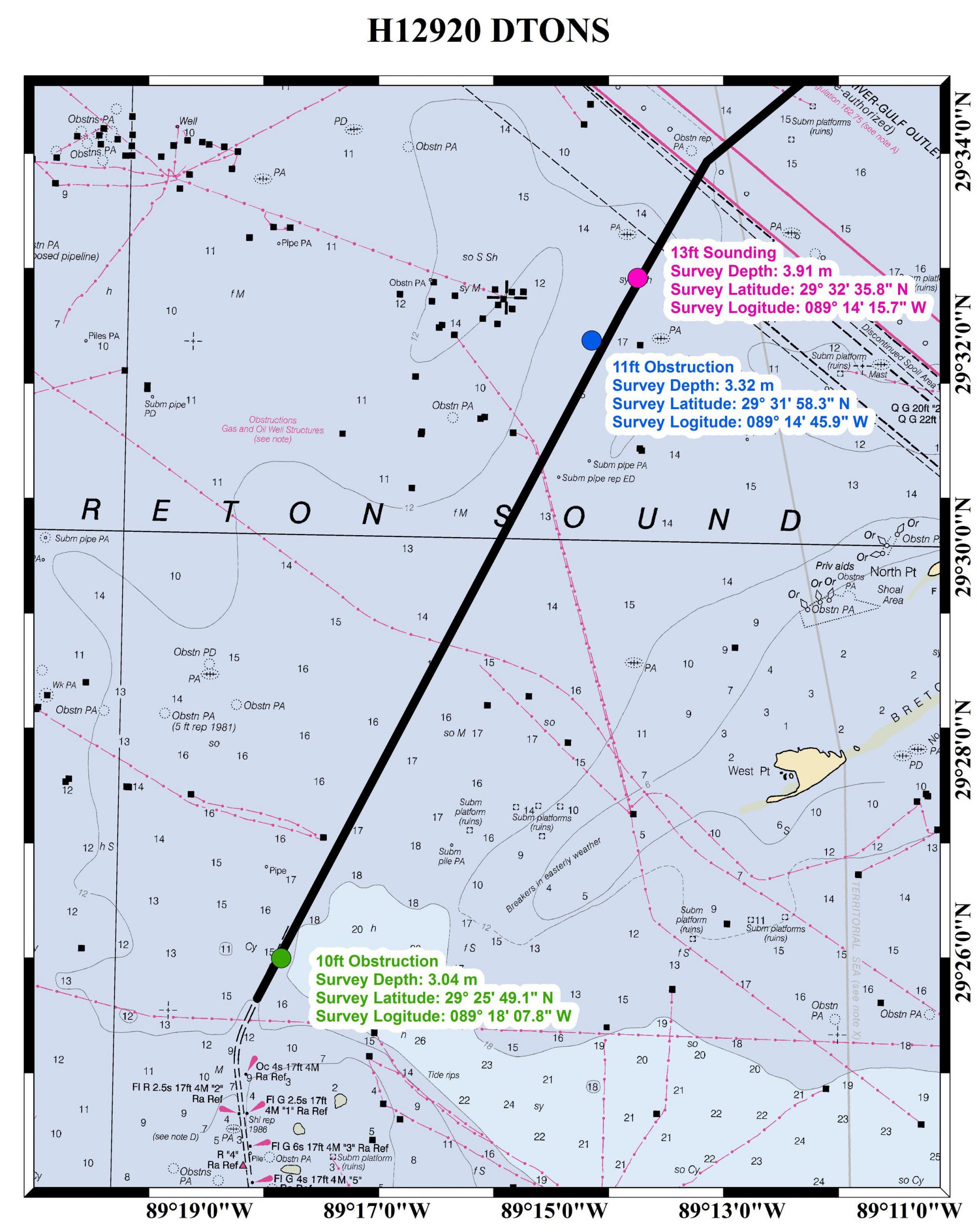
Assisting tow industry along Chandeleur Sound Alternate Route

The Inner Harbor Navigation Channel in New Orleans facilitates the transportation of tens of millions of tons of cargo each year. Since the channel was recently closed for repairs, a temporary Chandeleur Sound Alternate Route was established to ensure the flow of commerce between the western and eastern reaches of the Gulf Intracoastal Waterway. NOAA experts assisted with the alternate route development in various ways, collaborating with the U.S. Coast Guard, U.S. Army Corps of Engineers, and the maritime industry.
Continue reading “Assisting tow industry along Chandeleur Sound Alternate Route”

New private hydro vessel adds to nation’s capabilities

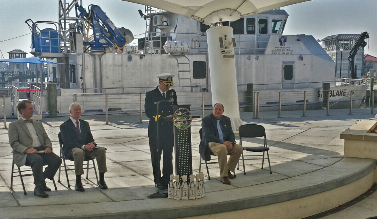
Under beautiful blue skies yesterday in Gulfport, Mississippi, David Evans and Associates, Inc. commissioned its new 82-foot hydrographic survey and scientific vessel Blake. Rear Admiral Gerd Glang, Coast Survey’s director, welcomed the addition to the nation’s hydrographic surveying assets. DEA is under contract to NOAA to provide critical hydrographic data for updating the nation’s nautical charts.
Continue reading “New private hydro vessel adds to nation’s capabilities”

NOAA hydro field season underway

The 2014 hydrographic survey season is underway, with the NOAA fleet beginning its projects for this year.
Have you ever wondered how Coast Survey goes about determining where to survey and when? Several considerations go into prioritizing survey plans, which are laid out several years in advance. Coast Survey asks specific questions about each potential survey area.

  • Is it considered a critical area? If so, how old are the most current survey data?
  • Have local pilots or port authorities submitted reports of shoaling, obstructions or other concerns?
  • Does the U.S. Coast Guard or other stakeholders from the maritime community (e.g., fisheries, energy, pipelines) need surveys for economic development or ecological protection?

Coast Survey’s 2014 projects reflect these priorities.
Continue reading “NOAA hydro field season underway”