
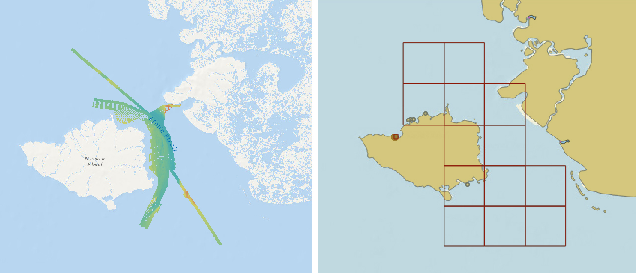
NOAA recently released 13 new large-scale electronic navigational charts (NOAA ENC®) of Etolin Strait, Alaska. These charts provide a nearly twenty-fold increase in scale over the previous ENC coverage. New Etolin Strait hydrographic surveys and the resulting ENCs served as a pilot project for the overall rescheming of the entire NOAA ENC suite with a regular, gridded layout for ENC charts, as outlined in NOAA’s National Charting Plan. No corresponding NOAA raster nautical chart products in Etolin Strait will be produced. This is in keeping with Coast Survey’s “ENC-only” production concept, which generally maintains the current raster chart product coverage, but only creates new larger scale coverage in the ENC product line.
“Last summer, I heard stakeholder groups request better charts for Western Alaska. Etolin Strait is a refuge from the often harsh Bering Sea and a transfer point for community resupply in this area,” said Rear Adm. Shep Smith, director, NOAA Office of Coast Survey. “I am thrilled that we are able to produce a new series of larger scale charts to meet this need and kick-off the rescheming effort as part of the National Charting Plan.”
When notified of the new large-scale ENCs, Captain Bill Gillespie, Alaska Marine Pilots, LLC, replied, “That’s good news and a step in the right direction that will be helpful to all the vessels and barges using that area.”


Etolin Strait runs in the north-south direction between Nunivak Island and mainland Alaska and had not been surveyed for over 100 years. This area was charted at a 1:1.5 million general scale, making it difficult for deep draft vessels to safely navigate among relative shoal areas. In June 2016, the Champion Ebony, a 600-foot chemical tanker, ran aground on an uncharted shoal just days before NOAA commenced planned survey operations. Coast Survey’s hydrographic contractor, Terrasond, surveyed Etolin Strait in August 2016 covering approximately 570 square nautical miles of seafloor.

The 13 new ENCs, produced at a more detailed 1:80,000 scale, include this newly collected hydrographic data. The new ENCs provide depths in meters with whole-meter contours at 5m, 10m, 20m, and 30m. The ENC outline also fits the multi-cell grid layout that will define the boundaries of all future reschemed ENCs. Updates to the Etolin Strait ENCs will not be made to the NOAA raster nautical chart products in keeping with the “ ENC-only” production concept outlined in the National Charting Plan.

Coast Survey is currently rescheming a portion of New York Harbor and anticipates releasing new ENCs of this area by the end of 2019.