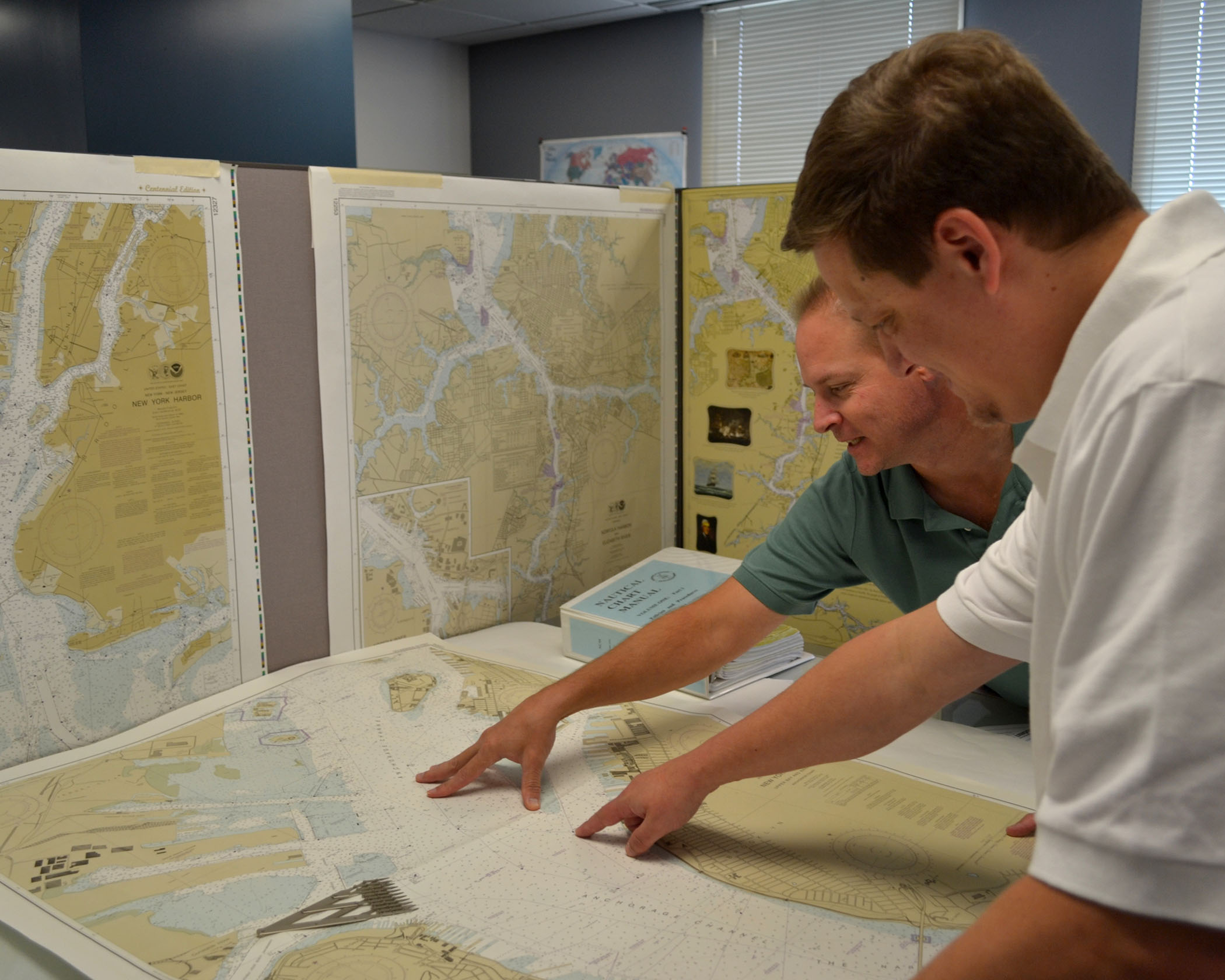
The field of hydrography, like most sciences, is comprised of experts honing their craft, improving their tools, building upon the successes of previous years, and learning from their mistakes. Hydrographers typically accomplish this iterative process in the field, publishing papers, presenting at industry conferences, and often through discussions over the phone or via email. However, once a year, the NOAA hydrographic community — those who measure and describe the features of the seafloor to update nautical charts and support a variety of sciences — meets at the Field Procedures Workshop to not only share information, but have frank discussions about their challenges and the path forward in preparation for the upcoming hydrographic field season.
Continue reading “NOAA hydrographic community prepares for field season at annual workshop”NOAA releases 2020 hydrographic survey season plans
NOAA hydrographic survey ships and contractors are preparing for the 2020 hydrographic survey season. The ships collect bathymetric data (i.e. map the seafloor) to support nautical charting, modeling, and research, but also collect other environmental data to support a variety of ecosystem sciences. NOAA considers hydrographic survey requests from stakeholders such as marine pilots, local port authorities, the Coast Guard, and the boating community, and also consider other hydrographic and NOAA science priorities in determining where to survey and when. Visit our “living” story map to find out more about our mapping projects and if a hydrographic vessel will be in your area this year!
Continue reading “NOAA releases 2020 hydrographic survey season plans”Register for NOAA Nav-cast webinar: How to obtain NOAA ENC-based paper nautical charts
Join us for our next NOAA Nav-cast, a quarterly webinar series that highlights the tools and trends of NOAA navigation services.
How to obtain NOAA ENC-based paper nautical charts after NOAA ends production of traditional paper charts
Recently, NOAA announced the start of a five-year process to end traditional paper nautical chart production. While NOAA is sunsetting its traditional nautical chart products, it is undertaking a major effort to improve the data consistency and provide larger scale coverage within its electronic navigational chart (NOAA ENC®) product suite. Over the next five years, NOAA will work to ease the transition to ENC-based products, such as providing access to paper chart products based on ENC data. The online NOAA Custom Chart prototype application enables users to create their own charts from the latest NOAA ENC data. Users may define the scale and paper size of custom-made nautical charts centered on a position of their choosing. Users may then download, view, and print the output. The application is an easy way to create a paper or digital backup for electronic chart systems.
This webcast will provide an overview of the sunsetting process and a live demonstration of the NOAA Custom Chart prototype, including a discussion of the improvements that are planned for the prototype.
Date and time: Thursday, January 9, 2020, at 2 p.m. (EST)
How to register: https://attendee.gotowebinar.com/register/7410207397804043779
Change of command for NOAA Ship Rainier
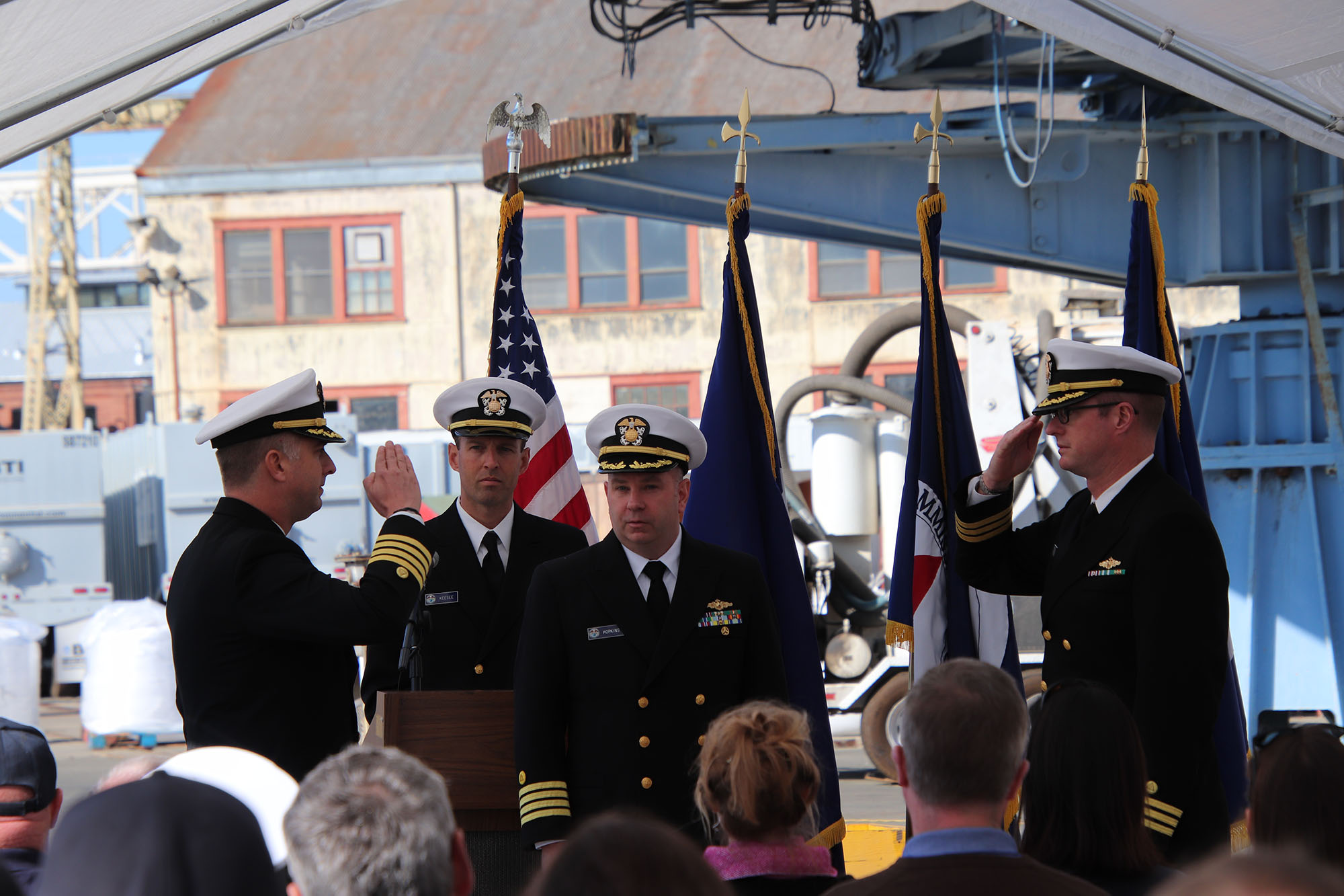
On November 15, 2019, the crew of NOAA Ship Rainier hosted a change of command in Valejo, California. Cmdr. Sam Greenaway accepted command of Rainier, relieving Capt. Ben Evans in a ceremony led by Capt. Michael Hopkins, commanding officer of NOAA’s Office of Marine and Aviation Operations (OMAO) Marine Operations Center-Pacific.
Continue reading “Change of command for NOAA Ship Rainier”One year later – Coast Survey’s response to the Anchorage earthquake
By Lt. Cmdr. Bart Buesseler
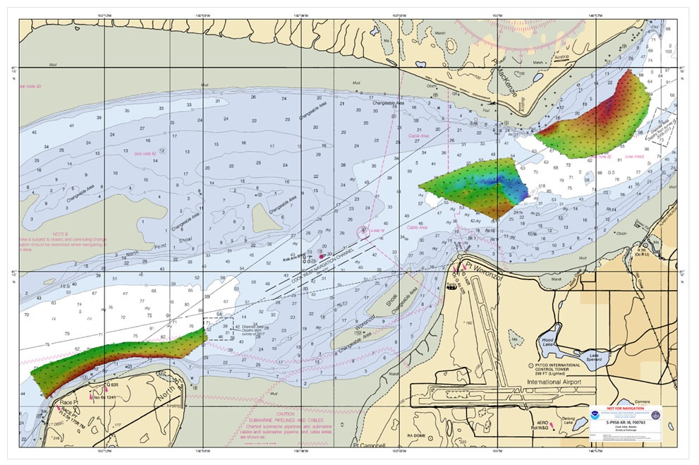
At 8:29, on the morning of Friday, November 30, 2018, a magnitude 7.1 earthquake shook Anchorage, Alaska, for thirty stressful seconds. It was the largest earthquake in Anchorage since the Good Friday Quake of 1964, and brought Alaska’s most populated city to a standstill as residents evacuated buildings and came to terms with what they had just experienced.
Continue reading “One year later – Coast Survey’s response to the Anchorage earthquake”NOAA Ship Rainier returns to survey the Hawaiian coast, provides update on lava flow development
By Ens. Harper Umfress
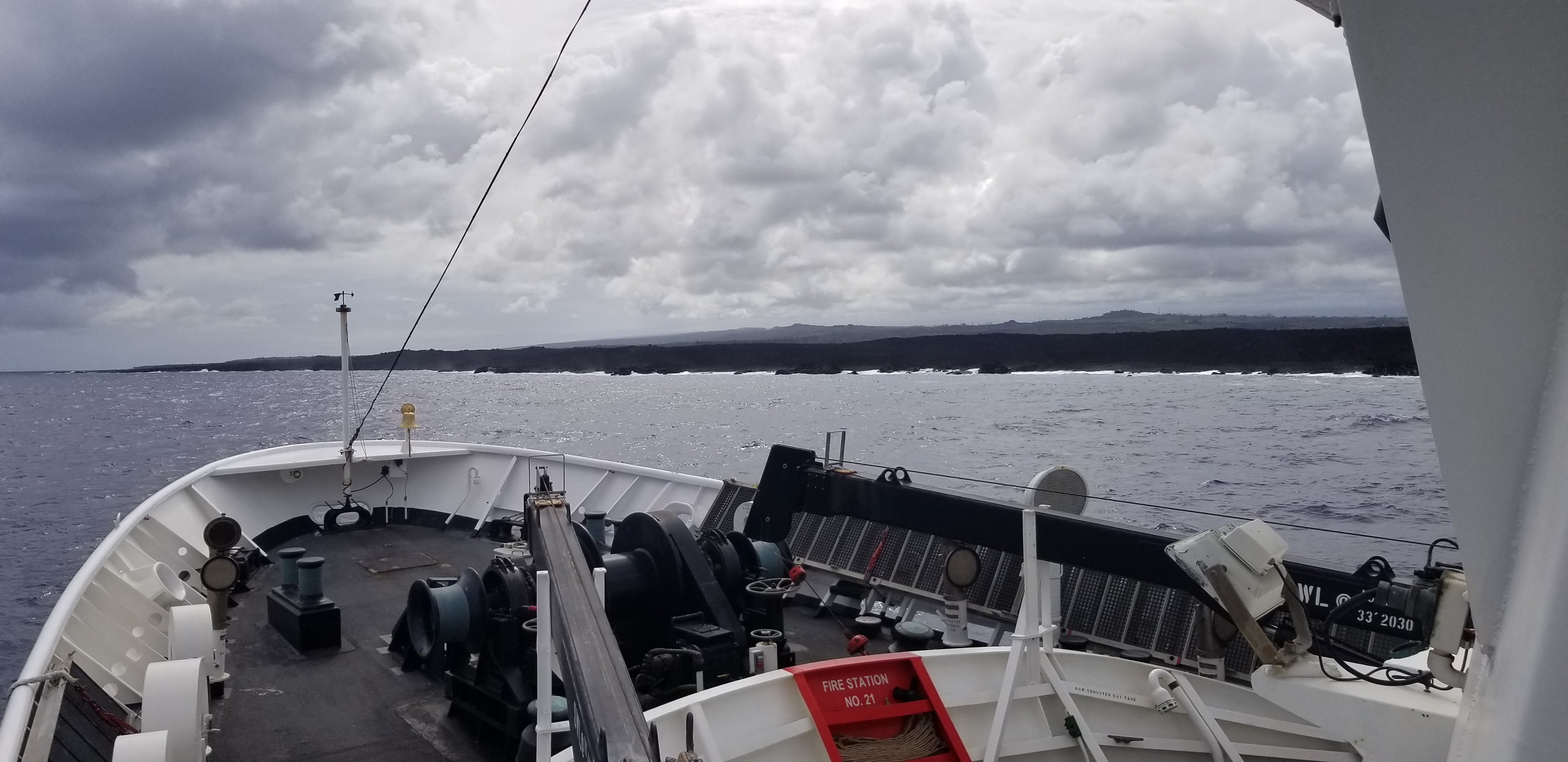
NOAA Ship Rainier’s four-decade tropical sonar silence is over and Hawaiian hydrography is back! The 2019 field season was productive, challenging, and geographically diverse. After starting the season with traditional hydrographic surveys in Alaska, Rainier was re-tasked to support science diving operations in the Papahānaumokuākea Marine National Monument that surrounds the Northwestern Hawaiian Islands. Though the primary purpose of this dispatch was to support coral reef research, the world’s most productive coastal hydrographic survey platform would have been remiss to forego this opportunity to ping new waters.
Continue reading “NOAA Ship Rainier returns to survey the Hawaiian coast, provides update on lava flow development”NOAA seeks public comment on ending production of traditional paper nautical charts
NOAA is initiating a five-year process to end all traditional paper nautical chart production and is seeking the public’s feedback via a Federal Register Notice published on November 15, 2019. Chart users, companies that provide products and services based on NOAA raster and electronic navigational chart (NOAA ENC®) products, and other stakeholders can help shape the manner and timing in which the product sunsetting process will proceed. Comments may be submitted through NOAA’s online ASSIST feedback tool.
Continue reading “NOAA seeks public comment on ending production of traditional paper nautical charts”NOAA supports safe ferry transit in Puget Sound
By Lt. j.g. Michelle Levano
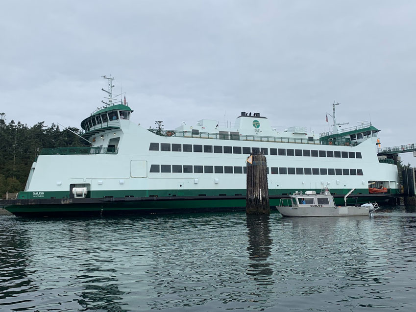
If you have spent time on the water in Puget Sound, you have probably seen the large, distinct green and white vessels. These vessels move passengers, vehicles, and cargo across Puget Sound to the San Juan Islands and to Victoria, Canada, year round. They are a part of the Washington State Department of Transportation ferry system. The state has been operating ferries since 1951, and intended to run the ferry service until cross Sound bridges could be built. These bridges were never built, and the state continues to operate the ferries to this day. As of last July, there are 22 state-operated ferries on Puget Sound, with the largest vessel able to carry 2500 passengers and 202 vehicles.
Continue reading “NOAA supports safe ferry transit in Puget Sound”NOAA searches for dangers to navigation following Hurricane Dorian
Storms, particularly hurricanes, can be unpredictable. Therefore, NOAA’s hydrographic survey response teams that aid in the reopening of ports following storms, are designed to be flexible, proactive, and are on call 24/7 should the need arise to identify dangers to navigation.
Continue reading “NOAA searches for dangers to navigation following Hurricane Dorian”Saildrone launched with seafloor mapping capabilities in the Gulf of Mexico shows promise for remote Arctic mapping
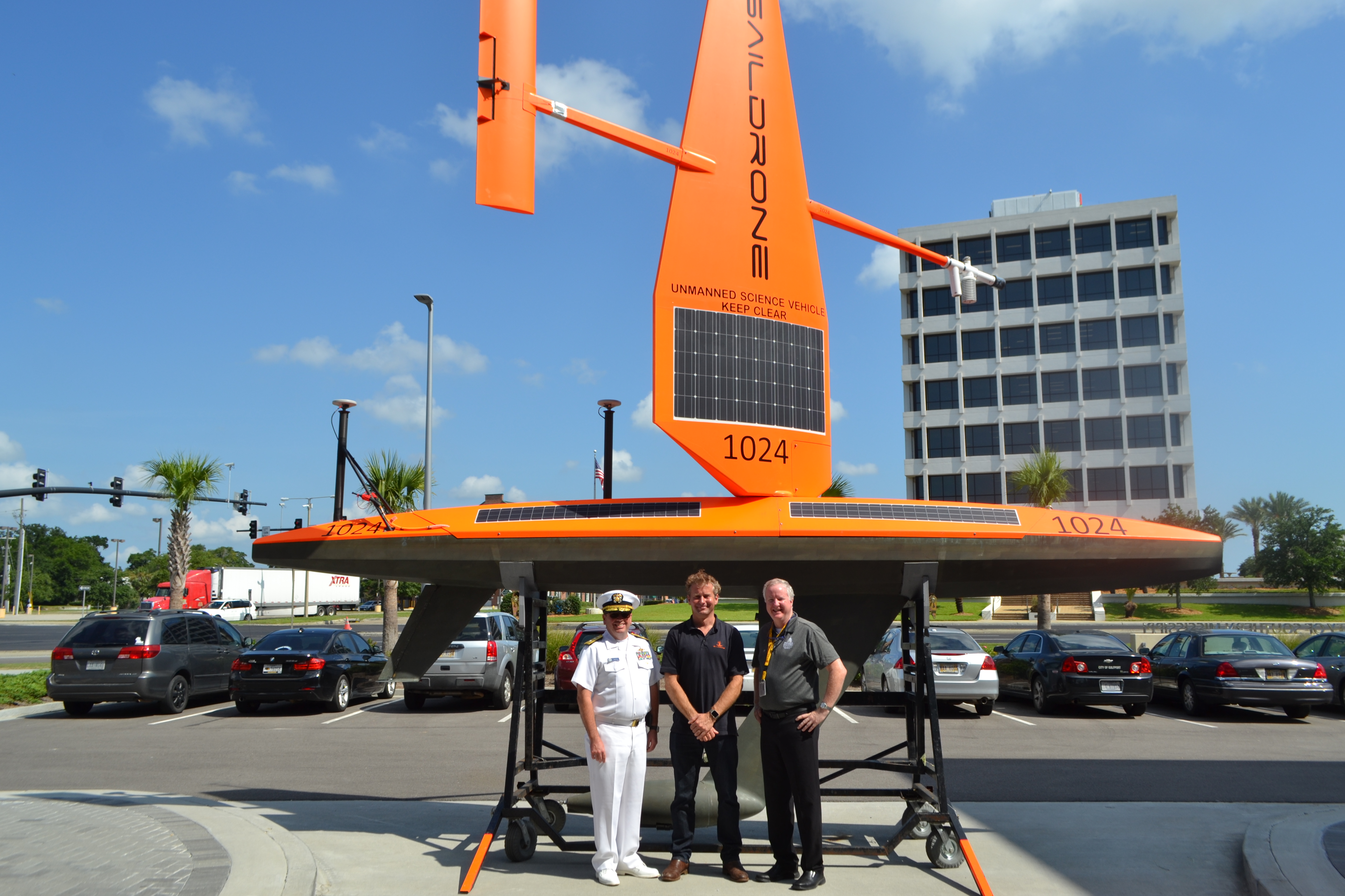
NOAA’s Office of Coast Survey, the University of Southern Mississippi (USM), and Saildrone accomplished a key milestone in the research and testing of unmanned technology that can lead to enhanced seafloor mapping capabilities with the launch of the first Saildrone — a wind-driven and solar-powered unmanned surface vehicle (USV) — equipped with multibeam echo sounder technology in the Gulf of Mexico. NOAA anticipates the success of this mission and technical achievement will lead to mapping projects in the Arctic.
Continue reading “Saildrone launched with seafloor mapping capabilities in the Gulf of Mexico shows promise for remote Arctic mapping”


