
On January 29, 2025, a commercial jetliner and a U.S. Army helicopter collided in midair over the Potomac River, near Washington’s Ronald Reagan National Airport. On February 2, the U.S. Coast Guard and District of Columbia Fire Department requested NOAA Coast Survey’s expertise in hydrographic surveying in order to locate wreckage from the incident using multibeam and side scan sonar technology. Once Coast Survey arrived, the incident command team turned over virtually all survey operations, particularly in the shallow water debris field, to our field units.
The Coast Survey navigation response teams worked alongside the National Transportation Safety Board, the U.S. Coast Guard, the U.S. Army Corps of Engineers, DC Fire and EMS, the Federal Bureau of Investigation (FBI), and other partners for eight straight days until the recovery effort was largely complete. In total, the navigation response teams acquired 32 linear nautical miles of multibeam echosounder data and 26 linear nautical miles of side scan sonar data. From these data, the location and acoustic imagery of 58 targets were provided directly to Navy, DC Fire, and FBI divers to focus their salvage efforts.
NOAA’s work fueled all salvage and dive operations for the remainder of the response, which included the support of weather and current operations provided by NOAA to support divers and on-the-water operations of salvage. Navigate here for more details on how NOAA mobilized experts and resources from the Center for Operational Oceanographic Products and Services, National Geodetic Survey, NOAA Commissioned Corps, the Office of Response and Restoration, and the National Weather Service.
The latest verified information about the accident is available on the National Transportation Safety Board’s dedicated webpage. Along with the recent release of the preliminary report, we’re now sharing more details of our response. Below is the timeline of events detailing Coast Survey efforts:
Friday, Jan 31
Coast Survey generates surface current predictions
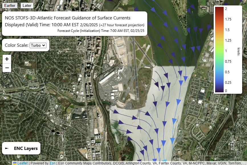
Coast Survey’s nowCoast team and the University of New Hampshire’s Center for Coastal & Ocean Mapping Data Visualization Research Lab collaborate to release the latest forecast guidance of surface currents in the Potomac River, upstream and downstream of Reagan National Airport.
Saturday, Feb 1
Cartographic updates
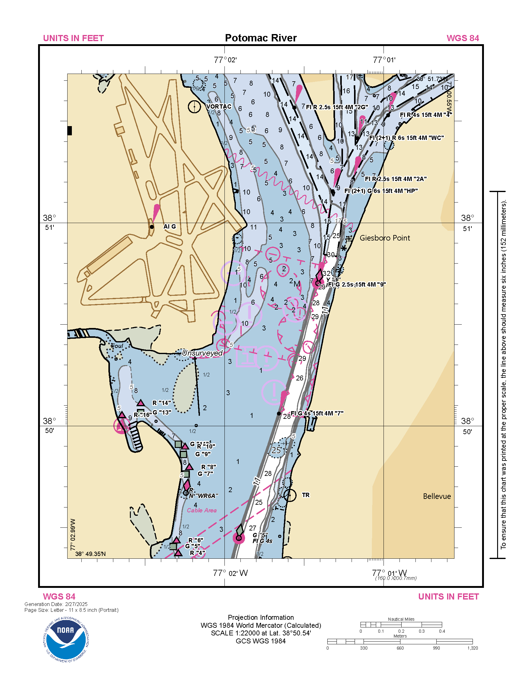
At the U.S. Coast Guard’s request, Coast Survey cartographers work over the weekend to apply the surface current predictions as well as new Army Corps of Engineer bathymetric data to the electronic navigation charts (NOAA ENCs). Coast Survey publishes updates to the charts on Monday, February 3.
Monday, Feb 3, 8:00am
Coast Survey splashes on the Potomac
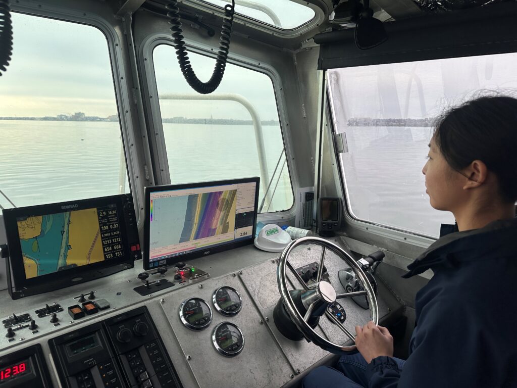
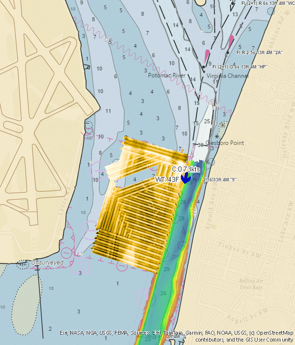
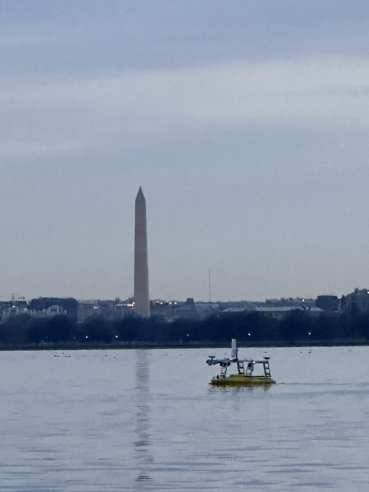
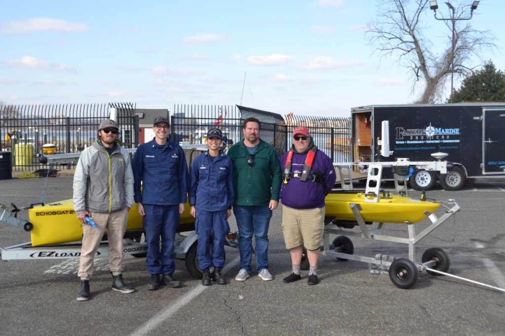
Navigation Response Team Patuxent—homeported in Solomons, Maryland—travels to the site of the wreckage to help survey the debris field with a 30-foot survey boat. The Patuxent team begins collecting data south of the wreckage site and inside the federal channel with 200% side scan sonar and multibeam echo sounder, object detection, running both high and low frequencies.

Meanwhile, the Mid-Atlantic Navigation Manager embeds in the Incident Command Center at the Coast Guard Air Station D.C. to communicate between the recovery teams and navigation response teams, as well as offer and coordinate requests to deploy a currents and meteorological buoy (CURBY) and Lidar flights.
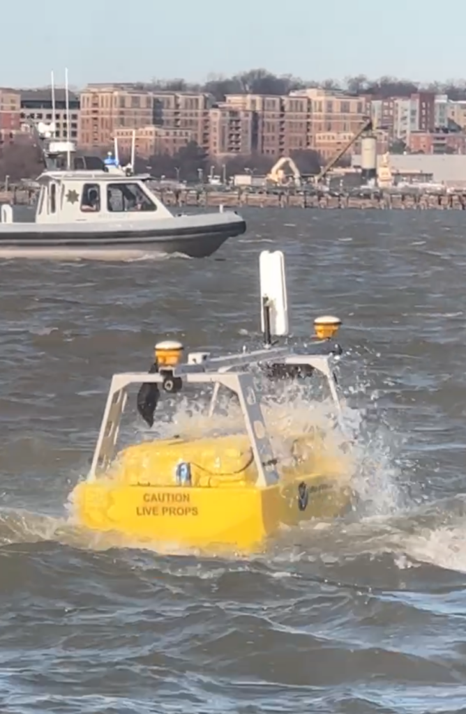
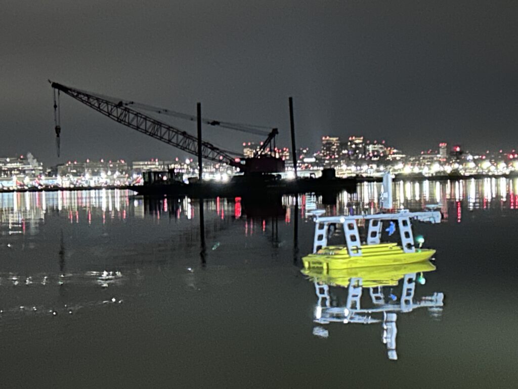
Navigation Response Team Gulfport’s Officer in Charge is able to join the Patuxent team, shifting travel plans from training to the recovery efforts. The rest of Navigation Response Team Gulfport begins mobilizing from Mississippi with two uncrewed surface vehicles in order to survey the shallow waters.
Tuesday, Feb 4
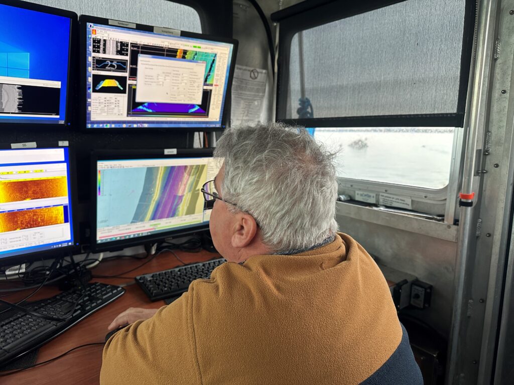
Navigation Response Teams begin processing the data collected
Navigation Response Team Seattle begins processing the multibeam echo sounder data and preliminary products. Navigation Response Team Fernandina begins processing side scan sonar data and preliminary products. Products include multibeam echosounder files, soundings, side scan sonar data, features files and images. The Seattle and Fernandina teams uploaded processed data to a shared GIS-based platform that local, state, and federal agencies involved in the recovery could immediately access.
Typically, the navigation response team surveying the area also processes the data to render it usable, adjusting for precise positioning based on the location of the boat as well as identifying any gaps in coverage. Having the Seattle and Fernandina teams process the data in near-real time helped in processing the data faster, and allowed the teams surveying on the water to rest and recuperate after long days in freezing temperatures.
Wednesday, Feb 5
Uncrewed surface vehicles splash on the Potomac
The rest of Navigation Response Team Gulfport arrived the night before from Mississippi with two uncrewed surface vehicles. On Wednesday morning, the Gulfport team deploys the uncrewed surface vehicles to survey the shallow waters adjacent to the federal channel.
Thursday, Feb 6
Surveying continues
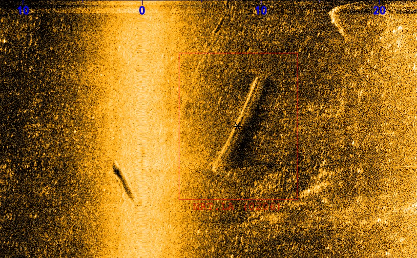
One of the targets Navigation Response Team Patuxent found on their first day on the water was an important piece of wreckage. Divers investigate on Thursday and discover it is one of the rotor blades. It also was in the navigable channel–clearing the object ensured a safe path of travel once the Potomac River was reopened.
Friday, Feb 7
Weather day
Due to high winds and small craft advisory, the teams are unable to safely splash onto the water. The teams attempt to survey with both uncrewed surface vehicles, but the vessels are overpowered by the wind and wind waves.
Saturday, Feb 8
Night operations begin
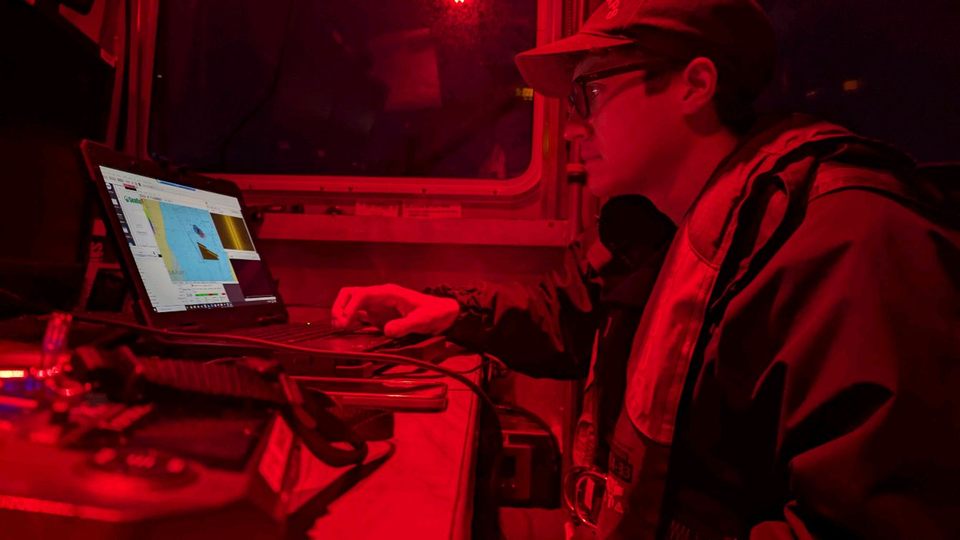
Before the FBI divers arrive on the scene at 7:30 a.m. on Saturday, the navigation response teams complete the two highest priority survey areas during night operations.
Monday, Feb 10
Teams finish field work
Our Mid Atlantic Navigation Manager gets U.S. Coast Guard concurrence to use the navigation response team’s initial channel survey as the final for charting purposes. Since the teams were so thorough in their initial surveying, it eliminated the need for a second survey–saving time and resources in reopening the navigable channel.
Tuesday, Feb 11
Teams demobilize
Teams finish processing the final survey data, and the navigation response teams in the field demobilize back to their home ports.
In total, Coast Survey had:
3 assets were in the water
14 personnel directly involved in emergency response, working around the clock (including Navigation Response Teams, Cartographers, GIS team, and the Navigation Manager)
8 days in the water surveying 0.51 square nautical miles total
32 linear nautical miles of multibeam data collected
25.7 linear nautical miles of side scan sonar data collected
58 identified locations for diving teams to investigate