In a unique deployment of resources, last week NOAA Ship Fairweather split its scientific team and vessels to tackle two distinct projects in Alaska. Coast Survey physical scientist Katrina Wyllie and Lt.j.g. Bart Buesseler report on the multi-mission projects.
***
On August 9, NOAA Ship Fairweather departed Dutch Harbor, Alaska, for a FISHPAC project, led by Dr. Bob McConnaughey from NOAA’s Alaska Fisheries Science Center. This project’s primary mission is to statistically associate acoustic backscatter returns with the abundances of fish and crabs that frequent the Bering Sea seafloor. The science team accomplishes this with acoustic data from multibeam, single beam, and side scan sonars. Understanding the value of acoustic backscatter as a habitat-defining character will help scientists understand where fish live and the importance of different habitats. The acoustic data will also be used to correct for differences in the performance of research bottom trawls on different seafloor types, so that stock assessments and fishery management can be improved. To make sure the scientists understand what the acoustic data are showing, each day the ship will stop and collect physical bottom samples of the seafloor to see, touch, and interpret their findings. Further increasing the effectiveness of this mission, all of the multibeam bathymetry data acquired will directly support NOAA’s Office of Coast Survey as the data will be used to update soundings on the nautical charts for the eastern Bering Sea where the ship will be operating.

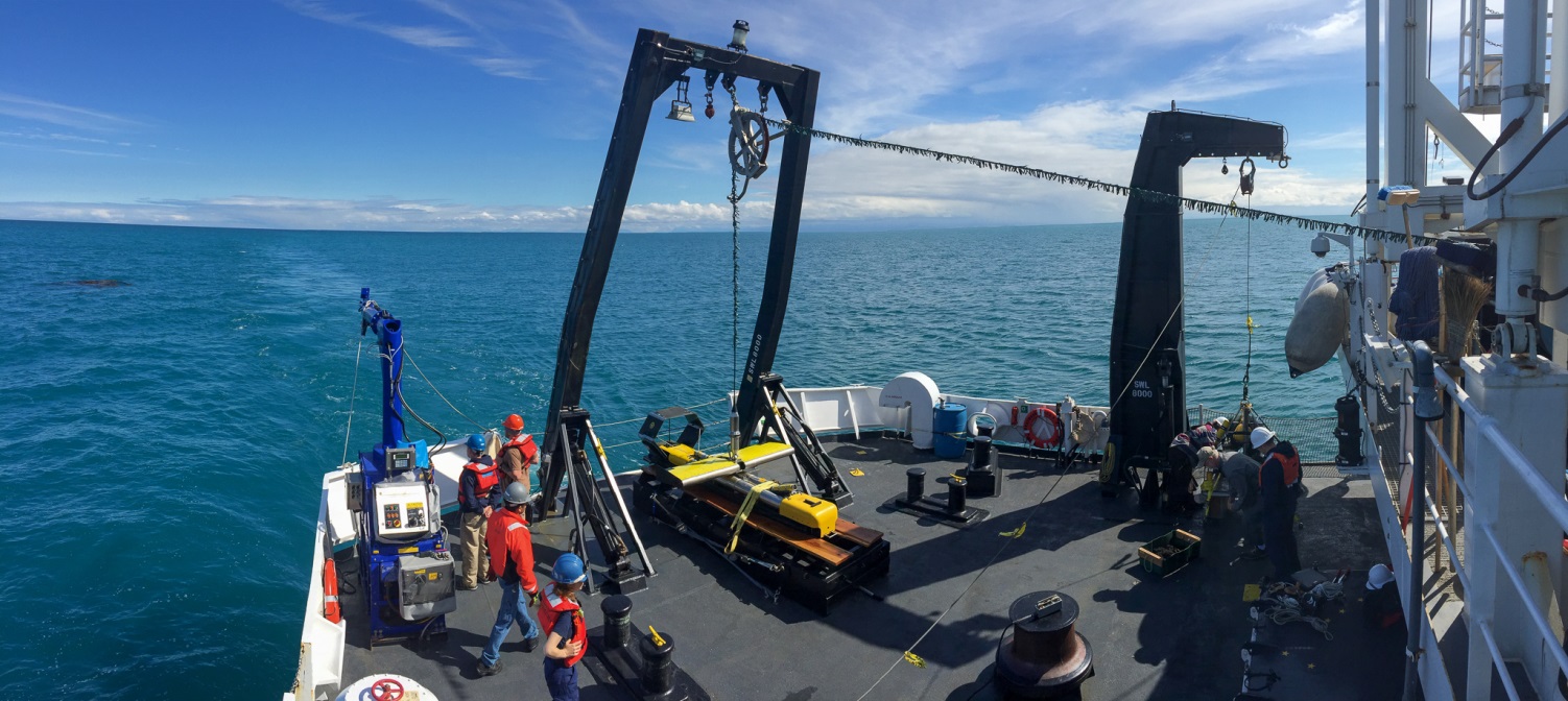
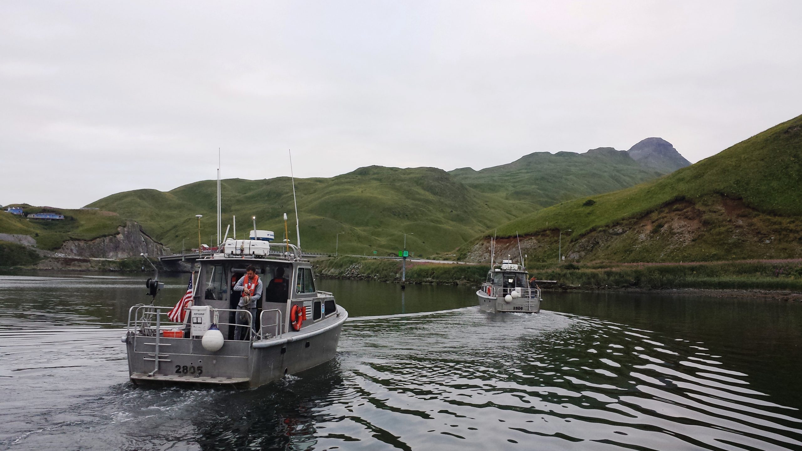
With Fairweather actively conducting 24-hour ship survey operations in Bristol Bay, there wouldn’t be any chance to deploy her four survey launches for additional acquisition. Sensing an opportunity, the Office of Coast Survey, the command of the Fairweather, and Marine Operations Center-Pacific collaboratively came up with a multi-mission plan to maximize the capabilities of Fairweather during the FISHPAC project. Before departing Dutch Harbor, Fairweather deployed a shore team with the four survey launches to stay in Dutch Harbor and address some critical navigation needs identified by the port.

Although its location is remote, the port of Dutch Harbor is a vibrant and bustling port serving full-size container ships. It is the country’s top fishing port in terms of landings for the past 18 years. Deep draft and ice-free year-round, Dutch Harbor provides a critical link in America’s transportation infrastructure. Trivia buffs may also know that Dutch Harbor is the only other American soil, in addition to Pearl Harbor, to be bombed during World War II. (For more on Alaska in World War II, see USC&GS Ship Hydrographer contributes to significant Allied victory.)
With the increase in commerce flowing into and out of the harbor, local maritime pilots asked Coast Survey navigation manager Lt. Timothy Smith for updated nautical charts to improve the safety of maritime traffic. This need was underscored in July 2015, when a polar ice class vessel ran aground in an area of the chart which hadn’t been surveyed since before World War II. Shortly after this grounding, Fairweather was able to alter their schedule to conduct a response survey in the area of the grounding (green area in project sheet layout, below). Additionally, Fairweather had previously surveyed small high priority areas in 2011 (orange areas).

This month’s collaborative project, performed in conjunction with FISHPAC, provided the perfect opportunity to address these navigational needs. With the survey launches remaining in Dutch Harbor, with a team of scientists, coxswains, and engineers to support them, Fairweather’s shore team will acquire complete coverage multibeam data in the entire project area, totaling approximately 38 square nautical miles, as outlined by the blue shapes in the project sheet layout.
The City of Unalaska has graciously facilitated this unique mission by providing pier space for all four launches for the project’s duration. The team itself has established a base of operations at the Grand Aleutian Hotel, where they have converted a conference room into a command center to process the day’s freshly collected data, while preparing the mission for the subsequent day.
The shore team has plenty of work to keep them busy until August 27, when Fairweather returns to Dutch Harbor after completing the more than 4,000 line-mile FISHPAC mission and recovers the survey team and launches. Fairweather then transits back to Kodiak, Alaska, for a scheduled inport and well deserved break before hydrographic survey operations resume in the vicinity of Sitkalidak Strait.


Additional resource:Combining expertise makes for better nautical charts and better understanding of fish habitats in Alaska, Oct. 9, 2012

News and Updates
I would love to see more pictures of the crew! Mainly LtCdr Barry since he is my brother 🙂
Where can I find the updated bathymetry for the mouth of Iliuliuk Bay and the entrance to Dutch Harbor? It would be most beneficial to our team planning a potential dredging project at that site.
Mike, all our bathymetry is available from NOAA’s National Centers for Environmental Information. Check the NOS Hydrographic Survey Data. Also, you might want to contact Coast Survey’s navigation manager for Alaska. Contact information for our navigation managers across the U.S. is available here.