
By: Erin Nagel, University Corporation for Atmospheric Research (UCAR) Visiting Scientist
NOAA is preparing to release a prototype of the new Precision Navigation Data Dissemination System in July, and the S-111 surface current forecast guidance will be the first prototype service available in this new system.
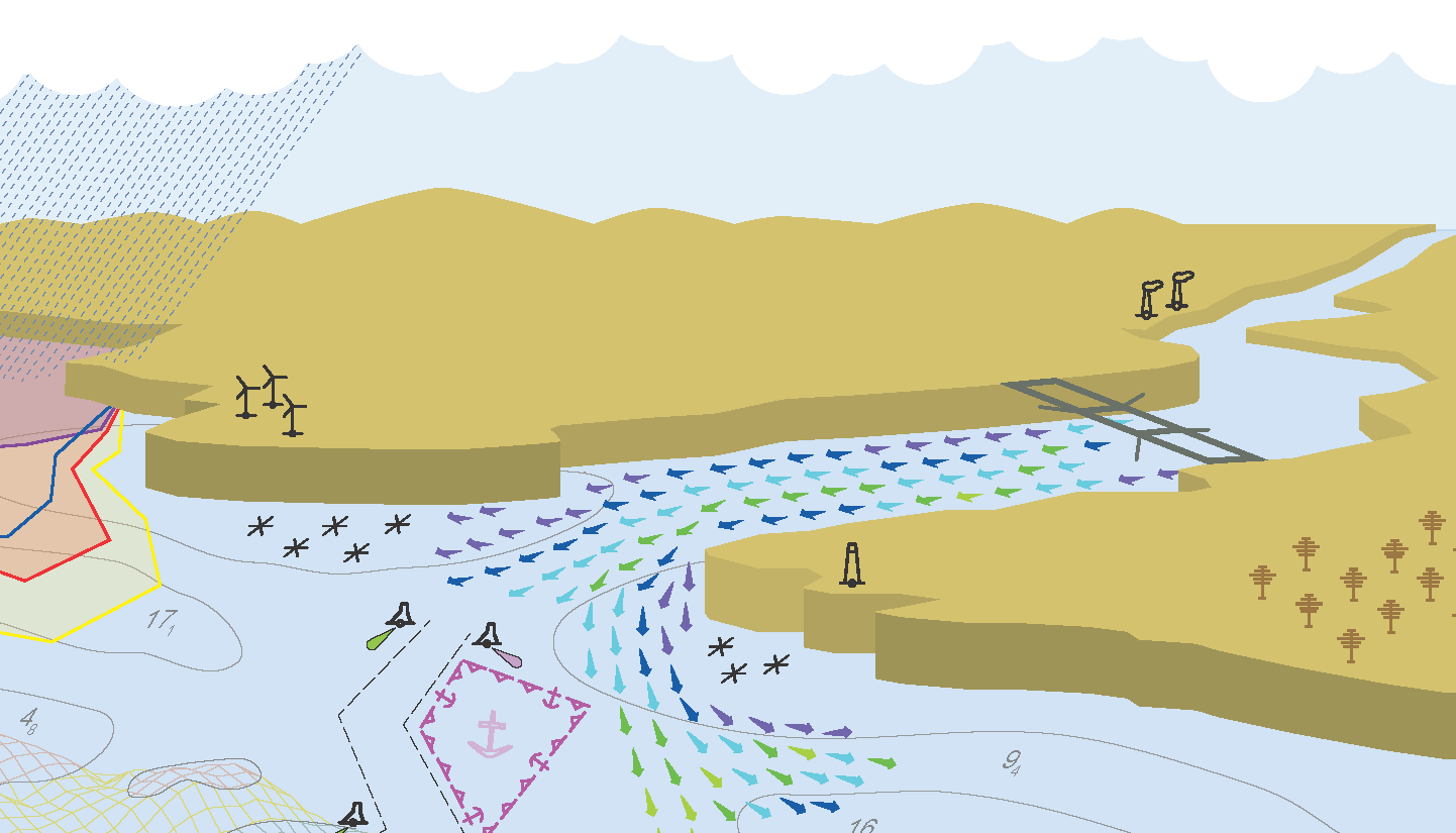
The S-111 Surface Current Product Specification provides a methodology to store and distribute observations and predictions of surface water current data and metadata. This standard, designed for interoperability with electronic navigational charts and other International Hydrographic Organization’s (IHO) S-100 product specifications, aims to standardize surface water currents for use in navigation systems in order to improve decision support for mariners.
The Precision Navigation Dissemination System was built and deployed using Amazon Web Services (AWS) cloud infrastructure and open source software. The system uses the National Ocean Service’s (NOS) suite of open source python packages developed to automatically encode and deliver standardized forecast guidance of surface water currents in S-111 HDF5 format, for U.S. navigation areas and 12 coastal water bodies. These forecasts are generated by NOS’s operational oceanographic forecast modeling systems. The S-111 HDF5 files contain the latest predictions from NOS ocean forecast modeling systems and will be made available this summer through the NOAA Big Data AWS S3 (storage) bucket for testing by commercial manufacturers of Electronic Chart Systems (ECS) such as Electronic Chart Display and Information Systems (ECDIS), portable pilot units (PPU). Having the surface currents integrated into these systems can improve the data mariners’ need for route optimization, maneuvering, berthing, and harbor movement.
These advancements have been demonstrated and shared with the IHO community, driving S-100 product development and testing globally. This project leverages multiple NOAA development efforts, increasing the utility of NOAA data streams, NOS operational oceanographic forecast modeling systems, nowCOAST™ web mapping services, and model data services from multiple NOAA servers. Be on the lookout for additional S-100 product lines, including S-102 (bathymetry), S-104 (water levels), and S-412 (maritime weather).
S-100, the Universal Hydrographic Data Model, provides the framework for the dissemination of NOAA data in the new Precision Navigation Data Dissemination System prototype. S-100 is a hydrographic geospatial data standard that can support a wide variety of hydrographic-related digital data sources, and aligns with mainstream international geospatial standards, in particular the ISO 19000 series of geographic standards. S-100 provides a framework of components that enables the building of standardized product specifications for the modelling of hydrographic data, thus providing true interoperability between different data standards and systems.