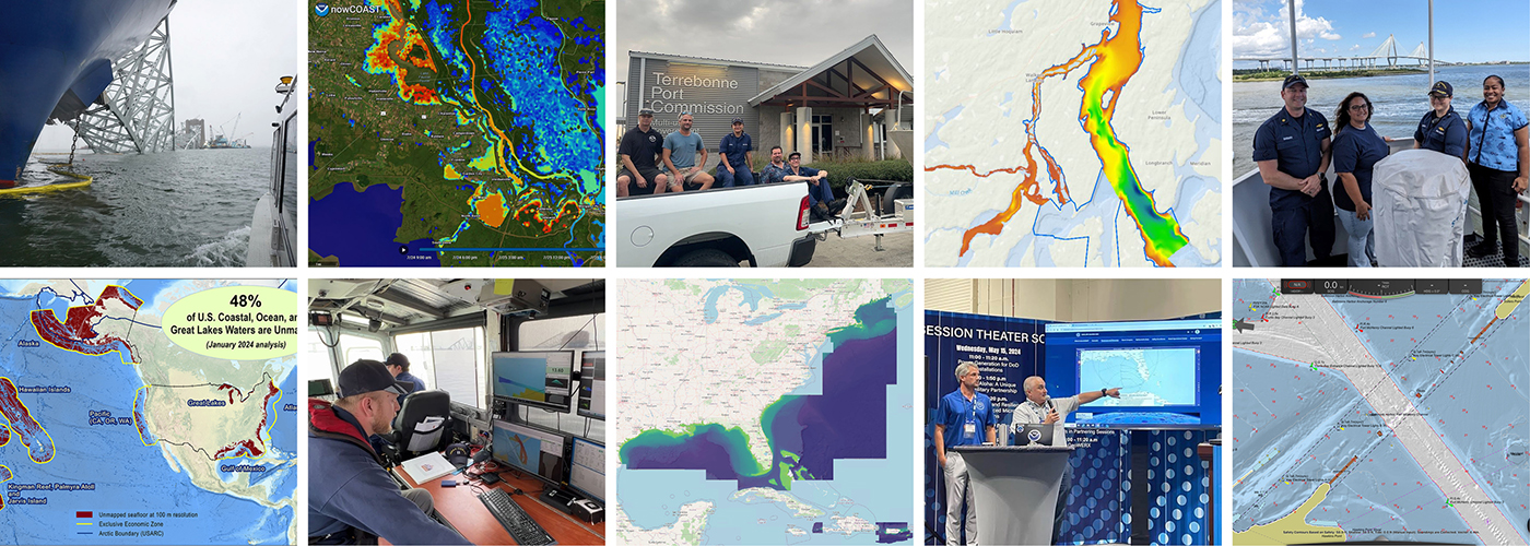
A look back at 2023 and the Office of Coast Survey’s significant activities throughout the year

An image of a rocky coastline and low clouds with the title Coast Survey Year in Review, superimposed over it.

NOAA’s Office of Coast Survey is reflecting on a successful and remarkable 2023! We completed many significant activities with meaningful impacts. As we look ahead to more progress in 2024, we are proud to share some highlights of the past year in our Coast Survey Year in Review ArcGIS StoryMap.

Continue reading “A look back at 2023 and the Office of Coast Survey’s significant activities throughout the year”

Model Upgrade: Global Extratropical Surge and Tide Operational Forecast System Upgraded to Version Two

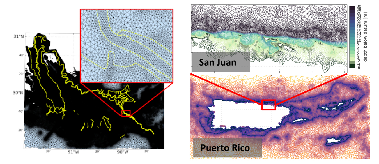
Screen captures of two new implementations of version two; federal levees along the Mississippi and flood plain inclusion for Puerto Rico.

In late July 2021, the Global Extratropical Surge and Tide Operational Forecast System (Global ESTOFS) upgrade to version two was implemented into operations on the National Weather Service’s (NWS) Weather and Climate Operational Supercomputing System (WCOSS). The modeling system provides forecast guidance for combined water levels caused by storm surge and tides globally, and is to our knowledge the highest resolution global operational storm surge modeling system available today. The forecast guidance from the model is used by forecasters at NWS Weather Forecast Offices (WFO) and the Ocean Prediction Center to generate their storm surge and flood forecasts during storms, including Nor’easters along the U.S. East Coast.

Continue reading “Model Upgrade: Global Extratropical Surge and Tide Operational Forecast System Upgraded to Version Two”

NOAA’s Precision Marine Navigation data service receives first major update

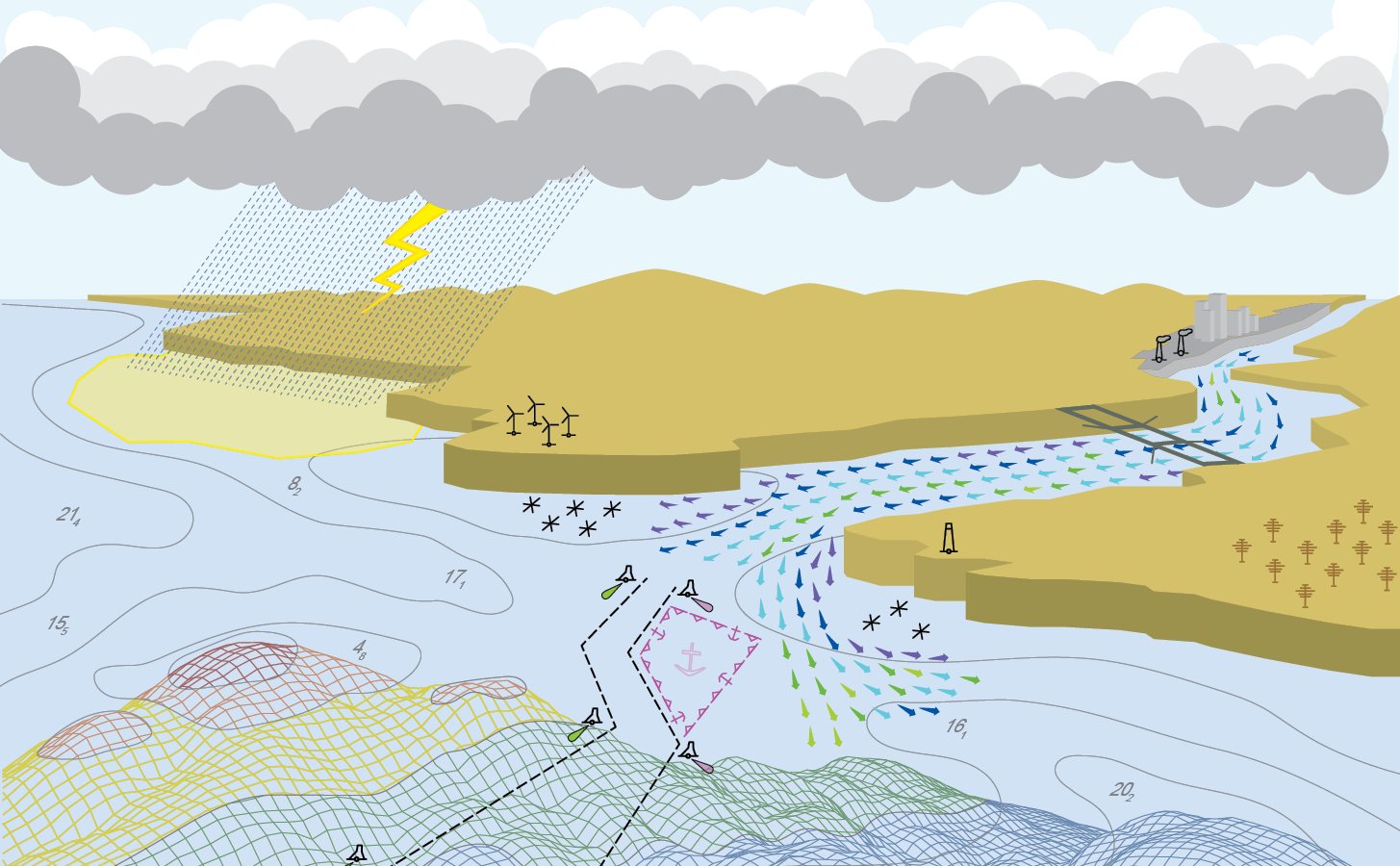
The Precision Marine Navigation (PMN) program has completed the first update of its prototype navigation data service – the PMN data processing and dissemination system and PMN Data Gateway viewer. The data processing and dissemination system provides surface current forecast guidance from NOAA’s forecast systems, in a prototype marine navigation data format. The viewer allows users to visualize the predictions and discover where they are. Both the system and the viewer were updated to include data from the recently upgraded Northern Gulf of Mexico Operational Forecast System (NGOFS2).

Continue reading “NOAA’s Precision Marine Navigation data service receives first major update”

NOAA releases new visualization resources: Precision Navigation Data Gateway and Data Dashboard

NOAA’s Precision Marine Navigation (PMN) program released two new visualization resources. The first is a beta version Precision Marine Navigation Data Gateway map viewer allowing users to explore NOAA’s S-100 data services. Currently, the Data Gateway presents prototype surface current forecast guidance, but new layers will be added as they are developed. NOAA welcomes feedback on the beta version of the Data Gateway. Please submit all comments to marinenav.team@noaa.gov by March 1, 2021.

Continue reading “NOAA releases new visualization resources: Precision Navigation Data Gateway and Data Dashboard”

Introducing the Inland-Coastal Flooding Operational Guidance System (ICOGS)

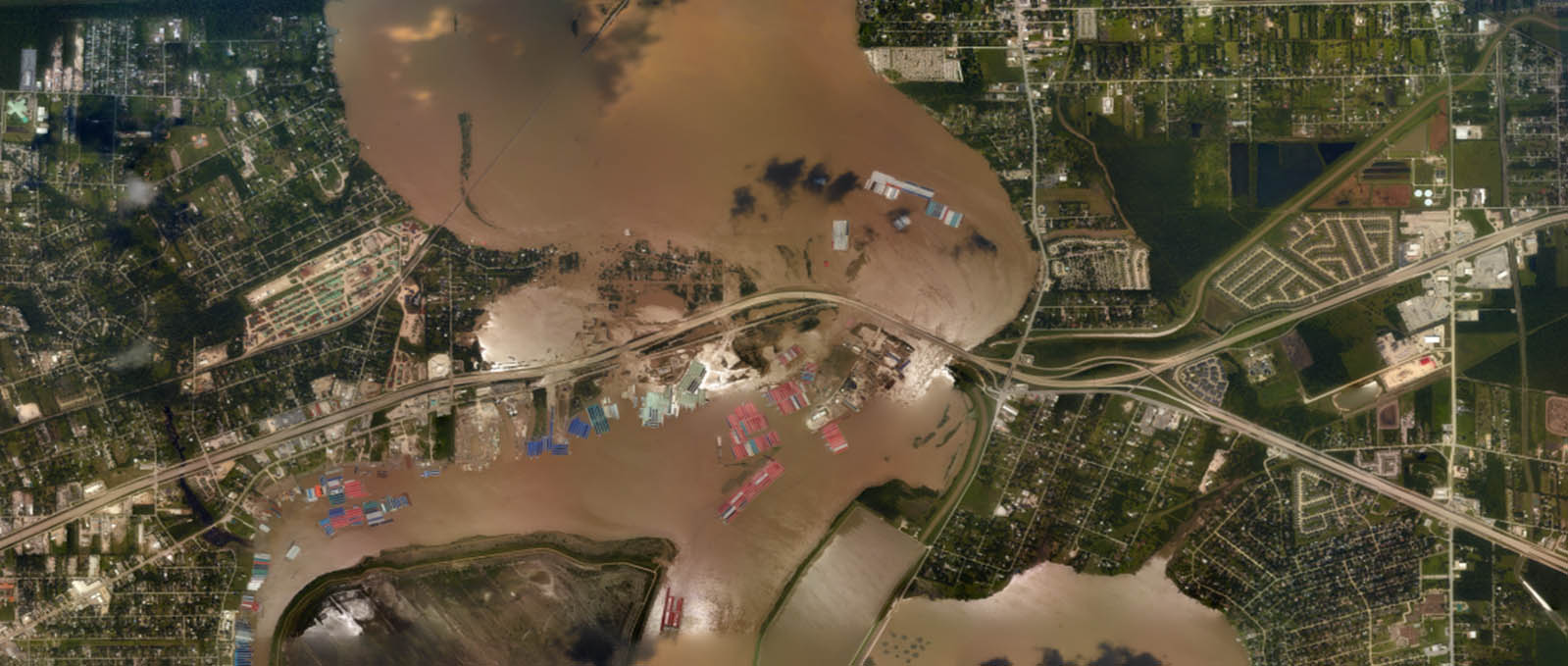
Aerial imagery of inland-coastal flooding during Hurricane Harvey, 2017 in Houston, Texas.

Where the river meets the sea can be both a turbulent and vulnerable space, particularly during strong storms when heavy precipitation and storm surge intersect. This intersection is known as “compound inland-coastal flooding,” and until now, had not been carefully studied and implemented in forecasting centers for public guidance due to its inherent complexity. NOAA’s Office of Coast Survey and the Virginia Institute of Marine Science recently developed the Inland-Coastal Flooding Operational Guidance System (ICOGS), the world’s first three-dimensional integrated compound inland-coastal flooding guidance system.

Continue reading “Introducing the Inland-Coastal Flooding Operational Guidance System (ICOGS)”

Model Upgrade: Extratropical Surge & Tide Operational Forecast System (ESTOFS) is Now Global

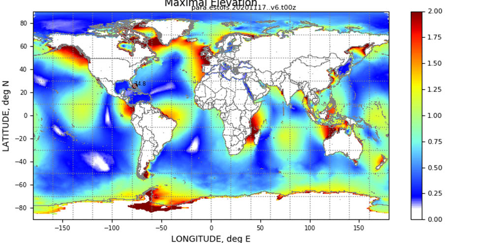
An example of maximum forecast water levels (m MSL) from a forecast cycle of Global ESTOFS.

On November 24, an upgrade to Global ESTOFS was implemented to provide NWS forecasters with high resolution water level forecast guidance including storm tide (storm surge plus tides) for the entire globe. Global ESTOFS forecast guidance will be used by forecasters at WFOs and the Ocean Prediction Center (OPC) to generate their storm surge forecasts during winter storms including Nor’easters along the U.S. East Coast.

Continue reading “Model Upgrade: Extratropical Surge & Tide Operational Forecast System (ESTOFS) is Now Global”

Precision marine navigation surface current dissemination trials

By: Erin Nagel, University Corporation for Atmospheric Research (UCAR) Visiting Scientist

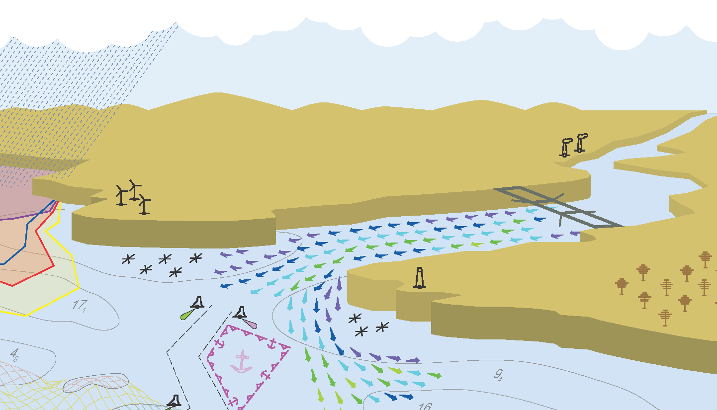
NOAA is preparing to release a prototype of the new Precision Navigation Data Dissemination System in July, and the S-111 surface current forecast guidance will be the first prototype service available in this new system. 

Continue reading “Precision marine navigation surface current dissemination trials”

NOAA seeks industry feedback as it begins testing the Precision Navigation Data Dissemination prototype

By Julia Powell, Precision Navigation Program Manager, Chief of the Navigation Services Division

NOAA’s Precision Navigation program is building a prototype data gateway for users to discover, visualize, and disseminate NOAA marine navigation products and services. The backbone of this dissemination system is to provide for machine-to-machine dissemination that allows the mariners’ existing navigation software to automatically discover if NOAA has made new data available and ingest it directly into the system. NOAA’s integrated marine navigation services through this site will help ship operators optimize their routes, save fuel, reduce lightering and reduce port wait times based on environmental conditions.

Continue reading “NOAA seeks industry feedback as it begins testing the Precision Navigation Data Dissemination prototype”

NOAA improves coastal resilience tools for U.S. Pacific Islands vulnerable to natural disasters

NOS tide and surge guidance coverage over the Pacific.

By Jack Riley and Sergey Vinogradov, Ph.D.

The Pacific Ocean is the largest and deepest of Earth’s oceanic divisions. It extends from the Arctic Ocean in the north to the Southern Ocean in the south and is bound by the continents of Asia and Australia in the west and the Americas in the east. Most of the U.S. Pacific territories are located in the northern half of the Pacific Ocean and are among the Pacific Islands that are highly exposed to natural disasters. As part of NOAA’s coastal resilience efforts, the National Ocean Service (NOS) is developing better tools to define changes in water level related to tropical cyclones and other weather related conditions. This work is part of the global effort to develop disaster risk assessment tools and practical technical applications to reduce and mitigate coastal countries’ vulnerability to natural disasters.

Continue reading “NOAA improves coastal resilience tools for U.S. Pacific Islands vulnerable to natural disasters”

Register for NOAA Nav-cast webinar: NOAA’s nowCOAST

Image announcing Nav-cast webinar.

UPDATE: The Nav-cast scheduled for 9/26 at 1 p.m. (EDT) is cancelled and will be rescheduled at a later date. We apologize for the inconvenience.

Join us for our next NOAA Nav-cast, a quarterly webinar series that highlights the tools and trends of NOAA navigation services.

NOAA’s nowCOAST: A one-stop-shop for coastal conditions before you head out on the water

NOAA’s nowCOAST (nowcoast.noaa.gov) — a free online interactive map viewer —provides situational awareness on present and future weather and oceanographic conditions for mariners and other coastal users by integrating data from across NOAA and regional observing systems. Users can assess present conditions by creating maps of the latest in-situ weather/marine weather observations, weather radar mosaics, cloud images from GOES weather satellites, and surface wind and sea-surface temperature analyses for the last few hours. Users can also obtain maps of critical weather/marine weather advisories, watches, and warnings, weather forecasts, tropical cyclone track and intensity forecasts, and forecast guidance of water levels, water temperature, salinity, and currents from NOAA oceanographic forecast models.  Users can display these maps using the nowCOAST map viewer or by connecting to its map services. nowCOAST operates in a high-availability hosting facility and is monitored 24 x 7.

Continue reading “Register for NOAA Nav-cast webinar: NOAA’s nowCOAST”