
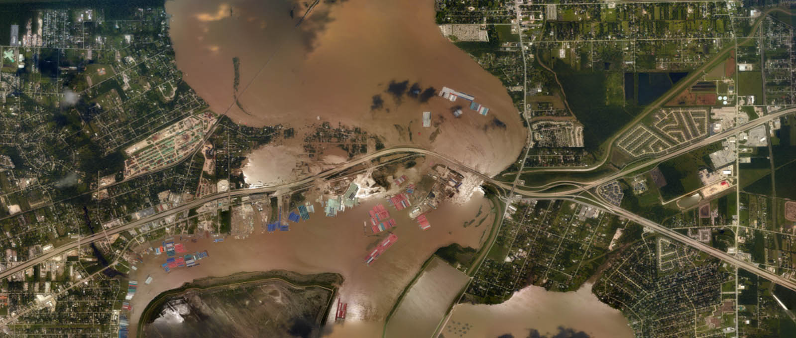
Where the river meets the sea can be both a turbulent and vulnerable space, particularly during strong storms when heavy precipitation and storm surge intersect. This intersection is known as “compound inland-coastal flooding,” and until now, had not been carefully studied and implemented in forecasting centers for public guidance due to its inherent complexity. NOAA’s Office of Coast Survey and the Virginia Institute of Marine Science recently developed the Inland-Coastal Flooding Operational Guidance System (ICOGS), the world’s first three-dimensional integrated compound inland-coastal flooding guidance system.
The increasing number of compound inland-coastal flooding events in recent years highlights the urgency for developing modeling capabilities to provide accurate guidance for wet storms such as Hurricane Harvey, 2017, and Hurricane Florence, 2018, with concurrence of storm surge and heavy precipitation. Guidance provided by ICOGS will benefit emergency response, disaster mitigation, and coastal resiliency efforts before, during, and after storm events.

In addition, an important product of a three-dimensional model based guidance system is to support safe and precise navigation during normal and storm times by providing mariners with reliable information on water levels, surface currents, and vertical stratification.
Results of this groundbreaking work were presented in several venues including 2nd International Workshop on Waves, Storm Surges & Coast Hazards 2019, American Meteorological Society Annual Meeting (AMS) 2020 and American Geophysical Union – Ocean Science Meeting 2020 in addition to 4 peer-reviewed publications (Ye et al. 2019; Zhang et al. 2020; Huang et al. submitted; Ye et al. submitted).
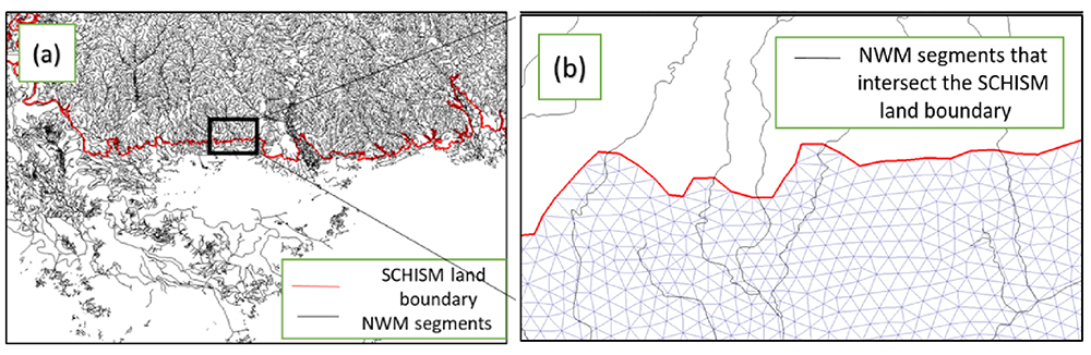
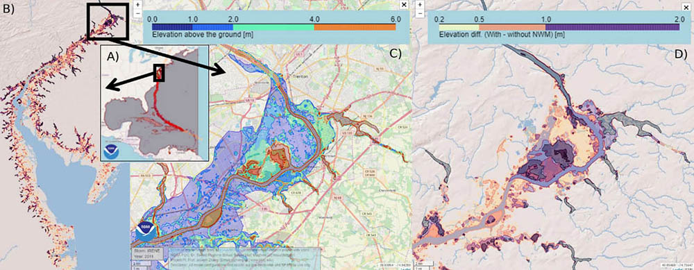
Coast Survey and the Virginia Institute of Marine Science developed the modeling system starting from basic science concepts all the way to a pre-operational capacity producing once a day forecasts. The next steps will be to transition this modeling guidance system to full operational capacity in Coast Survey to further support disaster mitigation, coastal resilience, and navigation. This effort is supported through the NOAA Water Initiative (NWI) and the NOAA National Oceanographic Partnership Program (NOPP).
A system like this one we need too! Luckily, we live inland, but few years ago, there were some terrible floods in our area: villages distroyed, crops, roads, railway also….a huge disaster! Thanks for sharing your article.