Nautical charts reflect alternate route along Gulf Intracoastal Waterway

Portion of Chandeleur Sound Gulf Intracoastal Waterway alternate route.

In anticipation of the temporary closure of the Gulf Intracoastal Waterway (GIWW)’s Inner Harbor Canal Lock, the Office of Coast Survey released three updated NOAA electronic navigational charts (NOAA ENC®) reflecting the Chandeleur Sound Alternate Route and the addition of 97 Aids to Navigation (ATON). The updated charts include US5LA24M, US4LA34M, and US4MS12M and can be viewed in NOAA’s ENC Viewer or downloaded from NOAA’s Chart Locator.

Continue reading “Nautical charts reflect alternate route along Gulf Intracoastal Waterway”

NOAA Coast Survey’s new strategy supports charting mandates and broader seafloor mapping

This week, NOAA’s Office of Coast Survey released the Mapping U.S. Marine and Great Lakes Waters: Office of Coast Survey Contributions to a National Ocean Mapping Strategy. This report is part of NOAA’s ongoing commitment to meet core surveying and nautical charting mandates while supporting broader needs to fill gaps in seafloor mapping and environmental sciences.

Continue reading “NOAA Coast Survey’s new strategy supports charting mandates and broader seafloor mapping”

NOAA releases prototype surface current forecast data for industry testing

portable pilot unit on the bridge of a ship

Prototype data for surface current forecasts in the International Hydrographic Organization (IHO) S-111 format is now available for testing through the NOAA Big Data Program. In June, NOAA announced that we were preparing surface current forecast data for dissemination trials. Now that these data are available, industry can integrate these prototype data into different types of navigation software systems such as portable pilot units and under keel clearance systems. By making these data more accessible, more machine-to-machine readable, and more integrated, NOAA aims to amplify the power of our navigation data for users across the maritime industry.    

Continue reading “NOAA releases prototype surface current forecast data for industry testing”

High-definition charts advance precision marine navigation

Vessel entering the port of Long Beach, California.

By Craig Winn, HD charting portfolio manager

For large vessels entering port where there is next to zero margin for error, pilots and shipmasters are looking for the highest resolution data available to help them navigate these tight spaces safely and efficiently. NOAA’s Office of Coast Survey recently constructed and released 16 high-definition (HD), band 6 (or berthing scale) electronic navigational charts for Los Angeles/Long Beach Harbor, providing mariners with the best charts available to do their job.

Continue reading “High-definition charts advance precision marine navigation”

NOAA joins federal and state partners in signing MOU on emergency maritime response in Hawaii

Coast Survey’s hydrographic survey experts along with the Office of National Marine Sanctuary staff are ready to survey Honolulu Channel following Hurricane Lane.

NOAA’s Office of Coast Survey, United States Coast Guard (USCG) Sector Honolulu, State of Hawaii Department of Transportation and United States Army Corps of Engineers (USACE) Honolulu Division established a memorandum of understanding (MOU) outlining each signatory’s area of responsibility in the event of a disaster in the Hawaii region. The intent of the MOU is to improve the efficiency and effectiveness of response efforts and speed the reopening of the ports and waterways following an emergency. 

Continue reading “NOAA joins federal and state partners in signing MOU on emergency maritime response in Hawaii”

Coast Survey Spotlight: Meet Martha Herzog

Martha Herzog enjoying the view of Sawyer Glacier in Tracy Arm, Alaska while aboard the "NOAA Ship Rainier."

Ever wonder what it’s like to be a member of the NOAA Coast Survey team? We use the Coast Survey spotlight blog series as a way to periodically share the experiences of Coast Survey employees as they discuss their work, background, and advice.


Martha Herzog, Physical Scientist

“…collecting the most accurate and up-to-date seafloor data to create nautical charting products is essential for ensuring public safety, commerce, and preventing human and environmental catastrophes.” 

Continue reading “Coast Survey Spotlight: Meet Martha Herzog”

NOAA supports arrival of USNS Comfort to New York City

USNS Comfort

For more than 200 years, nautical cartographers have methodically charted our nation’s coastline, adding new features or hazards and updating meandering shorelines, all in an effort to aid safe navigation. However, occasions do arise that require immediate charting, particularly in response to national emergencies. Notable examples include charting the projected oil spill zone during the Deepwater Horizon oil spill disaster, as well as hazards during hurricane response efforts. Most recently, NOAA’s Office of Coast Survey was called upon to support the arrival of USNS Comfort to New York City.

Continue reading “NOAA supports arrival of USNS Comfort to New York City”

NOAA certifies San Francisco Bay shipping channel with top survey rating, increasing confidence for deep draft vessel navigation

Tanker heading west and approaching the Richmond–San Rafael Bridge and Pinole Shoal Channel.

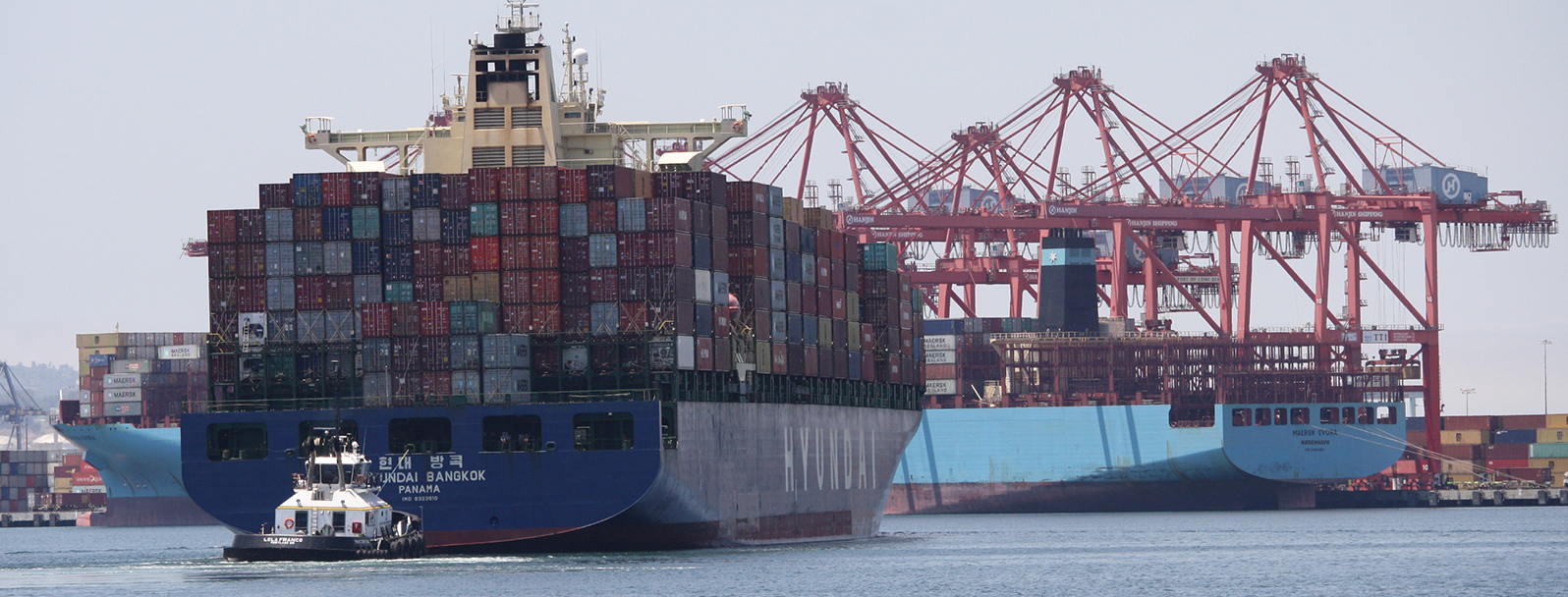
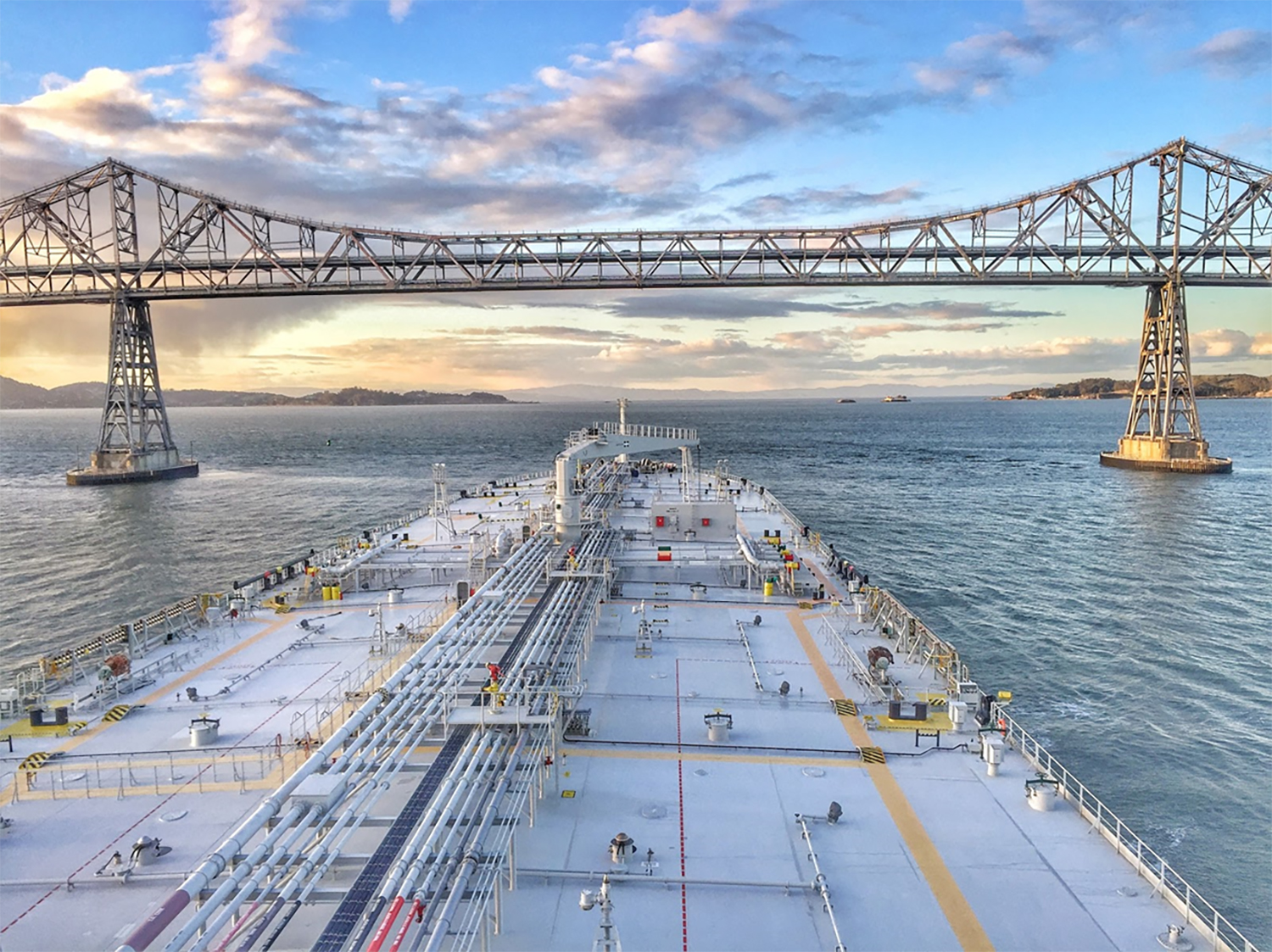
There is a risk factor when navigating in and out of our nation’s busiest ports, particularly at the helm of some of the world’s largest deep draft vessels. Mariners rely on tide and water level information, wind and weather data, but perhaps most importantly, they rely on electronic navigational charts and the quality of depth measurements that comprise them. Recently, NOAA’s Office of Coast Survey certified the U.S. Army Corps of Engineers (USACE) hydrographic surveys for the Pinole Shoal Channel in San Francisco Bay —  a critical waterway for bulk carriers and tankers to reach the ports of Sacramento, Stockton, Martinez, and Benicia — the highest possible data quality rating, Category Zone of Confidence (CATZOC) A1, for two years. This is the first USACE federally-maintained channel to receive the highest-level certification. NOAA anticipates the increased CATZOC rating will dramatically increase shipping efficiency.

Continue reading “NOAA certifies San Francisco Bay shipping channel with top survey rating, increasing confidence for deep draft vessel navigation”

NOAA releases 2020 hydrographic survey season plans

NOAA 2020 Hydrographic Survey Season Story Map Cover

NOAA hydrographic survey ships and contractors are preparing for the 2020 hydrographic survey season. The ships collect bathymetric data (i.e. map the seafloor) to support nautical charting, modeling, and research, but also collect other environmental data to support a variety of ecosystem sciences. NOAA considers hydrographic survey requests from stakeholders such as marine pilots, local port authorities, the Coast Guard, and the boating community, and also consider other hydrographic  and NOAA science priorities in determining where to survey and when. Visit our “living” story map to find out more about our mapping projects and if a hydrographic vessel will be in your area this year!

Continue reading “NOAA releases 2020 hydrographic survey season plans”

One year later – Coast Survey’s response to the Anchorage earthquake

Multibeam data acquired by eTrac in Knik Arm, offshore of Anchorage.

By Lt. Cmdr. Bart Buesseler

At 8:29, on the morning of Friday, November 30, 2018, a magnitude 7.1 earthquake shook Anchorage, Alaska, for thirty stressful seconds. It was the largest earthquake in Anchorage since the Good Friday Quake of 1964, and brought Alaska’s most populated city to a standstill as residents evacuated buildings and came to terms with what they had just experienced.

Continue reading “One year later – Coast Survey’s response to the Anchorage earthquake”