Surveying the Pribilof Islands, from Pathfinder to Fairweather

Two images of Pathfinder and Fairweather lined up side by side.

By Lt. Taylor Krabiel

In the 1950s, U.S. Coast and Geodetic Survey (USC&GS) Pathfinder surveyed the Pribilof Islands with the latest technologies to chart previously unsurveyed waters and bring the islands into a common datum with the mainland. Fast forward 71 years and NOAA Ship Fairweather continues this work. Despite the decades and technologies that separate the two ships, they share many commonalities in their mission and their surveying techniques.

Continue reading “Surveying the Pribilof Islands, from Pathfinder to Fairweather”

NOAA Ship Fairweather surveys the remote Pribilof Islands

Northern Fur Seals on the beach of St. George as Fairweather navigates the thick fog in the background.

By Lt. Taylor Krabiel

The Pribilof Islands are remote and isolated, located in the Bering Sea roughly 280 nautical miles north of Dutch Harbor Alaska. The economy and community are reliant on the surrounding ocean, while the islands themselves provide shelter for vessels working in the Bering Sea. Accurate nautical charts are not only integral to safe navigation and delivery of goods and services for the community, but also to commercial fishing and crabbing. The last major survey of the area was conducted from 1951 to 1954 by the U.S. Coast and Geodetic Survey vessel Pathfinder. However, much of the shoreline around St. George remained uncharted. The Fairweather’s surveys of the islands will provide modern bathymetric data for updating NOAA’s charting products in support of navigation safety.

Continue reading “NOAA Ship Fairweather surveys the remote Pribilof Islands”

Vessel pilots transition to new chart format

NOAA’s Precision Marine Navigation (PMN) program aims to seamlessly integrate high-resolution bathymetry and high accuracy positioning and shoreline data with the forecast data of water levels, currents, waves, and weather forecasts. This information can be easily accessed and integrated into maritime electronic charting systems and other decision support tools so mariners can plan their transits and make decisions while at sea and coming to and from port. A key component of this program is providing vessel pilots with detailed depth information to ensure safety of vessel transits and that critical under keel clearance safety margins are maintained. Electronic navigational charts, although accurate, typically do not provide the detail that pilots prefer.

Continue reading “Vessel pilots transition to new chart format”

Historical Hydrography on the St. Mary’s River

An image of NOAA's Bay Hydro II on the water with the Echoboat 240, uncrewed system in the foreground.

By Riley O’Connor

In November 1633, the Ark and the Dove set sail from the Isle of Wight—an island off the south coast of England—carrying English and Irish settlers bound for the new colony of Maryland. By January 1634, both vessels arrived at the Island of Barbados and began heading for the colony of Maryland. These settlers sailed into the Chesapeake Bay, the Potomac River, and eventually, the St. Mary’s River.  They stopped roughly 12 miles (19 km) northwest from Point Lookout, where the Potomac River enters the Chesapeake Bay. This group of settlers would go on to found Maryland’s first European settlement and future provincial capital, St. Mary’s City.

Continue reading “Historical Hydrography on the St. Mary’s River”

NOAA Announces 2024 Brennan Ocean Mapping Fund Selection and Webinar for 2025 Funding Opportunity

A decorative banner advertising the Brennan Matching Fund.

Meet our FY2024 Brennan Matching Fund partner at the upcoming August 10 webinar for the 2025 Rear Admiral Richard T. Brennan Ocean Mapping Fund program! The National Oceanic and Atmospheric Administration (NOAA) is pleased to announce our partnership with the State of Connecticut’s Department of Energy and Environmental Protection (CTDEEP) on behalf of the Steering Committee for the Long Island Sound Cable Fund (LISCF) for a hydrographic surveying project in Long Island Sound. The LISCF Steering Committee project was selected for the Brennan Matching Fund from last year’s round of applicants. Register for the August 10 informational webinar to learn about the new 2025 funding opportunity and to hear from a CTDEEP representative about their experience with the mapping matching fund process!

Continue reading “NOAA Announces 2024 Brennan Ocean Mapping Fund Selection and Webinar for 2025 Funding Opportunity”

United Nations Ocean Decade endorses Seascape Alaska

A graphic showing the Seascape Alaska and United Nations Decade of Ocean Science for Sustainable Development logos on a blue background.

Congratulations to Seascape Alaska! The Intergovernmental Oceanographic Commission of the United Nations Educational, Scientific and Cultural Organization recently endorsed this important regional mapping campaign as part of the UN Decade of Ocean Science for Sustainable Development 2021-2030 (Ocean Decade), in part for its contributions to The Nippon Foundation-GEBCO Seabed 2030 Project.

Continue reading “United Nations Ocean Decade endorses Seascape Alaska”

NOAA helps develop undergraduate course in lakebed mapping

Grand Traverse Light aerial of Northport Michigan.

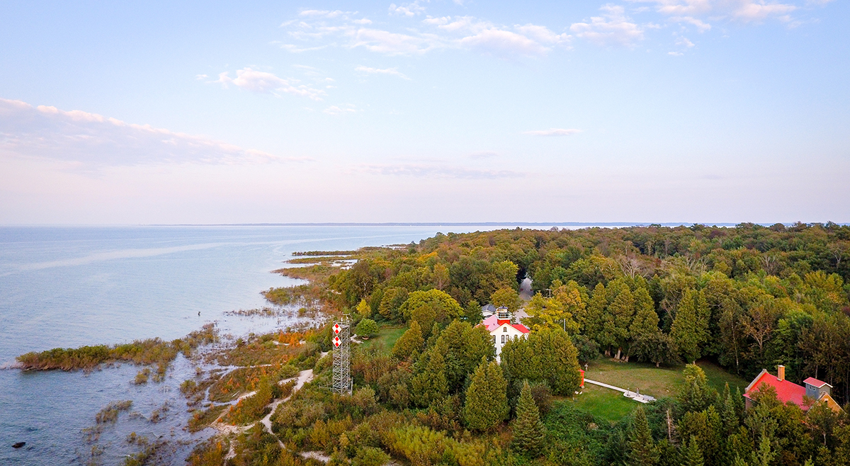
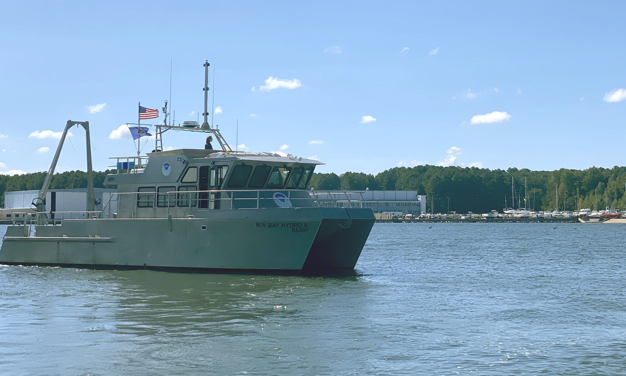
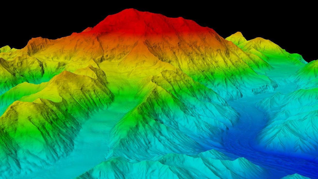
As the New Blue Economy grows along with demands for a climate-ready workforce, NOAA is connecting the dots between climate resilience and the need for a workforce skilled in science and technology supporting ocean and coastal mapping. Exposure to key disciplines, from geodesy, oceanography, and science data management to modeling, hydrography and GIS-based cartography, is critical to building robust interest, opportunities and expertise in the government and industry geospatial careers supporting climate resilience. NOAA works with a variety of partners to advance workforce development in these foundational geospatial areas. In particular, hydrography – measuring water depths, locating hazards, and describing the seafloor – is a challenging but exciting field dependent on skilled technicians, surveyors, and scientists to acquire mapping data using state-of-the-art technologies. With only 50% of U.S. coastal, ocean and Great Lakes waters mapped, there is a lot of work to do! Read on to learn about a hydrographic surveying project NOAA is supporting with Northwestern Michigan College in the Great Lakes.

Continue reading “NOAA helps develop undergraduate course in lakebed mapping”

Research vessel Bay Hydro II makes history on Mayland’s Elk River

NOAA survey vessel Bay Hydro II in it's homeport at the Patuxent River Naval Air Station.
By Lt.j.g. Carly Robbins, junior officer in charge R/V Bay Hydro II

Situated on the east side of the Chesapeake Bay, 162 nautical miles above the Virginia Capes, Elk River is the western approach to the Chesapeake and Delaware Canal. The canal is one of the busiest waterways in the country. It connects the Chesapeake and Delaware Bays, servicing the ports of Baltimore, Wilmington, and Philadelphia. The U.S. Army Corps of Engineers regularly surveys the dredged channels in the approaches and in the canal, but they are not responsible for the remaining waters of the Elk River. The Elk River was last surveyed in the early 1900s, making depths on the nautical chart close to 100 years old! As a result, NOAA R/V Bay Hydro II was tasked to conduct a modern hydrographic survey of Elk River in Spring 2023.

Continue reading “Research vessel Bay Hydro II makes history on Mayland’s Elk River”

3D Nation Study Hub Site now available!

The 3D Nation Elevation Requirements and Benefits Study focuses on 3D elevation data on land and underwater.

A new ArcGIS Hub Site sharing the results of the 3D Nation Elevation Requirements and Benefits Study, which was published in September 2022, is now available. The site currently features a tool which allows users to filter business use ranks by each state. The site will be updated with more immersive dashboards as they become available.  This study was sponsored by the National Oceanic and Atmospheric Administration (NOAA) and the U.S. Geological Survey (USGS), and conducted by Dewberry.  The study documents nationwide requirements and benefits of 3D elevation data both on land and underwater. The study also estimates the costs associated with meeting these requirements and evaluates multiple scenarios for enhancing national elevation mapping programs.

Continue reading “3D Nation Study Hub Site now available!”

NOAA represented at the International Hydrographic Organization Assembly in Monaco

An image of the harbor of Monte Carlo.

In early May, NOAA’s Office of Coast Survey Deputy Hydrographer John Nyberg, Ph.D., was elected as a director of the International Hydrographic Organization (IHO) during its Third Assembly. The six-year term begins in September and promises to be a critical time for the evolution of digital navigation infrastructure and capacity worldwide, with the implementation of the S-100 hydrographic model. John was nominated by the secretaries of commerce, defense, and state. His role will be to serve as part of the directing committee which is composed of a Secretary General and two directors to manage the day-to-day operations of the organization in order to advance the goals of the Member States.

Continue reading “NOAA represented at the International Hydrographic Organization Assembly in Monaco”