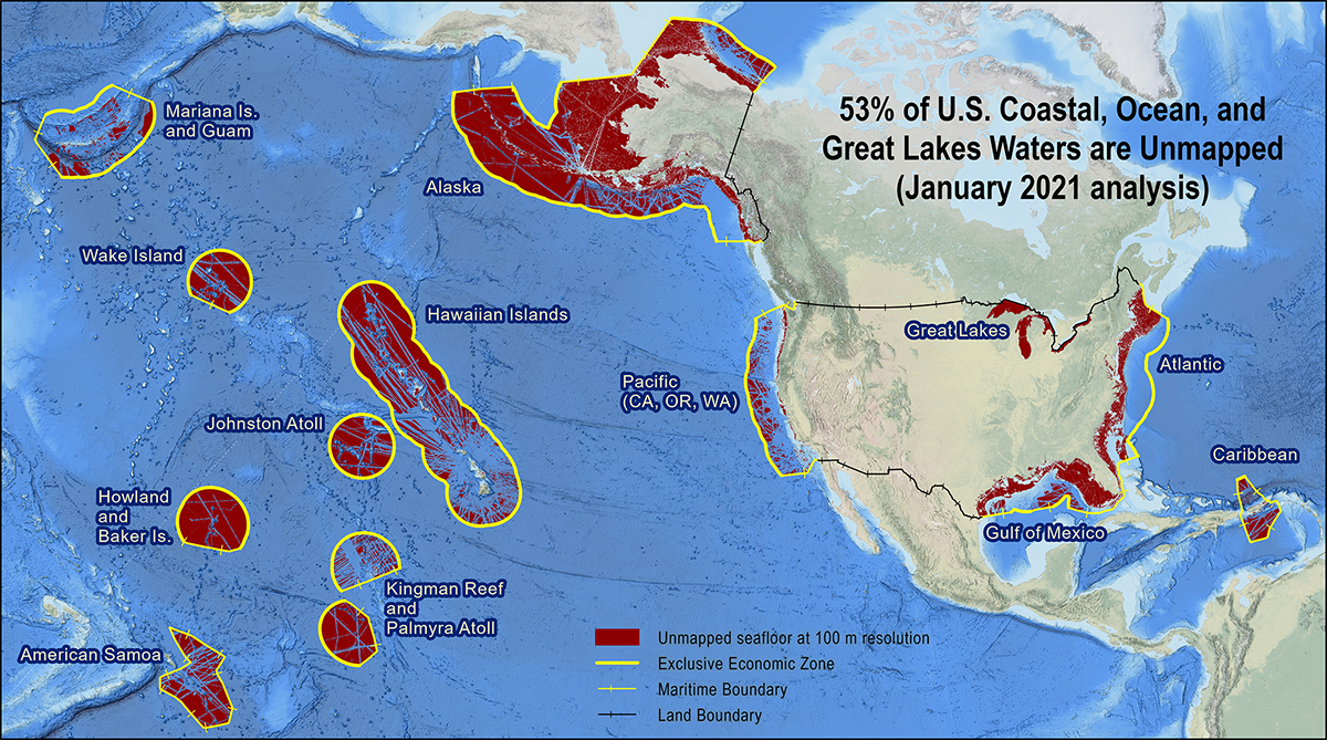
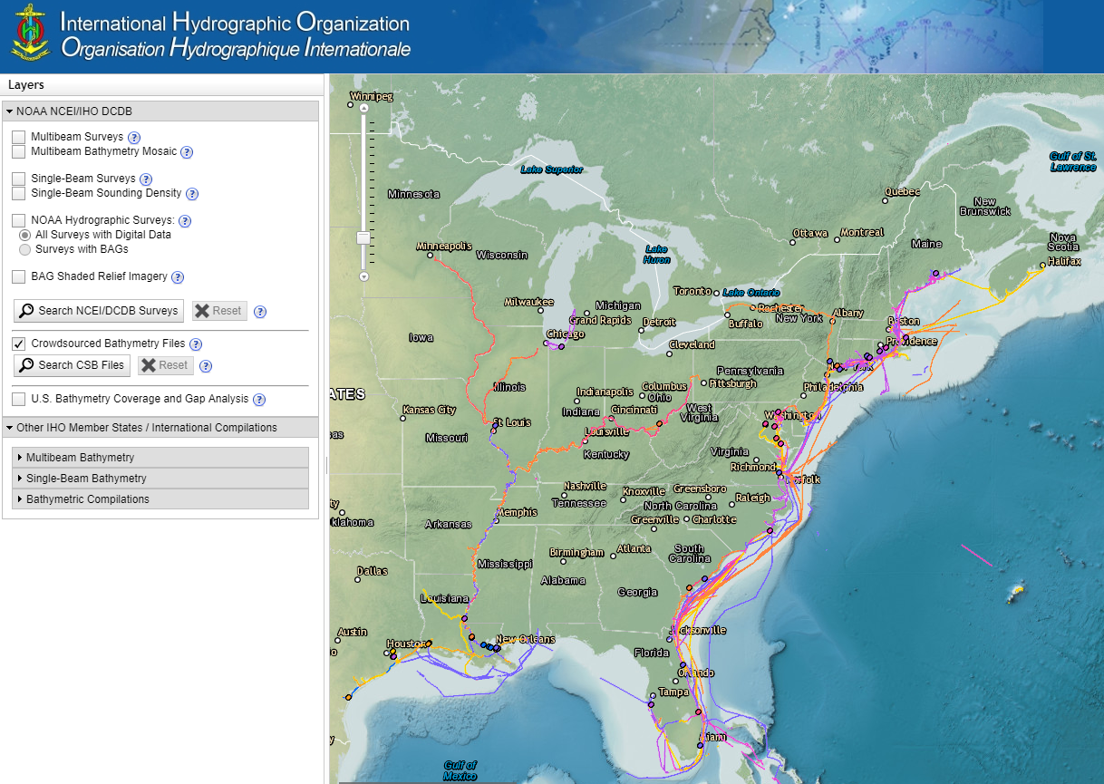
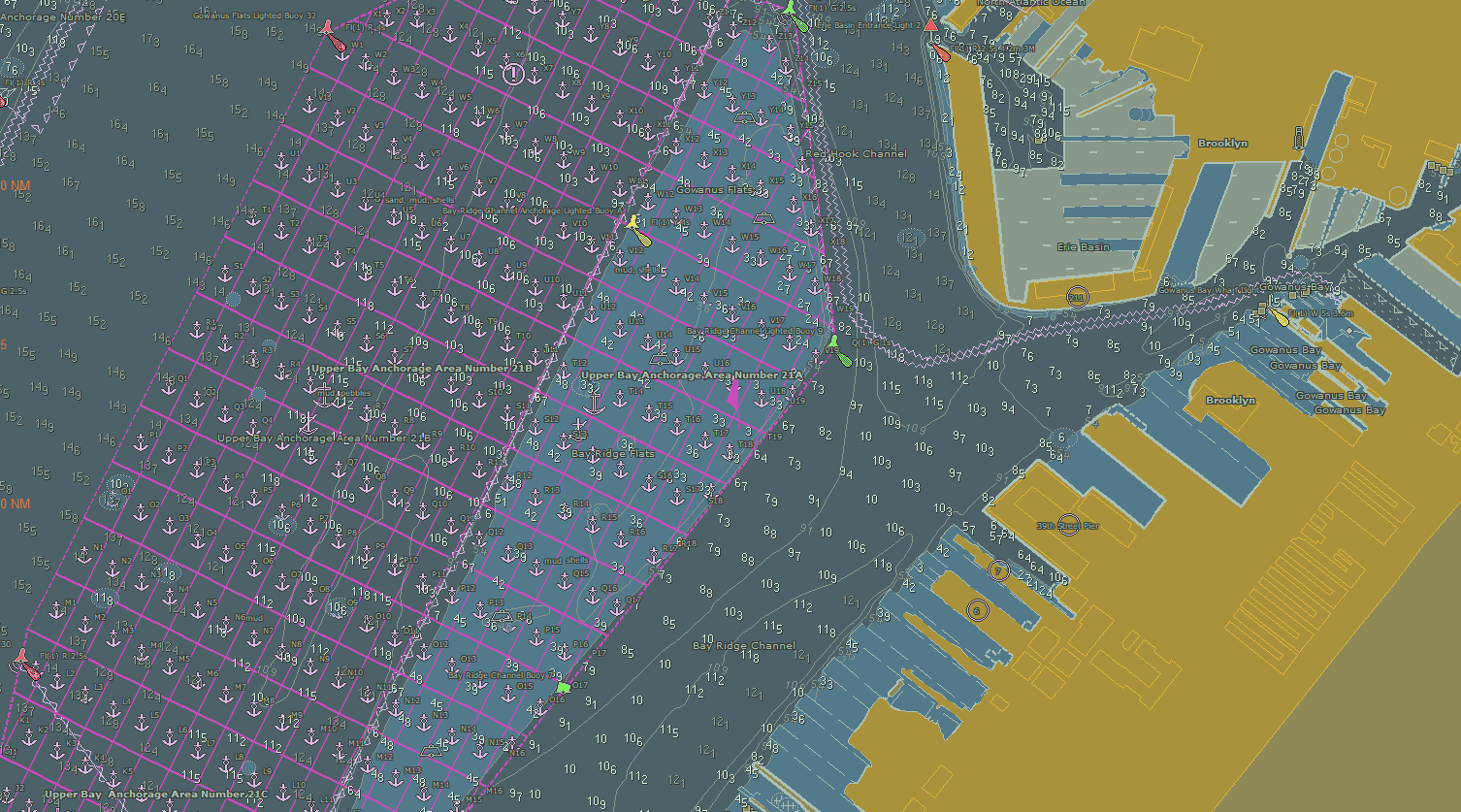
NOAA announces new progress report on mapping U.S. ocean, coastal, and Great Lakes waters

Map showing the geographic distribution and extent of the unmapped areas within U.S. waters. Analysis conducted in January 2020.

NOAA released the first annual report on the progress made in mapping U.S. ocean, coastal, and Great Lakes waters. The depth, shape, and composition of the seafloor are foundational data elements that we need to understand in order to explore, sustainably develop, conserve, and manage our coastal and offshore ocean resources. The 2019 Presidential Memorandum on Ocean Mapping of the United States Exclusive Economic Zone and the Shoreline and Nearshore of Alaska and the global Seabed 2030 initiative make comprehensive ocean mapping a priority for the coming decade. The Unmapped U.S. Waters report tracks progress toward these important goals.

Continue reading “NOAA announces new progress report on mapping U.S. ocean, coastal, and Great Lakes waters”

NOAA Ship Rainier returns to survey the Hawaiian coast, provides update on lava flow development

Rainier collects multibeam sonar data along Puna Coast on the Big Island of Hawaii.

By Ens. Harper Umfress

NOAA Ship Rainier’s four-decade tropical sonar silence is over and Hawaiian hydrography is back! The 2019 field season was productive, challenging, and geographically diverse. After starting the season with traditional hydrographic surveys in Alaska, Rainier was re-tasked to support science diving operations in the Papahānaumokuākea Marine National Monument that surrounds the Northwestern Hawaiian Islands. Though the primary purpose of this dispatch was to support coral reef research, the world’s most productive coastal hydrographic survey platform would have been remiss to forego this opportunity to ping new waters.

Continue reading “NOAA Ship Rainier returns to survey the Hawaiian coast, provides update on lava flow development”

NOAA preserves history of Washington, DC, with reproduced L’Enfant maps

This copper plate, named No. 3043 PRICE 45 CENTS, is one of the 3000 series of special products produced by Coast Survey’s predecessor, the Coast and Geodetic Survey. The Coast and Geodetic Survey primarily made nautical charts, but a number of maps in the 3000 series were instead maps of some thematic factor of interest (i.e., the Slaver Map, No. 3033; Glacier Bay, Alaska, No. 3095).

By Capt. Albert “Skip” Theberge (NOAA, ret.)

Research conducted by the NOAA Central Library uncovered a little known fact that NOAA Coast Survey’s skill in reproducing maps helped ensure that early maps of Washington, DC, and an interesting piece of history, weren’t lost. Coast Survey reproduced three historically significant maps from a copper plate engraving of Washington, DC, as surveyed by Pierre L’Enfant and Andrew Ellicott.
Continue reading “NOAA preserves history of Washington, DC, with reproduced L’Enfant maps”

NOAA welcomes local and international attendees at 2018 Nautical Cartography Open House

RDML Tim Gallaudet (Navy, ret.) with Sean Leger of Coast Survey

Last week NOAA Coast Survey welcomed approximately 170 attendees representing 17 countries to the 2018 Nautical Cartography Open House. Industry partners, members of the public, and other government agencies attended, including the Bureau of Ocean Energy Management, Naval Hydrographic and Oceanic Service (SHOM) from France, Canadian Hydrographic Service, Dalian Naval Academy, National Taiwan Ocean University, and the Joint Hydrographic Center/Center for Coastal and Ocean Mapping (JHC/CCOM).
Continue reading “NOAA welcomes local and international attendees at 2018 Nautical Cartography Open House”

NOAA announces launch of crowdsourced bathymetry database

The crowdsourced bathymetry database, displayed in the IHO Data Centre for Digital Bathymetry Data Viewer, has an updated user interface.

By Lt. Cmdr. Adam Reed, Integrated Oceans and Coastal Mapping (IOCM) assistant coordinator

Today NOAA announces the end of a testing phase in the development of a new crowdsourced bathymetry database. Bathymetric observations and measurements from participants in citizen science and crowdsourced programs are now archived and made available to the public through the International Hydrographic Organization (IHO) Data Centre for Digital Bathymetry (DCDB) Data Viewer. The operationalized database allows free access to millions of ocean depth data points, and serves as a powerful source of information to improve navigational products.
Continue reading “NOAA announces launch of crowdsourced bathymetry database”

Poster symposium marks milestone for inaugural class of the NOAA certification program in nautical cartography

NOAA’s Christie Ence (left), Megan Bartlett (third from left), and Noel Dyer (right) explain their posters to attendees of the poster symposium at the University of Maryland.

Students of NOAA’s certification program in nautical cartography completed their final projects and presented them along with other Master of Professional Studies in GIS students during a poster symposium at the University of Maryland’s Department of Geographical Sciences. At the event, NOAA students explained their capstone projects and described how their research benefits nautical charting at NOAA. Project topics included:

  • Improving Shoreline Application to NOAA Electronic Navigational Charts, Megan Bartlet
  • An Automated Approach to Generate Nautical Vector Features from Raster Bathymetric Attributed Grid Data, Noel Dyer
  • Developing a Rasterization Procedure for Vector Chart Data, Christie Ence
  • NOAA Chart Discrepancies: A Temporal and Spatial Analysis for Navigation Response Teams, Lt. Cmdr. Matt Forney
  • Airborne Lidar Bathymetry’s Impact on NOAA Charts, Andres Garrido
  • Validating and Refining the Proposed Rescheming of NOAA Electronic Navigational Charts, Colby Harmon
  • High Resolution Bathymetry as an Alternative to Charting Controlling Depths in U.S. Army Corps of Engineers Channels, Craig Winn
  • Satellite Derived Bathymetry: An Alternative Analysis to Nautical Chart Updates, Aleah Worthem

Continue reading “Poster symposium marks milestone for inaugural class of the NOAA certification program in nautical cartography”

NOAA adds grid overlay to chart anchorage areas in Port of New York and New Jersey

A grid overlay of anchorage grounds in the updated Port of New York and New Jersey ENCs, US5NY19M and US5NY1CM

NOAA Coast Survey recently released updates for two NOAA electronic navigational charts (NOAA ENC®) in the Port of New York and New Jersey, which added a permanent grid system overlay to anchorages in Bay Ridge, Graves End, and Stapleton. Coast Survey performed the update at the request of the Harbor Operations Steering Committee and collaborated with the Sandy Hook Pilots Association and U.S. Coast Guard (USCG) Sector New York’s Vessel Traffic Services (VTS). 
Continue reading “NOAA adds grid overlay to chart anchorage areas in Port of New York and New Jersey”

NOAA navigation response team investigates hazardous shoal off Rockaway Point, NY

Recently, NOAA navigation response team 5 (NRT5), responded to a survey request from U.S. Coast Guard (USCG) Sector New York following several groundings near Rockaway Point in Queens, New York. Waves and currents often influence the size and shape of nearshore sandbars, and the USCG was concerned that a sandbar may have expanded beyond the area depicted on the nautical chart. Lt. j.g. Dylan Kosten, Eli Smith, and Michael Bloom traveled from New London, Connecticut, to Jersey City, New Jersey, to launch their vessel and start the survey of the area.
Continue reading “NOAA navigation response team investigates hazardous shoal off Rockaway Point, NY”

NOAA quickly updates nautical chart, allowing large ships to dock with confidence in Port Everglades

Change in the slip length reflected in ENC cell US5FL32 and US4FL31.

NOAA’s Office of Coast Survey quickly updated NOAA electronic navigational charts (NOAA ENC®) to accurately reflect the 225 foot expansion of a slip in Port Everglades, Florida. Now at a total length of 1,125 feet, the elongated slip allows larger ships to dock with confidence. The Port Everglades Pilots – maritime pilots who maneuver ships through crowded harbors and confined waters – requested the chart update. With ENCs that accurately reflect the slip expansion in their hands, pilots can easily communicate to vessel captains that it is safe to dock their vessels in the slip.
Port Everglades is one of the top three cruise ports in the world, and is among the most active cargo ports in the United States. Every slip is kept in high use, and Coast Survey used a new data process that allowed the most critical and valuable information to be applied quickly and made available to the end user. Continue reading “NOAA quickly updates nautical chart, allowing large ships to dock with confidence in Port Everglades”