NOAA contributes to Empowering Women in Hydrography through at-sea experience, part 2

NOAA ship Thomas Jefferson from survey launch 2904 at sunrise.

The Empowering Women in Hydrography project is a global effort led by the International Hydrographic Organization and Canada that seeks to initiate, organize and track a series of activities and initiatives which will enable more women to participate equitably in the field of hydrography and to assume leadership roles within the hydrographic community. NOAA is contributing to the project via an ‘at-sea experience’ on NOAA hydrographic ships for three women each year over the four year lifespan of the project. After a global call for nominations, three women were selected to join NOAA ships for the 2022 survey season. Chiaki Okada from the Hydrographic and Oceanographic Department, Japan Coast Guard, joined NOAA Ship Thomas Jefferson from July 25 to August 6, 2022 while surveying the Great Lakes.

Continue reading “NOAA contributes to Empowering Women in Hydrography through at-sea experience, part 2”

Surveying south of Cape Cod, Massachusetts in transit to the Great Lakes

NOAA Ship Thomas Jefferson underway in the Chesapeake Bay performing pre-season testing.

By Hydrographic Assistant Survey Technician Sarah Thompson

April 10, 2022 marked the beginning of NOAA Ship Thomas Jefferson and her crew’s field season and transit up through the St. Lawrence River, Lake Ontario, and into Lake Erie. This field season, Thomas Jefferson’s base of operations will be in Cleveland, Ohio and has the distinction of being the first NOAA ship to survey the Great Lakes in over 30 years. On the way, Thomas Jefferson had the opportunity to respond to a U.S. Coast Guard request to survey and obtain modern bathymetry on Pollock Rip Channel off the Massachusetts coast.

Continue reading “Surveying south of Cape Cod, Massachusetts in transit to the Great Lakes”

Ocean and coastal mapping matching fund opportunity

A graphic showing Rear Admiral Richard Brennan over a background of bathymetry

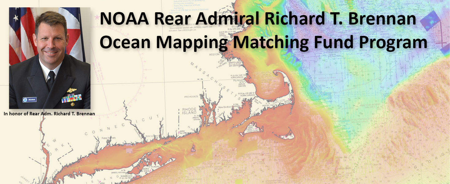
The Office of Coast Survey invites non-federal entities to partner with NOAA National Ocean Service’s ocean and coastal mapping programs on jointly funded projects of mutual interest using NOAA’s geospatial contracting vehicles. Known as the Brennan Matching Fund, the opportunity relies on NOAA’s mapping, charting, and geodesy expertise, appropriated funds, and its authority to receive and expend matching funds contributed by partners to conduct surveying and mapping activities. Partners benefit from this opportunity by leveraging NOAA’s contracting expertise, including its pool of pre-qualified technical experts in surveying and mapping as well as data management to ensure that the mapping data are fit for purpose and are usable for a broad set of purposes, including, for example, safe navigation, integrated ocean and coastal mapping, coastal zone management, renewable energy development, coastal and ocean science, climate preparedness, infrastructure investments, and other activities.

Continue reading “Ocean and coastal mapping matching fund opportunity”

NOAA focuses on the Great Lakes for the 2022 field season

NOAA Ship Thomas Jefferson shown from the bridge wing of a passing ship outside of Montreal, Quebec.

In 2022, NOAA and NOAA contractors will survey U.S. coastal waters and beyond, including multiple missions in the Great Lakes. As the volume, value and size of marine vessels in U.S. waters continues to grow, it is essential that NOAA increase the accuracy and frequency of surveys. A great amount of data on nautical charts of the Great Lakes is more than 50 years old, and only about 5 to 15 percent of the Great Lakes are mapped to modern standards using remote sensing methods such as light detection and ranging and sound navigation and ranging.

Continue reading “NOAA focuses on the Great Lakes for the 2022 field season”

NOAA ocean mapping and reef surveys in the Mariana Islands

NOAA Ship Rainier alongside Ford Island in Pearl Harbor, Hawaii. on a sunny day with white clouds in the sky.

On March 26, NOAA Ship Rainier  set sail from Honolulu, Hawaii on a 3,307-nautical mile expedition to the Western Pacific. Originally planned for 2020, this will be the ship’s first multidisciplinary expedition to Guam and the Commonwealth of the Northern Mariana Islands. This collaborative mission between NOAA’s National Ocean Service and National Marine Fisheries Service will deliver high‐quality data, data products, and tools to the region including a seamless map linking hilltops to underwater depths and integrated data on the surrounding coral reef ecosystems. These data can provide information for countless users to make critical management decisions within disciplines such as habitat management and restoration, tsunami modeling, monitoring, and marine resource management.

Continue reading “NOAA ocean mapping and reef surveys in the Mariana Islands”

The Interagency Working Group on Ocean and Coastal Mapping announces progress report on mapping U.S. ocean, coastal, and Great Lakes waters

Graphic showing the percentage of coastal, ocean, and Great Lakes waters of the United States that are unmapped as of January 2022.

The Interagency Working Group on Ocean and Coastal Mapping (IWG-OCM) has released the third annual report on the progress made in mapping U.S. ocean, coastal, and Great Lakes waters. Knowledge of the depth, shape, and composition of the seafloor has far-reaching benefits, including safer navigation, hazard mitigation for coastal resilience, preservation of marine habitats and heritage, and a deeper understanding of natural resources for sustainable ocean economies. The 2020 National Strategy for Mapping, Exploring, and Characterizing the United States Exclusive Economic Zone and the global Seabed 2030 initiative make comprehensive ocean mapping a priority for the coming decade. The Unmapped U.S. Waters report tracks progress toward these important goals.

Continue reading “The Interagency Working Group on Ocean and Coastal Mapping announces progress report on mapping U.S. ocean, coastal, and Great Lakes waters”

NOAA releases 2022 hydrographic survey season plans

NOAA Ship Fairweather in College Fiord, Alaska

NOAA hydrographic survey ships and contractors are preparing for the 2022 hydrographic survey season in U.S. coastal waters and beyond. The ships collect bathymetric data (i.e. map the seafloor) to support nautical charting, modeling, and research, but also collect other environmental data to support a variety of ecosystem sciences. NOAA considers hydrographic survey requests from stakeholders such as marine pilots, local port authorities, the Coast Guard, and the boating community, and also considers other hydrographic and NOAA science priorities in determining where to survey and when. Visit our “living” story map to find out more about our mapping projects and if a hydrographic vessel will be in your area this year!

Continue reading “NOAA releases 2022 hydrographic survey season plans”

The nautical chart update process – build it and we will chart it

Nautical charts are updated with the most current information available through several processes and workflows within NOAA’s Office of Coast Survey. The large majority of these updates consist of revisions to water depth information. The bottom of a water body is changeable by nature, thus hydrographic surveys are constantly necessary to show contemporary depths in a given body of water. What doesn’t happen quite as often are changes to land along the coast, altering the way inlets, harbor entrances, and river mouths appear from a bird’s eye view. Unless there has been a catastrophic event, these changes in land are usually the result of human interaction.

Continue reading “The nautical chart update process – build it and we will chart it”

Backscatter and oil platforms – a Channel Islands adventure

Image showing Channel Islands National Marine Sanctuary, oil platforms, and the sheets covering the project area.
By HAST Bailey Schrader, Operations Officer Lt. Shelley Devereaux and HST Adriana Varchetta

After enjoying the California sunshine in San Francisco Bay, NOAA Ship Fairweather began its transit down the coast towards Santa Barbara, California. The ship would not anchor for the next sixteen days, leaving all crew on 24-hour rotations. Thankfully, the already attenuated crew was visited by augmenting scientists and hydrographers – Physical Scientist Devereaux from the Pacific Hydrographic Branch, HHST Arboleda from NOAA Ship Thomas Jefferson, and HAST Schrader from NOAA Ship Rainier. Together, they traveled south to complete one of the last projects of the season, the area in and around Channel Islands National Marine Sanctuary.

Continue reading “Backscatter and oil platforms – a Channel Islands adventure”

Underway from Alaska to California encountering a new phenomenon, cellular service

Image showing NOAA Ship Fairweather turning towards the Golden Gate at the end of the project.
By ACHST Simon Swart, Operations Officer Lt. Shelley Devereaux, and HST Adriana Varchetta

After six months of surveying in Alaska, NOAA Ship Fairweather was ready to point the bow south and set sail for San Francisco Bay. However, an unforeseen circumstance stymied the planned underway date. Although we eagerly anticipated the warmer waters of San Francisco Bay, this delay was well received by the hydrographers in the survey department and amongst the NOAA Corps officers. Our work had begun stacking up due to an extremely busy season, coupled with the fact that for most of us, this was our first time working on hydrographic project sheets. Therefore, we happily used this week of “down-time” to complete previous project sheets and plan for the upcoming survey. Those of us as sheet managers focused on cleaning multibeam data, processing backscatter mosaics, attributing features, conducting quality control checks, and writing descriptive reports. This process was greatly assisted with the help of augmenting physical scientists Pete Holmberg and Janet Hsiao. In the end, we were able to finish processing a number of sheets and reach a comfortable place on all the others. After a week of long hours, we were finally ready to toss lines and say “see you next year Alaska.”

Continue reading “Underway from Alaska to California encountering a new phenomenon, cellular service”