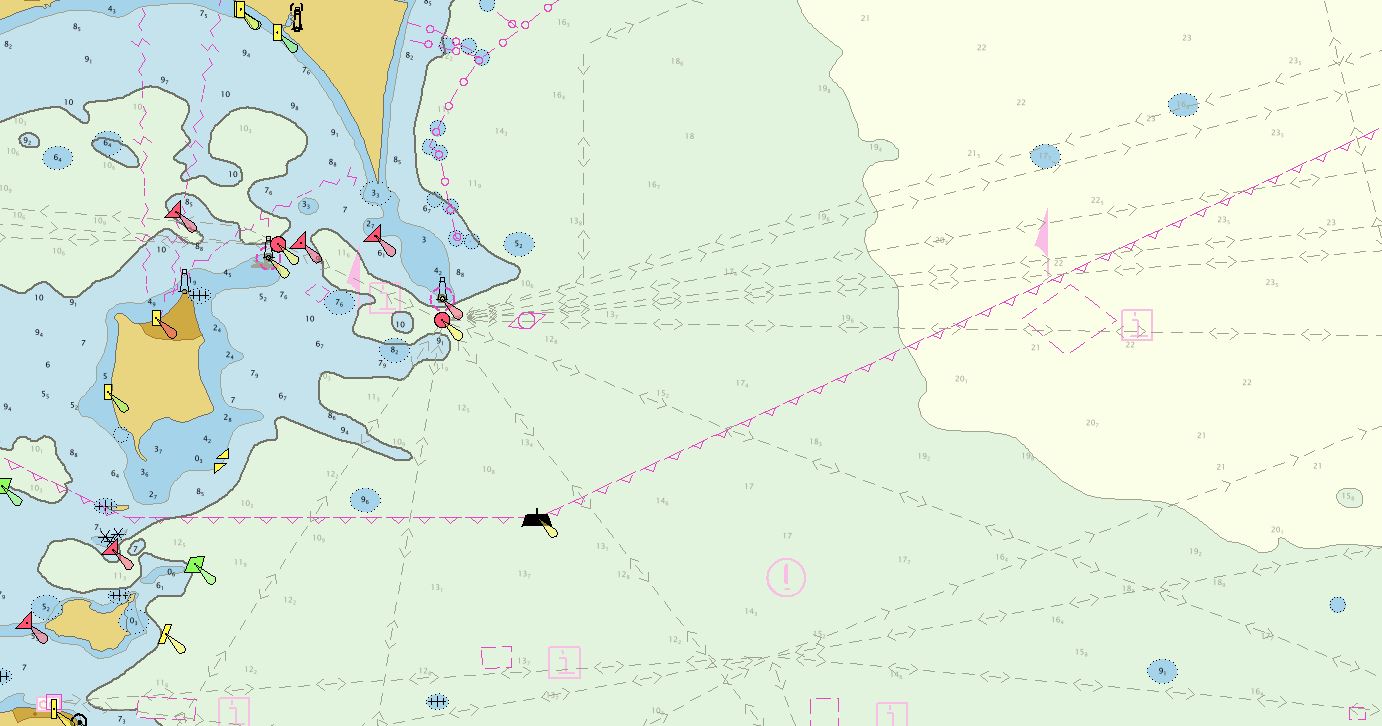
NOAA’s Office of Coast Survey collaborated with U.S. and Canadian mariners, the Lake Carriers’ Association (LCA), and the Canadian Chamber of Marine Commerce (CMC) to update the Recommend Courses in Lake Erie and transfer them from paper charts to NOAA electronic navigational charts (NOAA ENC®). This bi-national effort involved compiling and updating information for Lake Erie’s 75 routes which span both U.S. and Canadian waters. These routes cover 20 NOAA and five Canadian ENCs.
“This was and continues to be an important bi-national effort. With the NOAA efforts to sunset raster charts, it was important that we transferred these routes into the ENC format,” said Tom Loeper, chief of Coast Survey’s Nautical Publications Branch.
The LCA, a trade association representing the U.S. Great Lakes fleet since 1880, developed the recommended courses 113 years ago. The LCA developed the traffic separation scheme to keep the growing maritime trade in the Great Lakes safe, by indicating the direction ships should travel within certain zones. These recommended courses are used to regulate traffic in busy, confined waterways, and understanding these courses are part of the training and licensing of pilots on the Great Lakes. After seeing the success of recommend courses in the American waters, the CMC, adopted them for Canadian waters in 1915.
“The recommended courses found on the Great Lakes were the first formal attempt in the world to improve navigation safety by separating traffic. They have stood the test of time and have saved countless lives and vessels for over a century and will continue to do so well into the next century,” said Captain Timothy J. Dayton, master mariner and former captain for Interlake Steamship Company.
The original routes established in 1907 and 1915 were applied to U.S. Army Corps of Engineers Lake Survey and Canadian Hydrographic Service (CHS) paper charts. The responsibility for these routes was transferred from the Army Corps to NOAA in 1970.
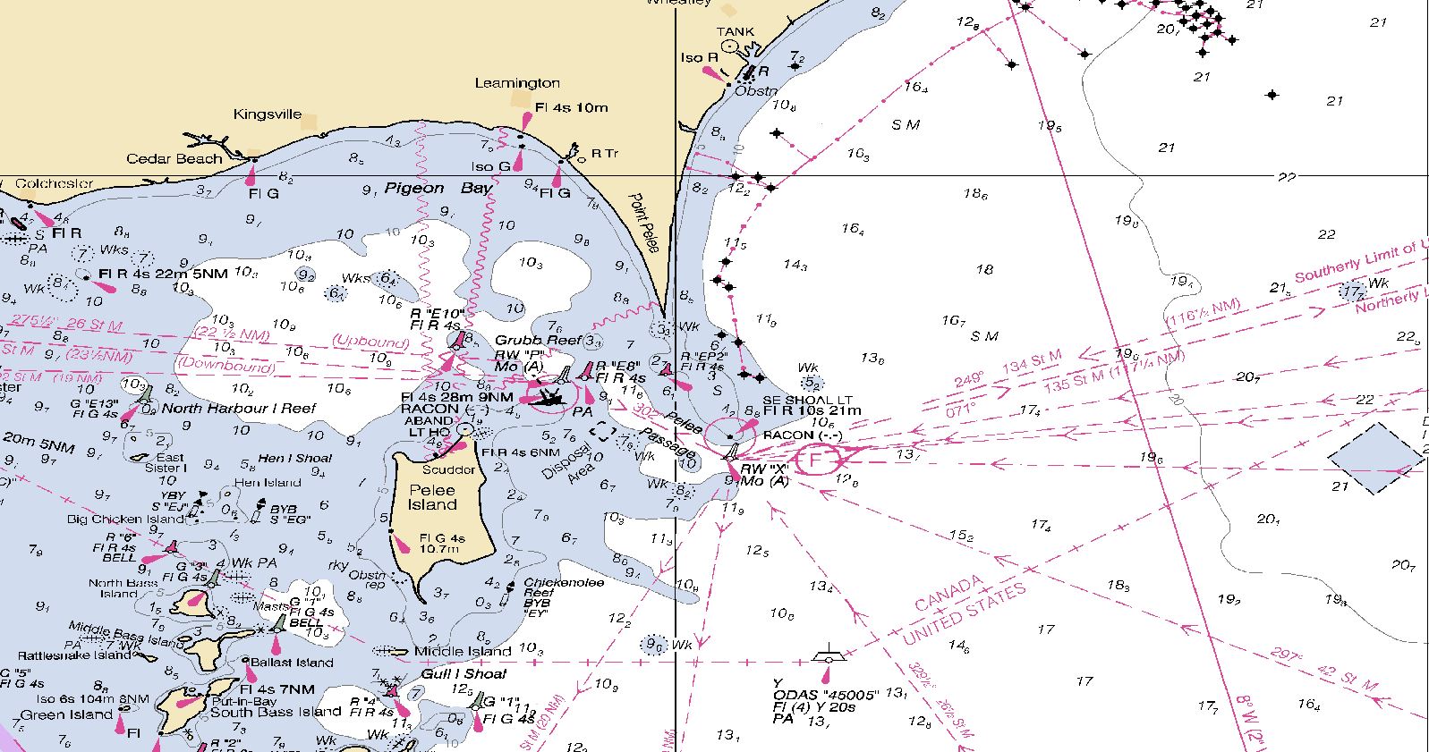
In 2018, a group of U.S. and Canadian mariners, the LCA, the CMC, and the NOAA Great Lakes navigation manager met in Cleveland, Ohio, to discuss updating and documenting the courses for today’s electronic navigation environment. Some of the issues this group faced in moving the routes from paper charts to ENCs included edge matching inconsistencies, missing routes on large scale products, no GPS waypoints, and missing information on the routes. The team determined that the routes as written were not accurate enough to use in an ECDIS environment since the waypoints were based on visual bearings and ranges. From this meeting, the team set out to bring the paper charts into the digital age.
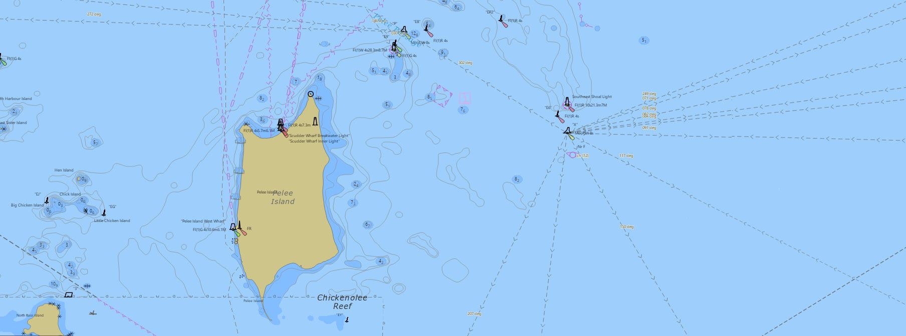
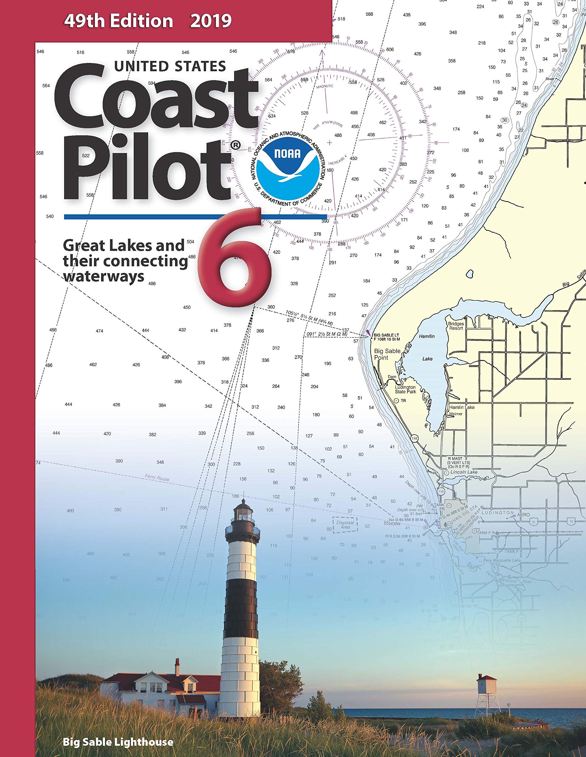
The team collected all of the documented and undocumented routes from the paper charts and information on the courses, narratives, approximate waypoints, turn bearings, ranges and distances. These were then plotted and attributed across multiple ENC scale bands, and the route narratives for Lake Erie are being formatted for the next edition of Coast Pilot 6Ⓡ. The route narratives allow a mariner to navigate using traditional pilotage techniques. In addition to the ENC products and Coast Pilot 6Ⓡ, NOAA will create a small scale overview route planning chart.
Coast Survey updated Lake Erie first and plans to update Lake Huron (106 routes) and Lake Ontario (52 routes) in the coming weeks. Coast Survey will wrap up this project with the completion of Lake Superior (90 routes) and Lake Michigan (110 routes). The bi-national chart rescheming plan in Great Lakes will also include small scale coverage for each Lake by both the CHS and NOAA for use by mariners in voyage planning.
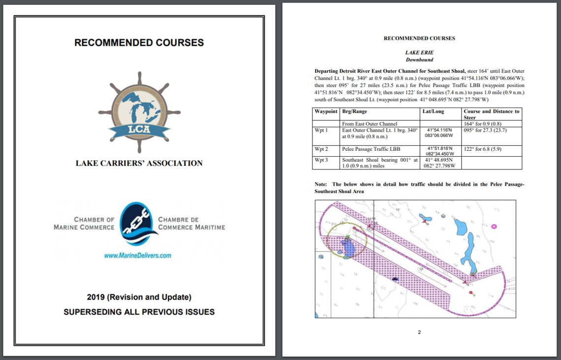
These recommended courses have kept mariners on the Great Lakes safe for over 100 years. This bi-national effort to update the routes and bring them into the ENC will ensure that the routes keep up with changing times and keep mariners safe into the future.

Do you happen to have a program to sell less than perfect charts or give away charts to poor people?
I am disabled, bad legs and have no money but am trying to plan a kayak circumnavigation of the San Francisco. Bay, using the SF BAY Water-trails system, then have a multi month to explore the Delta.
If you have any charts I could have, I would greatly appreciate it
Sue Mace
POB 4221
San Rafael CA 94913
I am starting to acquire knowledge to become an effective and knowledgeable captain of my own boat. I plan to cruise coastal waters and voyages such as the Great Loop. Being new to boating, I do not know where to begin learning. I will be taking some boating courses to give me a beginner’s grasp of boating. I need to know what training would be recommended and in what order I should take different courses. I know navigation acumen will be the focal issue but where and what types of charts are best to learn and use? I’m lost and I need to know the recommended way to go about becoming trained as i should be.
Power boat or sail boat? Sailing= begin with the American Sailing Association (ASA). They have many classes to choose from. Or….Chapman Piolting 62 edition is a Great place to start for either. Under $10.00 on thrift books .com.
Start googleing books and questions and get with someone that has a boat. Get on chat channels and get out on the water. It’s the best teacher.
Glad to see you in Lake Erie. a few background reports you may not be aware of.
USGS Open file reports;
Foster et al, 1995 OF 95-252
Fuller et al , 1995 OF 95-220
Fuller et al, 1996 OF-96-520
Fuller et al, 1996 OF 96-21
Fuller, 1998 Ohio DNR Division Geological Survey (DCMS # 23 re-released as LE-1
There are two old Core of engineers CERC reports that may be of interest;
Williams 1980
Carter 1982
Another couple are;
Liebenthal et al, 2001, NOAA grant # NA86RG0053/OSU RF Project # 735480
Fuller et al, 2002 Great Lakes Protection Fund Project # 470