
As the New Blue Economy grows along with demands for a climate-ready workforce, NOAA is connecting the dots between climate resilience and the need for a workforce skilled in science and technology supporting ocean and coastal mapping. Exposure to key disciplines, from geodesy, oceanography, and science data management to modeling, hydrography and GIS-based cartography, is critical to building robust interest, opportunities and expertise in the government and industry geospatial careers supporting climate resilience. NOAA works with a variety of partners to advance workforce development in these foundational geospatial areas. In particular, hydrography – measuring water depths, locating hazards, and describing the seafloor – is a challenging but exciting field dependent on skilled technicians, surveyors, and scientists to acquire mapping data using state-of-the-art technologies. With only 50% of U.S. coastal, ocean and Great Lakes waters mapped, there is a lot of work to do! Read on to learn about a hydrographic surveying project NOAA is supporting with Northwestern Michigan College in the Great Lakes.
Since September 2022, NOAA’s Integrated Ocean and Coastal Mapping (IOCM) program and the National Centers for Environmental Information (NCEI) have been working with the Great Lakes Water Studies Institute at Northwestern Michigan College (NMC) and the Great Lakes Observing System (GLOS) to develop a lakebed mapping capstone course for undergraduate students in Marine Technology. This program’s courses support the Lakebed 2030 goal to fully survey and map the Great Lakes, as 92% of the Great Lakes are still unmapped as of January 2023. NMC’s Marine Technology degree programs were launched in 2019 to address the demand for surveying skills and the shortage of survey technicians in the ocean mapping industry.
Designed to emulate a professional coastal mapping project, the course has students taking on various planning or managerial roles throughout the process, from data collection to data submission at NCEI. This gives students hands-on experience in the intricacies of survey planning and execution, as well as the nuances of quality metadata and data-sharing with NOAA.
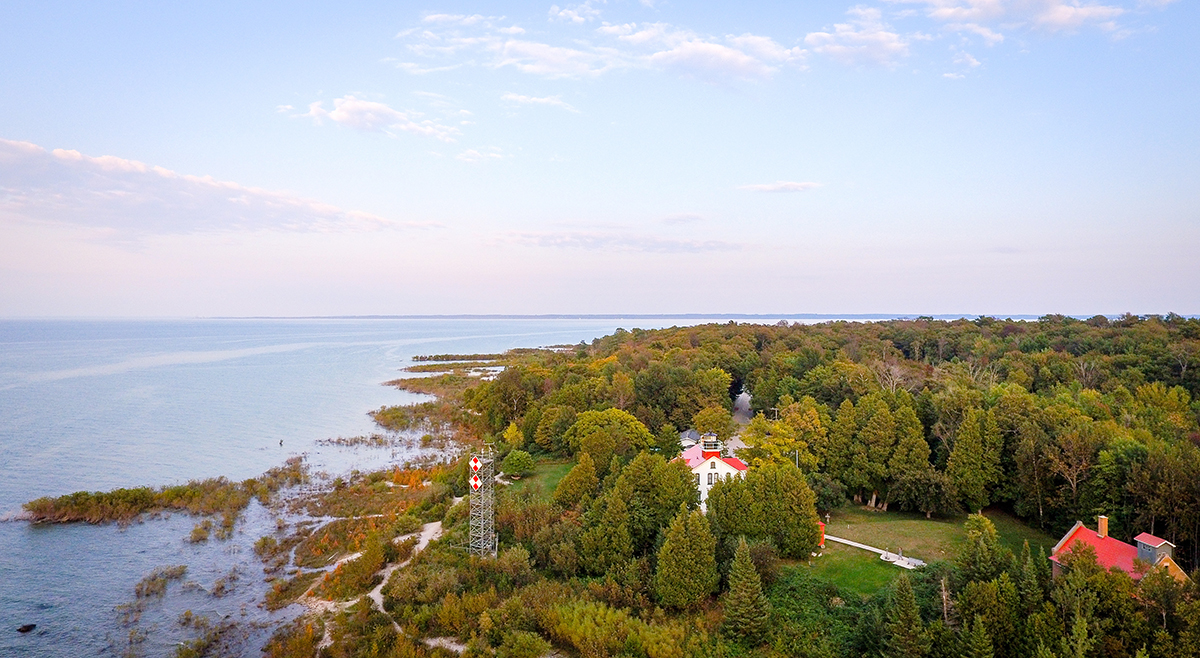
For 2023, organizers used the GLOS/IOCM 2022 Great Lakes Spatial Priorities Study results to identify a 10 by 10-kilometer area of interest east of Leelanau County, Michigan, with prominent overlapping priorities and close proximity to Northwestern Michigan College. This study asked stakeholders to identify where they needed mapping data, and level of priority based on urgency. The study also asked briefly why the data was needed, and what types of mapping products would be of benefit.
The students used the area of interest as a baseline for collaboration and planning. They contacted four organizations with mapping priorities in order to practice coordination and collaboration: NOAA’s Office for Coastal Management, U.S. Geological Survey, Nature Conservancy, and Michigan Department of Natural Resources. The students also canvassed in their local community to determine any additional interest in the area–the Grand Traverse Lighthouse was one. After consulting with interested parties, the students divided and prioritized their area, deciding to focus the season’s collection on the highest priority zone.
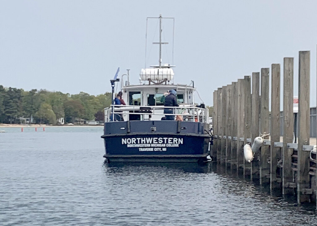
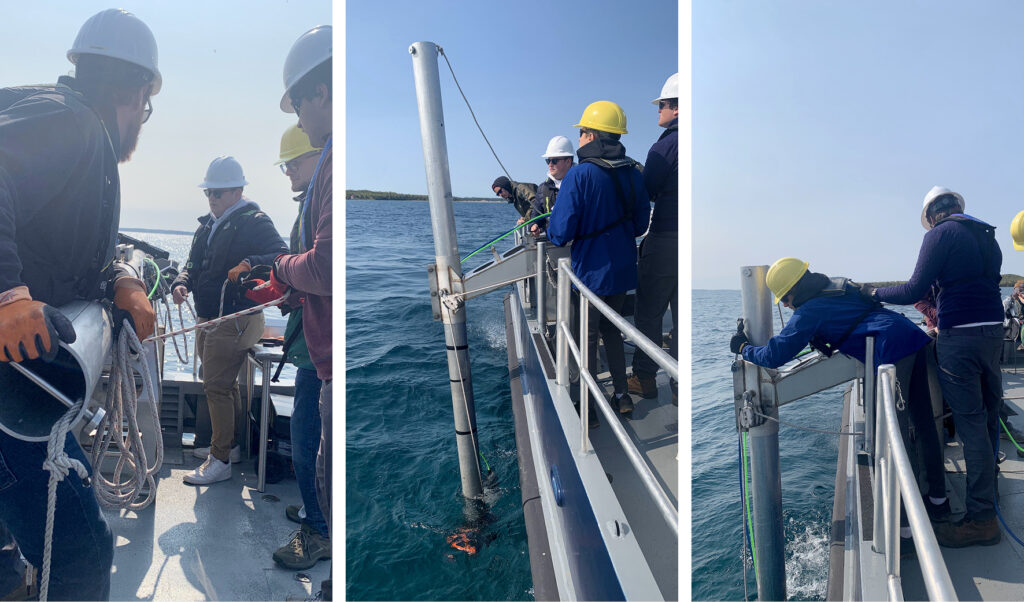
During the week of May 15, 2023, the students conducted initial multibeam survey data collection aboard Northwestern Michigan College’s vessel, R/V Northwestern. The NOAA IOCM GIS Coordinator joined to assist. The team deployed their multibeam device and over the next four days successfully collected bathymetric data. They also identified several targets for further imagery to be taken using a remotely operated vehicle, a process known as “ground truthing.” Ground truth targets were requested by the Grand Traverse Lighthouse. The students formed a submission agreement with NOAA’s NCEI and provided the multibeam data to the national archive, so it can count toward Lakebed 2030 mapping goals. The NMC student data is the first multibeam dataset in the Great Lakes to be available to the public through NCEI’s bathymetric data viewer.
Glad to know that NOAA is out there cultivating interest and opportunities in water resources, especially in the Great Lakes. I was reading about the one specific event about the Great Lakes the other day, The alewife die-off of 1967. Terribly interesting, invasive species are such a nuisance. Anyway, good luck mapping, someone has got to do it!