
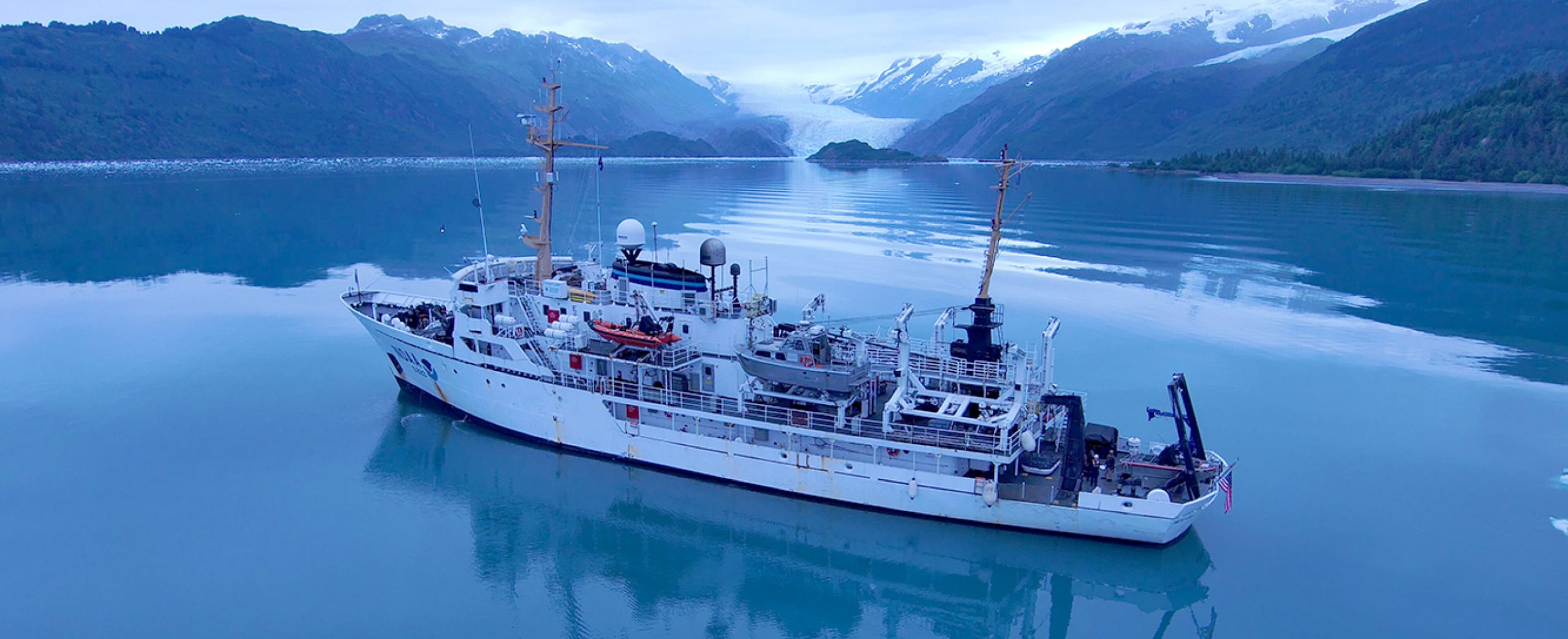
NOAA hydrographic survey ships and contractors are preparing for the 2022 hydrographic survey season in U.S. coastal waters and beyond. The ships collect bathymetric data (i.e. map the seafloor) to support nautical charting, modeling, and research, but also collect other environmental data to support a variety of ecosystem sciences. NOAA considers hydrographic survey requests from stakeholders such as marine pilots, local port authorities, the Coast Guard, and the boating community, and also considers other hydrographic and NOAA science priorities in determining where to survey and when. Visit our “living” story map to find out more about our mapping projects and if a hydrographic vessel will be in your area this year!
Great Lakes
Western Lake Michigan – This project is located in Western Lake Michigan, within the Wisconsin Shipwreck Coast National Marine Sanctuary. Previous charting efforts within the proposed 680 square nautical mile project extent were of lead line and singlebeam echo sounders from the mid-twentieth century. The area has never before been surveyed using multibeam echosounder systems.
Detroit River, Michigan – This project includes the entire 28-mile river area between Lake St. Clair and Lake Erie. This river is a critical transportation route connecting various ports along the Great Lakes, handling approximately 1,500 transits or 80 million tons of cargo annually.
Cleveland, Ohio – This project will provide modern bathymetric data for the Cleveland area as well as the vicinity of South Bass Island and Presque Isle. Conducting a modern bathymetric survey in this area will identify hazards and changes to the seafloor, provide critical data for updating NOAA’s nautical charting products, and improve maritime safety.
Atlantic Coast
Onslow Bay, North Carolina – The Onslow Bay project off the North Carolina Coast covers approximately 488 square nautical miles. The project area includes Cape Lookout Shoals, routes to the North Carolina ports of Morehead City and Beaufort, and heavily trafficked shipping routes for the Atlantic seaboard.
Approaches to Chesapeake Bay – This project covers 154 square nautical miles approaching the Chesapeake Bay, home to two of the top 20 container ports in the U.S. – the Port of Baltimore, Maryland and the Port of Virginia (Richmond, Norfolk, Portsmouth). This survey is part of an ongoing, multi-year hydrographic project to support the safety of waterborne commerce to the Chesapeake Bay and transit along the eastern seaboard.
Approaches to Newport, Rhode Island – This project covers 160 square nautical miles in an area that connects Long Island Sound with Buzzards Bay and Vineyard Sound. The bathymetric data of the survey area were mostly a century old, with the latest survey having been acquired in the 1930s. The modern bathymetric data will be used to update NOAA’s nautical charting products that improve maritime safety as well as support the The Nippon Foundation-GEBCO Seabed 2030 Project global mapping initiative.
Southeastern Virginia rivers – The Potomac, Rappahannock, York, and James Rivers are major tributaries of the Chesapeake Bay. The communities along these rivers are among the oldest in the United States and host a population of over nine million people. Large portions of these rivers have not been surveyed to modern standards, with the average age of the last survey in many areas exceeding 50 years. This project will provide modern bathymetric data for safety of navigation and water inundation modeling efforts, from which informed decisions may be made to protect the communities along these rivers.
Pacific Coast
Washington, Oregon, and California – This project will cover a total of 1,372 square nautical miles. The primary objective of this project is to collect data for surficial geology, benthic habitats, sub-bottom faults, geologic hazards and sedimentary processes. Data from the project will support a variety of disciplines including offshore energy projects and infrastructure, marine spatial planning, ecosystem assessments, and marine geohazards. Bathymetric data from the project will be used to update NOAA’s nautical charting products and improve maritime safety.
Gulf of Mexico
Approaches to Calcasieu, Louisiana – Since 2020, the Louisiana coast has been hit by six hurricanes and two named tropical storms, several of which caused serious damage to the Port of Lake Charles. The port is ranked in the top 15 U.S. ports based on annual cargo tonnage. The proposed survey area was identified as an area of significant need by NOAA and through correspondence with the Lake Charles Pilots Association which revealed a critical need for updated hydrographic data and charting products in the approaches and anchorages to the port.
Northern Gulf of Mexico – This survey covers an area of over 770 square nautical miles, identified as an injured area of mesophotic and deep benthic habitat surrounding the wellhead of the 2010 Deepwater Horizon oil spill. The data collected will be foundational for exploring these habitats of the marine ecosystem and will provide accurate high-resolution bathymetric and habitat data needed to guide restoration. The data will also be used to update nautical charting products.
Alaska
Pribilof Islands, Alaska – This survey covers the area surrounding the principal islands of Saint Paul and Saint George. The majority of the area was last surveyed in the 1950s. This project will provide modern bathymetric data for updating NOAA’s nautical charting products to improve maritime safety and support the Seabed 2030 Project global mapping initiative.
Nunivak Island, Alaska – The 1,500 square nautical miles of targeted area surrounding Nunivak Island are used by regional traffic, supply tankers, and the U.S. Coast Guard to seek protection from weather. The survey vintage in this area is between 1902 and 1953. Old and sparse data elevate the potential risk for groundings. The survey will provide updated bathymetric and feature data that will be used to create highly detailed nautical charts for the area, reducing the risk to navigation for transiting vessels.
Newenham, Alaska – The project area includes the waters north of Cape Newenham, including Kuskokwim Bay and Goodnews Bay, and the approaches to Hagermeister Strait south of Cape Pierce. Most of the project area has not been surveyed since the early 1900s, and is relatively shallow, with depths averaging 1 to 20 meters. This survey will provide contemporary data to update NOAA’s nautical charting products and services, improving the safety of maritime traffic and services available to these communities by reducing the current risk due to unknown bathymetry.
Nushagak Peninsula, Alaska – The Nushagak Peninsula project will provide contemporary surveys to update nautical charting products and services. The surveys will provide modern bathymetry to update historic charted data, map uncharted waters, and address concerns of navigational risk due to the numerous shifting shoal formations off Cape Constantine, at the south end of the Nushagak Peninsula.
Western Pacific
Commonwealth of the Northern Mariana Islands – A multidisciplinary NOAA team will conduct an extensive hydrographic survey to map bathymetry and habitat around the islands, pinnacles, and reefs in support of nautical charting and habitat mapping.
NOAA’s four hydrographic survey ships –Thomas Jefferson, Ferdinand Hassler, Rainier, and Fairweather – are operated and maintained by the Office of Marine and Aviation Operations, with hydrographic survey projects managed by the Office of Coast Survey.
Thank you for sharing this informative article. I hope a lot of land surveyor could read this and be guided accordingly.
I use the Bathymetry viewer on a weekly basis for SCUBA diving in Washington state.
There are some areas presently not covered such as mid sound Point Jefferson, San Juan Islands, Straits of Juan De Fuca. When will these areas be available on the Bathymetry viewer?
Has a survey of Lake Charles already been conducted in the time since? Thanks.
The channels leading to the Port of Lake Charles are maintained at project depths of 35 to 40 feet by the US Army Corps of Engineers. The depths in the lake itself look to be older, from 1900 to 1939. Unfortunately, there doesn’t appear to be a project for Lake Charles this year.