
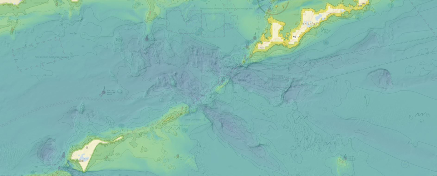
NOAA’s Office of Coast Survey produces and maintains several types of data models and products, from operational forecast systems to nautical charts. One of these models comes from the office’s National Bathymetric Source, or NBS, program which creates and maintains high-resolution bathymetry composed of the best available data. Bathymetry is a term that refers to the depths and shapes of underwater terrain and is a visualization of the “beds” or “floors” of water bodies, including the ocean, rivers, streams, and lakes. This data model is available to the public in a product called BlueTopo.
What is BlueTopo?
BlueTopo combines various hydrographic surveys into one nationwide model of the seafloor. By integrating surveys in this fashion, we ensure the best available data is represented in the model first, along with a factor that describes how good we think this measurement is, or its uncertainty. In addition, BlueTopo data includes a wealth of additional information that is important for understanding data quality. Information such as the source institution, survey name, and survey date are available for each image pixel. BlueTopo is updated on a weekly to monthly basis, according to regional rates of coastal change and availability of new source data.
How can users access BlueTopo?
BlueTopo can be accessed through NOAA’s nowCOAST, a cloud-based web mapping GIS portal to real-time coastal observations, forecasts, and warnings of interest to the maritime and coastal communities, developed and operated by NOAA’s Office of Coast Survey. Once opened in a web browser, a layer menu on the right side of the screen shows a list of different layers that represent various types of displayable information. Using the toggle to switch BlueTopo on will display the layer. Other layers may need to be turned off in order to aid in viewing the BlueTopo layer.

A new feature in nowCOAST allows users to view BlueTopo’s data source information, or metadata, for a specific area. The new BlueTopo data is displayed on the nowCOAST viewer by clicking the BlueTopo menu item and selecting the data type in the dropdown menu. This will display all the data source information associated with the bathymetric data including source institution, coverage, and survey start and end dates. When users click on a location on the map, the data and source information for the selected site will be displayed in a table on the viewer. More information and descriptions about the new data is available at BlueTopo’s data specifications website.

What is the importance of metadata?
Metadata allows users to see all information associated with a specific information source. For instance, if you need to know the year a particular site was surveyed, this information can be found within the metadata. This is particularly useful when researching an area of interest, making sure you have the most recent information available.

What type of information is contained within metadata?
One of the most important facets of metadata is the source of the information. This lets users know the specific source document that was used to generate the data. Most often this is likely from a hydrographic survey, for example with a source survey identification of H09367 or something similar, where H denotes a NOAA hydrographic survey, followed by a unique identifier. This survey identification number can be copied into a text search for National Ocean Service hydrographic survey data at the National Centers for Environmental Information. The search results for this particular survey indicate that survey H09367 was started in February 1973 off the coast of St. Augustine, Florida. Other types of information available in the metadata include survey coverage amount, significant features identified, model uncertainty, and data license information
As a publicly available resource, BlueTopo enables a more complete understanding of bathymetry in numerous applications. These applications include any GIS that can visualize the widely accessible Web Map Tile Service, or a GeoTIFF, such as QGIS or ESRI ArcPro. While this nowCOAST release facilitates use in GIS through web services, the web viewer facilitates exploration and use by the general public without GIS expertise.